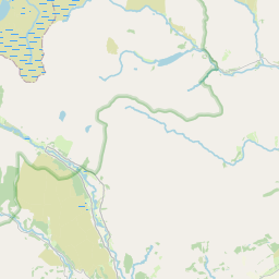
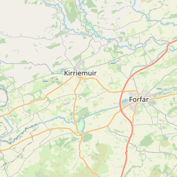
Mill of Marcus Map, Satellite view of Mill of Marcus, Angus, Scotland
Mill of Marcus is located in Angus County, Angus, Scotland, Scotland, United Kingdom.
Location informations of Mill of Marcus
Latitude of city of Mill of Marcus is 56.72464 and longitude of city of Mill of Marcus is -2.79414. Mill of Marcus has 1 postcode / zip code, in county of Angus.The County of Mill of Marcus is Angus.
Postcode / zip code of Mill of Marcus
DD8 3Administrative division of Mill of Marcus
County :AngusGPS coordinates of Mill of Marcus
Latitude : 56.72464Longitude : -2.79414
Online Map of Mill of Marcus - road map, satellite view and street view


Leaflet | © OpenStreetMap contributors
Search distance between two cities
The weather for Mill of Marcus in the United Kingdom
Get today and tomorrow's weather forecasts for Mill of Marcus. Find out the weather forecast for the week ahead and the weekend for Mill of Marcus in the UK.Mill of Marcus weather forecast 15 days
What is the nearest train station to Mill of Marcus?
List of Railway Stations near to Mill of MarcusThe nearest railway stations to Mill of Marcus are listed below. Tickets are available at the train station ticket office or ticket machines.
| Name | Distances from Mill of Marcus |
|---|---|
| Montrose Station | 19.70 Km |
| Arbroath Station | 22.23 Km |
| Laurencekirk Station | 23.54 Km |
| Carnoustie Station | 25.49 Km |
| Golf Street Station | 25.63 Km |
| Barry Links Station | 25.91 Km |
| Monifieth Station | 27.23 Km |
| Balmossie Station | 27.94 Km |
| Broughty Ferry Station | 29.04 Km |
What is the nearest Public Transport Stops to Mill of Marcus?
List of Stops near to Mill of MarcusGetting there by public transport (nearest train, tube, overground line station and bus stops). The nearest stops to Mill of Marcus are listed below.
| Stop Name | Distances from Mill of Marcus |
|---|---|
| Easter Marcus Bus Stop (at) | 1.15 Km |
| Hillhead of Careston Bus Stop (at) | 1.21 Km |
| Hillhead of Careston Bus Stop (opp) | 1.23 Km |
| Hilton of Fern Road End Bus Stop (at) | 1.23 Km |
| Waterston Road Bus Stop (at) | 1.25 Km |
| Farm Road End Bus Stop (at) | 1.25 Km |
| Peathill Road End Bus Stop (opp) | 1.87 Km |
| Peathill Road End Bus Stop (at) | 1.89 Km |
| Vayne Cottages Bus Stop (at) | 2.25 Km |
| Whiteside of Careston Road End Bus Stop (at) | 2.29 Km |
Historic Places to Visit near Mill of Marcus
List of Historic places near to Mill of Marcus
| Name | Distances from Mill of Marcus |
|---|---|
| Finavon Doocot | 3.43 Km |
| Aberlemno Sculptured Stones | 4.00 Km |
| White Caterthun Fort | 7.37 Km |
| Brechin Castle | 7.73 Km |
| Brechin Cathedral Round Tower | 8.10 Km |
| Brechin Cathedral | 8.11 Km |
| Maison Dieu Chapel | 8.18 Km |
| Brown Caterthun Fort | 8.39 Km |
| Restenneth Priory | 8.54 Km |
| Pitmuies Gardens | 11.04 Km |
| Lindsay Burial Aisle | 11.52 Km |
| Edzell Castle | 12.10 Km |
| Capo Long Barrow | 13.71 Km |
| JM Barries Birthplace | 13.80 Km |
| St Orlands Stone | 14.87 Km |
Cities or Towns near Mill of Marcus
List of places near to
| Name | Distance |
|---|---|
| Marcus | 2.00 Km |
| Careston | 2.62 Km |
| Cadger Path | 2.82 Km |
| Finavon | 2.96 Km |
| Crosston | 3.16 Km |
| Milton of Finavon | 3.60 Km |
| Netherton | 3.72 Km |
| Aberlemno | 3.85 Km |
| Fern | 3.88 Km |
| Melgund | 4.08 Km |
| Tannadice | 4.19 Km |
| Mains of Melgund | 4.23 Km |
| Balhall | 4.27 Km |
| Noranside | 4.90 Km |
| Carsegownie | 5.09 Km |
| Oathlaw | 5.12 Km |
| Kirkton of Menmuir | 5.26 Km |
| Tigerton | 5.44 Km |
| Bogindollo | 5.80 Km |
| Deuchar | 5.82 Km |
| Auchnacree | 6.39 Km |
| Balrownie | 6.94 Km |
| Turin | 6.98 Km |
| Blackgate | 7.26 Km |
| Rescobie | 7.64 Km |
| Little Brechin | 7.65 Km |
| Glenogil | 7.73 Km |
| Brechin | 8.21 Km |
| Mains of Balgavies | 8.24 Km |
| Lunanhead | 8.27 Km |
| Pickerton | 8.59 Km |
| Memus | 8.85 Km |
| East Mains of Burnside | 9.05 Km |
| Bridgend | 9.12 Km |
| Balfield | 9.30 Km |
| North Whitehills | 9.32 Km |
| Suttieside | 9.42 Km |
| South Whitehills | 9.46 Km |
| Gowanbank | 9.50 Km |
| Milldens | 9.62 Km |
| Trinity | 9.67 Km |
| Greens of Gardyne | 9.98 Km |
| Guthrie | 10.07 Km |
| Newtonmill | 10.28 Km |
| Forfar | 10.67 Km |
| Dunnichen | 10.72 Km |
| Letham | 10.76 Km |
| Kingsmuir | 10.78 Km |
| Inchbare | 10.99 Km |
| Hillend | 11.14 Km |