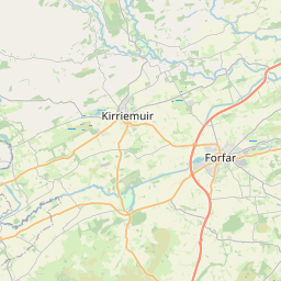
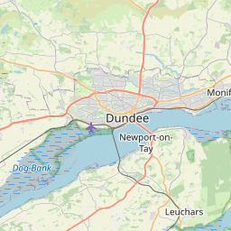
Forfar Town Map, Satellite view of Forfar, Angus, Scotland
Forfar is located in Angus County, Angus, Scotland, Scotland, United Kingdom.
Location informations of Forfar
Latitude of city of Forfar is 56.64407 and longitude of city of Forfar is -2.88898. Forfar has 1 postcode / zip code, in county of Angus.The County of Forfar is Angus.
Postcode / zip code of Forfar
DD8 1Administrative division of Forfar
County :AngusGPS coordinates of Forfar
Latitude : 56.64407Longitude : -2.88898
Online Map of Forfar - road map, satellite view and street view


Leaflet | © OpenStreetMap contributors
Search distance between two cities
The weather for Forfar in the United Kingdom
Get today and tomorrow's weather forecasts for Forfar. Find out the weather forecast for the week ahead and the weekend for Forfar in the UK.Forfar weather forecast 15 days
What is the nearest train station to Forfar?
List of Railway Stations near to ForfarThe nearest railway stations to Forfar are listed below. Tickets are available at the train station ticket office or ticket machines.
| Name | Distances from Forfar |
|---|---|
| Monifieth Station | 18.74 Km |
| Barry Links Station | 18.95 Km |
| Balmossie Station | 19.10 Km |
| Golf Street Station | 19.29 Km |
| Carnoustie Station | 19.48 Km |
| Broughty Ferry Station | 19.70 Km |
| Arbroath Station | 20.63 Km |
| Dundee Station | 21.46 Km |
| Invergowrie Station | 23.27 Km |
| Montrose Station | 26.59 Km |
What is the nearest Public Transport Stops to Forfar?
List of Stops near to ForfarGetting there by public transport (nearest train, tube, overground line station and bus stops). The nearest stops to Forfar are listed below.
| Stop Name | Distances from Forfar |
|---|---|
| The Cross Bus Stop (opp) | 12 m |
| Council Offices Bus Stop (at) | 55 m |
| Castle Street Taxi Rank Taxi Rank (at) | 90 m |
| The Cross Taxi Rank (at) | 117 m |
| Asda Bus Stop (at) | 193 m |
| Police Station Bus Stop (at) | 195 m |
| East High Street Taxi Rank Taxi Rank (opp Royal Bank) | 200 m |
| Royal Bank of Scotland Bus Stop (at) | 215 m |
| Police Station Bus Stop (opp) | 235 m |
| St Johns Church Taxi Rank (at) | 238 m |
Historic Places to Visit near Forfar
List of Historic places near to Forfar
| Name | Distances from Forfar |
|---|---|
| Restenneth Priory | 2.81 Km |
| St Orlands Stone | 5.59 Km |
| Finavon Doocot | 7.33 Km |
| JM Barries Birthplace | 7.65 Km |
| Angus Folk Museum | 7.95 Km |
| Glamis Castle | 8.20 Km |
| Aberlemno Sculptured Stones | 8.30 Km |
| Eassie Old Church | 10.75 Km |
| Eassie Sculptured Stone | 10.82 Km |
| Pitmuies Gardens | 11.21 Km |
| Tealing Dovecot and Earth House | 13.16 Km |
Cities or Towns near Forfar
List of places near to
| Name | Distance |
|---|---|
| South Whitehills | 1.24 Km |
| Suttieside | 1.28 Km |
| North Whitehills | 1.35 Km |
| Pitreuchie | 1.43 Km |
| Balmashanner | 1.43 Km |
| Gowanbank | 1.61 Km |
| Caldhame | 2.55 Km |
| Lunanhead | 2.57 Km |
| Kingsmuir | 2.58 Km |
| Padanaram | 2.89 Km |
| Lownie Moor | 3.14 Km |
| Drumgley | 3.39 Km |
| Blackgate | 3.64 Km |
| Hillend | 3.81 Km |
| Wester Meathie | 4.10 Km |
| Easter Meathie | 4.20 Km |
| East Mains of Burnside | 4.91 Km |
| Ballindarg | 4.92 Km |
| Rescobie | 4.95 Km |
| Douglastown | 5.08 Km |
| Bogindollo | 5.14 Km |
| Kirkton | 5.17 Km |
| Dunnichen | 5.63 Km |
| Craichie | 5.78 Km |
| Oathlaw | 5.98 Km |
| Carsegownie | 6.26 Km |
| Inverarity | 6.26 Km |
| Wester Foffarty | 6.52 Km |
| Bowriefauld | 6.54 Km |
| Gateside | 6.54 Km |
| Maryton | 6.62 Km |
| Whigstreet | 6.97 Km |
| Milton of Finavon | 7.07 Km |
| Tulloes | 7.47 Km |
| Letham | 7.50 Km |
| Holemill | 7.67 Km |
| Kirriemuir | 7.76 Km |
| Finavon | 7.78 Km |
| Tannadice | 7.82 Km |
| Cadger Path | 7.92 Km |
| Mains of Balgavies | 7.95 Km |
| Roundyhill | 8.06 Km |
| Tillyloss | 8.06 Km |
| Glamis | 8.06 Km |
| Turin | 8.18 Km |
| Aberlemno | 8.27 Km |
| Gallowfauld | 8.36 Km |
| Galllowfauld | 8.54 Km |
| Southmuir | 8.56 Km |
| Wreaths | 8.60 Km |