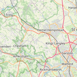
Underhill Map, Satellite view of Underhill, Greater London, England
Underhill is located in Greater London County, Barnet, London, England, United Kingdom.
Location informations of Underhill
Latitude of city of Underhill is 51.64663 and longitude of city of Underhill is -0.19632. Underhill has 1 postcode / zip code, in county of Greater London.The County of Underhill is Greater London.
Postcode / zip code of Underhill
EN5 2Administrative division of Underhill
County :Greater LondonGPS coordinates of Underhill
Latitude : 51.64663Longitude : -0.19632
Online Map of Underhill - road map, satellite view and street view

Leaflet | © OpenStreetMap contributors
Search distance between two cities
The weather for Underhill in the United Kingdom
Get today and tomorrow's weather forecasts for Underhill. Find out the weather forecast for the week ahead and the weekend for Underhill in the UK.Underhill weather forecast 15 days
What is the nearest train station to Underhill?
List of Railway Stations near to UnderhillThe nearest railway stations to Underhill are listed below. Tickets are available at the train station ticket office or ticket machines.
| Name | Distances from Underhill |
|---|---|
| New Barnet Station | 1.62 Km |
| Oakleigh Park Station | 2.30 Km |
| Hadley Wood Station | 2.80 Km |
| New Southgate Station | 5.16 Km |
| Mill Hill Broadway Station | 5.22 Km |
| Potters Bar Station | 5.61 Km |
| Elstree and Borehamwood Station | 5.82 Km |
| Palmers Green Station | 6.71 Km |
| Winchmore Hill Station | 6.73 Km |
| Bowes Park Station | 6.84 Km |
Elstree Airfield , UK (8.99 Km)
What is the nearest Public Transport Stops to Underhill?
List of Stops near to UnderhillGetting there by public transport (nearest train, tube, overground line station and bus stops). The nearest stops to Underhill are listed below.
| Stop Name | Distances from Underhill |
|---|---|
| Elton Avenue Bus Stop (Stop) | 20 m |
| Dollis Valley Way Bus Stop (Stop) | 62 m |
| Underhill Bus Stop (Stop U) | 283 m |
| Underhill Bus Stop (Stop) | 338 m |
| High Barnet Bus Stop (Stop R) | 369 m |
| Westcombe Drive Bus Stop (Stop) | 374 m |
| Underhill Bus Stop (Stop) | 382 m |
| High Barnet Bus Stop (Stop Q) | 397 m |
| Fairfield Way Bus Stop (->N) | 404 m |
| Westcombe Drive Bus Stop (->N) | 407 m |
Historic Places to Visit near Underhill
List of Historic places near to Underhill
Cities or Towns near Underhill
List of places near to
| Name | Distance |
|---|---|
| Chipping Barnet / High Barnet | 1.07 Km |
| Ducks Island | 1.27 Km |
| New Barnet | 1.27 Km |
| Hadley | 1.34 Km |
| Monken Hadley | 1.68 Km |
| Barnet | 1.76 Km |
| East Barnet | 2.15 Km |
| Totteridge | 2.17 Km |
| Arkley | 2.46 Km |
| Oakleigh Park | 2.56 Km |
| Whetstone | 2.72 Km |
| Woodside Park | 2.79 Km |
| Hadley Wood | 2.89 Km |
| Kitts End | 2.99 Km |
| Highwood Hill | 3.27 Km |
| Cockfosters | 3.33 Km |
| Barnet Gate | 3.39 Km |
| Rowley Green | 3.66 Km |
| Dancers Hill | 3.73 Km |
| Bentley Heath | 3.78 Km |
| Ganwick Corner | 3.80 Km |
| Mill Hill | 3.89 Km |
| North Finchley | 3.92 Km |
| Brunswick Park | 4.00 Km |
| Elstree Park | 4.21 Km |
| Osidge | 4.21 Km |
| Friern Barnet | 4.56 Km |
| Well End | 4.88 Km |
| New Southgate | 4.97 Km |
| Colney Hatch | 4.98 Km |
| Church End | 4.98 Km |
| Southgate | 5.10 Km |
| Oakwood | 5.10 Km |
| Finchley | 5.14 Km |
| Borehamwood | 5.26 Km |
| The Hale | 5.30 Km |
| Deacons Hill | 5.38 Km |
| Potters Bar | 5.39 Km |
| Holders Hill | 5.42 Km |
| Arnos Grove | 5.76 Km |
| Ridge | 5.77 Km |
| Highlands Village | 5.89 Km |
| Botany Bay | 5.89 Km |
| South Mimms | 5.90 Km |
| World's End | 5.99 Km |
| Grahame Park | 6.01 Km |
| Edgware Bury | 6.06 Km |
| Green Street | 6.25 Km |
| Edgware | 6.34 Km |
| Coldfall | 6.36 Km |