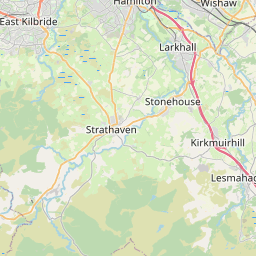
Torbothie Map, Satellite view of Torbothie, Lanarkshire, Scotland
Torbothie is located in Lanarkshire County, North Lanarkshire, Scotland, Scotland, United Kingdom.
Location informations of Torbothie
Latitude of city of Torbothie is 55.81928 and longitude of city of Torbothie is -3.77745. Torbothie has 1 postcode / zip code, in county of Lanarkshire.The County of Torbothie is Lanarkshire.
Postcode / zip code of Torbothie
ML7 5Administrative division of Torbothie
County :LanarkshireGPS coordinates of Torbothie
Latitude : 55.81928Longitude : -3.77745
Online Map of Torbothie - road map, satellite view and street view


Leaflet | © OpenStreetMap contributors
Search distance between two cities
The weather for Torbothie in the United Kingdom
Get today and tomorrow's weather forecasts for Torbothie. Find out the weather forecast for the week ahead and the weekend for Torbothie in the UK.Torbothie weather forecast 15 days
What is the nearest train station to Torbothie?
List of Railway Stations near to TorbothieThe nearest railway stations to Torbothie are listed below. Tickets are available at the train station ticket office or ticket machines.
| Name | Distances from Torbothie |
|---|---|
| Shotts Station | 1.31 Km |
| Fauldhouse Station | 3.65 Km |
| Hartwood Station | 3.96 Km |
| Breich Station | 6.89 Km |
| Blackridge Station | 7.41 Km |
| Cleland Station | 8.46 Km |
| Armadale Station | 8.99 Km |
| Caldercruix Station | 10.28 Km |
| Wishaw Station | 10.69 Km |
| Carluke Station | 10.76 Km |
What is the nearest Public Transport Stops to Torbothie?
List of Stops near to TorbothieGetting there by public transport (nearest train, tube, overground line station and bus stops). The nearest stops to Torbothie are listed below.
| Stop Name | Distances from Torbothie |
|---|---|
| Charles Street Bus Stop (Opp) | 13 m |
| Charles Street Bus Stop (at) | 34 m |
| Torbothie Road Bus Stop (Opp) | 102 m |
| Torbothie Road Bus Stop (at) | 113 m |
| Torbothie Road Bus Stop (opp 160) | 156 m |
| Kelvin Drive Bus Stop (at) | 183 m |
| Cemetery Road Bus Stop (before) | 213 m |
| Kelvin Drive Bus Stop (opp) | 253 m |
| Kelvin Drive Bus Stop (before) | 276 m |
| Cemetery Road Bus Stop (At) | 352 m |
Historic Places to Visit near Torbothie
Cities or Towns near Torbothie
List of places near to
| Name | Distance |
|---|---|
| Stane | 0.44 Km |
| Springhill | 0.77 Km |
| Calderhead | 1.06 Km |
| Burnbrae | 1.35 Km |
| Shotts | 1.39 Km |
| Dykehead | 1.93 Km |
| Bowhousebog / Liquo | 3.58 Km |
| West Benhar | 3.63 Km |
| Hartwood | 3.93 Km |
| Allanton | 4.11 Km |
| Hirst | 4.16 Km |
| Eastfield | 4.38 Km |
| Fauldhouse | 4.56 Km |
| Allanbank | 4.84 Km |
| Harthill | 4.86 Km |
| Greenburn | 4.90 Km |
| Kirk of Shotts | 4.96 Km |
| Greenrigg | 5.38 Km |
| Leven Seat | 5.76 Km |
| Bonkle | 5.86 Km |
| Climpy | 6.15 Km |
| Greenwall | 6.62 Km |
| Salsburgh | 6.62 Km |
| Longridge | 6.63 Km |
| Crindledyke | 6.82 Km |
| Morningside | 7.23 Km |
| Blackridge | 7.24 Km |
| Newmains | 7.42 Km |
| Chapel | 7.43 Km |
| Shawstonfoot | 7.54 Km |
| West Crindledyke | 7.60 Km |
| Breich | 7.61 Km |
| Westrigg | 7.64 Km |
| Croftmalloch | 7.79 Km |
| Whitburn | 7.82 Km |
| Hareshaw | 7.90 Km |
| Bellside | 8.05 Km |
| Forth | 8.13 Km |
| Blaeberryhill | 8.15 Km |
| Wilsontown | 8.19 Km |
| Bogside | 8.24 Km |
| Forrestfield | 8.27 Km |
| Cambusnethan | 8.49 Km |
| Parkside | 8.59 Km |
| Rootpark | 8.63 Km |
| Bents | 8.74 Km |
| Cleland | 8.75 Km |
| Knownoble | 8.78 Km |
| East Whitburn | 9.10 Km |
| Wildmanbridge | 9.18 Km |