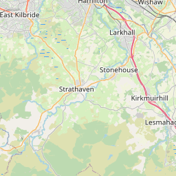
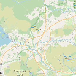
Forrestfield Map, Satellite view of Forrestfield, Lanarkshire, Scotland
Forrestfield is located in Lanarkshire County, North Lanarkshire, Scotland, Scotland, United Kingdom.
Location informations of Forrestfield
Latitude of city of Forrestfield is 55.88698 and longitude of city of Forrestfield is -3.83218. Forrestfield has 1 postcode / zip code, in county of Lanarkshire.The County of Forrestfield is Lanarkshire.
Postcode / zip code of Forrestfield
ML6 7Administrative division of Forrestfield
County :LanarkshireGPS coordinates of Forrestfield
Latitude : 55.88698Longitude : -3.83218
Online Map of Forrestfield - road map, satellite view and street view


Leaflet | © OpenStreetMap contributors
Search distance between two cities
The weather for Forrestfield in the United Kingdom
Get today and tomorrow's weather forecasts for Forrestfield. Find out the weather forecast for the week ahead and the weekend for Forrestfield in the UK.Forrestfield weather forecast 15 days
What is the nearest train station to Forrestfield?
List of Railway Stations near to ForrestfieldThe nearest railway stations to Forrestfield are listed below. Tickets are available at the train station ticket office or ticket machines.
| Name | Distances from Forrestfield |
|---|---|
| Caldercruix Station | 3.46 Km |
| Blackridge Station | 5.08 Km |
| Drumgelloch Station | 7.60 Km |
| Shotts Station | 7.89 Km |
| Hartwood Station | 8.41 Km |
| Armadale Station | 8.53 Km |
| Airdrie Station | 9.74 Km |
| Fauldhouse Station | 10.05 Km |
| Cleland Station | 10.37 Km |
| Coatdyke Station | 11.07 Km |
What is the nearest Public Transport Stops to Forrestfield?
List of Stops near to ForrestfieldGetting there by public transport (nearest train, tube, overground line station and bus stops). The nearest stops to Forrestfield are listed below.
| Stop Name | Distances from Forrestfield |
|---|---|
| Limerigg Turning Circle Bus Stop (at) | 2.96 Km |
| Gladstone Terrace Bus Stop (at) | 2.99 Km |
| Viewfield Place Bus Stop (opp) | 3.06 Km |
| Glengowan Road Bus Stop (before) | 3.17 Km |
| Glengowan Road Bus Stop (Opp) | 3.18 Km |
| Glengowan Primary School Bus Stop (near) | 3.26 Km |
| Glengowan Primary school Bus Stop (opp) | 3.26 Km |
| Playing Field Bus Stop (at) | 3.29 Km |
| Playing Field Bus Stop (opp) | 3.30 Km |
| Dunbreck Avenue Bus Stop (near 14) | 3.36 Km |
Historic Places to Visit near Forrestfield
List of Historic places near to Forrestfield
| Name | Distances from Forrestfield |
|---|---|
| Watling Lodge (Antonine Wall) | 12.32 Km |
| Torphichen Preceptory | 12.41 Km |
| Antonine Wall, Rough Castle | 12.50 Km |
| Antonine Wall, Seabegs Wood | 12.52 Km |
| Westquarter Dovecot | 12.61 Km |
| Antonine Wall, Castlecary Roman Fort | 12.61 Km |
| Callendar House | 12.64 Km |
| Dullatur | 13.66 Km |
| Cairnpapple Hill | 13.82 Km |
Cities or Towns near Forrestfield
List of places near to
| Name | Distance |
|---|---|
| Hillend | 3.13 Km |
| Caldercruix | 3.38 Km |
| Limerigg | 3.57 Km |
| Blackridge | 4.02 Km |
| Longriggend | 4.12 Km |
| Hirst | 4.21 Km |
| Roughrigg | 4.31 Km |
| Binniehill | 4.86 Km |
| Westrigg | 4.95 Km |
| West Benhar | 4.99 Km |
| Kirk of Shotts | 5.09 Km |
| Crossburn | 5.09 Km |
| Eastfield | 5.29 Km |
| Salsburgh | 5.50 Km |
| Slamannan | 5.59 Km |
| Plains | 5.84 Km |
| Harthill | 5.88 Km |
| Upperton | 5.93 Km |
| Greenrigg | 6.69 Km |
| Moffat Mills | 7.06 Km |
| Dunrobin | 7.25 Km |
| Greengairs | 7.44 Km |
| Dykehead | 7.45 Km |
| Airdriehill | 7.49 Km |
| Avonbridge | 7.53 Km |
| Clarkston | 7.60 Km |
| Gartness | 7.80 Km |
| Jawcraig | 7.81 Km |
| Shotts | 7.81 Km |
| Petersburn | 7.84 Km |
| Barbauchlaw | 7.86 Km |
| Calderhead | 7.97 Km |
| Hareshaw | 8.11 Km |
| Craigneuk | 8.20 Km |
| Wattston | 8.21 Km |
| Torbothie | 8.27 Km |
| Newhouse | 8.32 Km |
| Drumgelloch | 8.34 Km |
| Armadale | 8.34 Km |
| Strathloanhead | 8.45 Km |
| Hartwood | 8.47 Km |
| Stane | 8.53 Km |
| Burnbrae | 8.58 Km |
| Holehills | 8.60 Km |
| Mayfield | 8.65 Km |
| Bathville | 8.72 Km |
| Chapelhall | 8.83 Km |
| Brownsburn | 8.91 Km |
| Rawyards | 8.91 Km |
| Bowhousebog / Liquo | 8.93 Km |