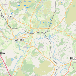
Skirling Map, Satellite view of Skirling, Tweeddale, Scotland
Skirling is located in Tweeddale County, Scottish Borders, Scotland, Scotland, United Kingdom.
Location informations of Skirling
Latitude of city of Skirling is 55.63869 and longitude of city of Skirling is -3.46922. Skirling has 1 postcode / zip code, in county of Tweeddale.The County of Skirling is Tweeddale.
Postcode / zip code of Skirling
ML12 6Administrative division of Skirling
County :TweeddaleGPS coordinates of Skirling
Latitude : 55.63869Longitude : -3.46922
Online Map of Skirling - road map, satellite view and street view


Leaflet | © OpenStreetMap contributors
Search distance between two cities
The weather for Skirling in the United Kingdom
Get today and tomorrow's weather forecasts for Skirling. Find out the weather forecast for the week ahead and the weekend for Skirling in the UK.Skirling weather forecast 15 days
What is the nearest train station to Skirling?
List of Railway Stations near to SkirlingThe nearest railway stations to Skirling are listed below. Tickets are available at the train station ticket office or ticket machines.
| Name | Distances from Skirling |
|---|---|
| Carstairs Station | 13.79 Km |
| Lanark Station | 19.47 Km |
| Addiewell Station | 24.33 Km |
| Breich Station | 24.39 Km |
| West Calder Station | 24.69 Km |
| Fauldhouse Station | 25.75 Km |
| Carluke Station | 25.93 Km |
| Livingston South Station | 25.99 Km |
| Kirknewton Station | 27.89 Km |
| Shotts Station | 28.72 Km |
What is the nearest Public Transport Stops to Skirling?
List of Stops near to SkirlingGetting there by public transport (nearest train, tube, overground line station and bus stops). The nearest stops to Skirling are listed below.
| Stop Name | Distances from Skirling |
|---|---|
| Village Green Bus Stop (at) | 234 m |
| Goatfoot Bus Stop (at) | 357 m |
| Candymill Road Bus Stop (Opp) | 2.22 Km |
| Candymill Road Bus Stop (at) | 2.27 Km |
| Leafield Road Bus Stop (opp) | 3.17 Km |
| Leafield Road Bus Stop (after) | 3.18 Km |
| Cross Road Bus Stop (after) | 3.39 Km |
| Broughton Road Bus Stop (opp) | 3.44 Km |
| John Street Bus Stop (before) | 3.61 Km |
| John Street Bus Stop (opp) | 3.68 Km |
Historic Places to Visit near Skirling
List of Historic places near to Skirling
| Name | Distances from Skirling |
|---|---|
| Gladstone Court Museum | 3.62 Km |
| Greenhill Covenanters House | 3.85 Km |
| Biggar Gasworks Museum | 4.04 Km |
| Coulter Motte | 6.57 Km |
| Dawyck Botanic Garden | 9.53 Km |
| Stobo Parish Church | 10.78 Km |
Cities or Towns near Skirling
List of places near to
| Name | Distance |
|---|---|
| Candy Mill | 2.37 Km |
| Kaimrig End | 2.87 Km |
| Edmonston | 3.17 Km |
| Biggar | 3.81 Km |
| Elsrickle | 4.24 Km |
| Broughton | 4.69 Km |
| Calzeat | 5.30 Km |
| Mitchell Hill | 5.93 Km |
| Rachan Mill | 6.19 Km |
| Walston | 6.51 Km |
| Kirkurd | 6.97 Km |
| Netherurd | 7.26 Km |
| Coulter | 7.48 Km |
| Castlecraig | 7.82 Km |
| Drumelzier | 7.85 Km |
| Quothquan | 7.91 Km |
| Dolphinton | 8.07 Km |
| Blyth Bridge | 8.39 Km |
| Dunsyre | 8.82 Km |
| Newbigging | 8.97 Km |
| Symington | 9.01 Km |
| Libberton | 9.30 Km |
| Bellspool | 9.65 Km |
| Covington | 10.02 Km |
| Kaimend | 10.27 Km |
| Spittal | 10.36 Km |
| Thankerton | 10.38 Km |
| Mountain Cross | 10.57 Km |
| Stanhope | 10.63 Km |
| Bordlands | 10.64 Km |
| Stobo | 10.89 Km |
| Kingledores | 11.19 Km |
| Hallyne | 11.50 Km |
| Carnwath | 11.95 Km |
| Romannobridge | 12.13 Km |
| Lamington | 12.63 Km |
| Pettinain | 12.69 Km |
| Haswellsykes | 12.85 Km |
| West End | 13.29 Km |
| Carstairs Junction | 13.47 Km |
| Bogs Bank | 13.65 Km |
| Lyne Station | 13.84 Km |
| Barns | 13.84 Km |
| Harehope | 13.85 Km |
| Hallyards | 13.96 Km |
| The Glack | 13.96 Km |
| Wiston | 14.05 Km |
| Glenrath | 14.10 Km |
| Posso | 14.10 Km |
| Glenternie | 14.13 Km |