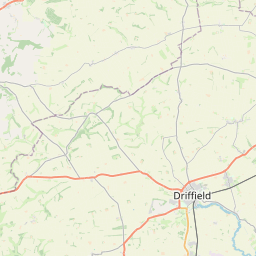
Meaux Map, Satellite view of Meaux, East Riding of Yorkshire, England
Meaux is located in East Riding of Yorkshire County, East Riding of Yorkshire, Yorkshire and the Humber, England, United Kingdom.
Location informations of Meaux
Latitude of city of Meaux is 53.83635 and longitude of city of Meaux is -0.33621. Meaux has 1 postcode / zip code, in county of East Riding of Yorkshire.The County of Meaux is East Riding of Yorkshire.
Postcode / zip code of Meaux
HU17 9Administrative division of Meaux
County :East Riding of YorkshireGPS coordinates of Meaux
Latitude : 53.83635Longitude : -0.33621
Online Map of Meaux - road map, satellite view and street view


Leaflet | © OpenStreetMap contributors
Search distance between two cities
The weather for Meaux in the United Kingdom
Get today and tomorrow's weather forecasts for Meaux. Find out the weather forecast for the week ahead and the weekend for Meaux in the UK.Meaux weather forecast 15 days
What is the nearest train station to Meaux?
List of Railway Stations near to MeauxThe nearest railway stations to Meaux are listed below. Tickets are available at the train station ticket office or ticket machines.
| Name | Distances from Meaux |
|---|---|
| Beverley Station | 5.73 Km |
| Cottingham Station | 7.63 Km |
| Arram Station | 7.97 Km |
| Hull Station | 10.27 Km |
| Hutton Cranswick Station | 14.75 Km |
| Hessle Station | 14.93 Km |
| New Holland Station | 15.03 Km |
| Barrow Haven Station | 15.89 Km |
| Ferriby Station | 17.40 Km |
| Goxhill Station | 17.75 Km |
What is the nearest Public Transport Stops to Meaux?
List of Stops near to MeauxGetting there by public transport (nearest train, tube, overground line station and bus stops). The nearest stops to Meaux are listed below.
| Stop Name | Distances from Meaux |
|---|---|
| Wawne Main Street Bus Stop (22011705) | 2.25 Km |
| Wawne Main Street Bus Stop (22011704) | 2.28 Km |
| Wawne Main Street Bus Stop (22011706) | 2.28 Km |
| Wawne Sutton Road Bus Stop (22011708) | 2.28 Km |
| Wawne Main Street Bus Stop (22011707) | 2.30 Km |
| Wawne Green Lane Bus Stop (22001551) | 2.32 Km |
| Kentmere Close Bus Stop | 2.77 Km |
| Fairbourne Close Bus Stop | 2.78 Km |
| South Field Bus Stop | 2.79 Km |
| Carlamhill Bridge Bus Stop (adj) | 2.79 Km |
Historic Places to Visit near Meaux
List of Historic places near to Meaux
| Name | Distances from Meaux |
|---|---|
| Skirlaugh, St Augustines Church | 4.69 Km |
| Beverley Friary | 5.71 Km |
| Beverley Minster | 5.79 Km |
| Beverley, St Marys Church | 6.56 Km |
| Catwick, St Michaels Church | 7.12 Km |
| Brandesburton, St Marys Church | 8.82 Km |
| Sigglesthorne, St Lawrence Church | 8.84 Km |
| Skidby Windmill | 9.34 Km |
| Burton Constable Hall | 9.93 Km |
| Maister House | 10.32 Km |
| Burton Bishop, All Saints Church | 10.50 Km |
| Goxhill, St Giles Church | 11.72 Km |
| Etton, St Marys Church | 11.90 Km |
| Rowley, St Peters Church | 13.28 Km |
| Hornsea Museum | 13.71 Km |
| Mappleton, All Saints Church | 13.83 Km |
| South Dalton, St Marys Church | 14.37 Km |
| Kilnwick, All Saints Church | 14.48 Km |
Cities or Towns near Meaux
List of places near to
| Name | Distance |
|---|---|
| Wawne | 2.29 Km |
| Weel | 3.17 Km |
| Thearne | 3.17 Km |
| Routh | 3.56 Km |
| Woodmansey | 3.79 Km |
| Arnold | 3.86 Km |
| Midmeredales | 3.94 Km |
| Tickton | 4.21 Km |
| Long Riston | 4.57 Km |
| Dunswell | 4.57 Km |
| Skirlaugh | 4.59 Km |
| Grey Legs | 4.67 Km |
| Kingswood | 4.76 Km |
| Hull Bridge | 5.15 Km |
| Swine | 5.20 Km |
| Bransholme | 5.59 Km |
| Little Catwick | 6.15 Km |
| West Carr | 6.26 Km |
| Oubrough | 6.28 Km |
| Leven | 6.37 Km |
| Beverley | 6.43 Km |
| Little Leven | 6.49 Km |
| Sutton on Hull | 6.59 Km |
| Rise | 6.64 Km |
| Molescroft | 6.96 Km |
| Catwick | 7.03 Km |
| Coniston | 7.17 Km |
| Ganstead | 7.18 Km |
| New Village | 7.25 Km |
| New Ellerby | 7.41 Km |
| Old Ellerby | 7.50 Km |
| Newland | 7.65 Km |
| Newland Park | 7.81 Km |
| Sutton Ings | 7.88 Km |
| Inglemire | 7.90 Km |
| Arram | 7.96 Km |
| Whitedale | 7.99 Km |
| Bentley | 8.00 Km |
| Stoneferry | 8.01 Km |
| Cottingham | 8.01 Km |
| Sandfield | 8.11 Km |
| Aike | 8.26 Km |
| Sculcoates | 8.29 Km |
| Marton | 8.36 Km |
| New Arram | 8.41 Km |
| Thirtleby | 8.53 Km |
| Summergangs | 8.56 Km |
| Brandesburton | 8.75 Km |
| Little Hatfield | 8.84 Km |
| Wilmington | 8.84 Km |