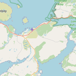
Letterfearn Map, Satellite view of Letterfearn, Ross and Cromarty, Scotland
Letterfearn is located in Ross and Cromarty County, Highland, Scotland, Scotland, United Kingdom.
Location informations of Letterfearn
Latitude of city of Letterfearn is 57.26053 and longitude of city of Letterfearn is -5.51474. Letterfearn has 1 postcode / zip code, in county of Ross and Cromarty.The County of Letterfearn is Ross and Cromarty.
Postcode / zip code of Letterfearn
IV40 8Administrative division of Letterfearn
County :Ross and CromartyGPS coordinates of Letterfearn
Latitude : 57.26053Longitude : -5.51474
Online Map of Letterfearn - road map, satellite view and street view


Leaflet | © OpenStreetMap contributors
Search distance between two cities
The weather for Letterfearn in the United Kingdom
Get today and tomorrow's weather forecasts for Letterfearn. Find out the weather forecast for the week ahead and the weekend for Letterfearn in the UK.Letterfearn weather forecast 15 days
What is the nearest train station to Letterfearn?
List of Railway Stations near to LetterfearnThe nearest railway stations to Letterfearn are listed below. Tickets are available at the train station ticket office or ticket machines.
| Name | Distances from Letterfearn |
|---|---|
| Stromeferry Station | 10.44 Km |
| Duncraig Station | 11.24 Km |
| Kyle Of Lochalsh Station | 12.16 Km |
| Plockton Station | 12.19 Km |
| Duirinish Station | 12.50 Km |
| Attadale Station | 15.37 Km |
| Strathcarron Station | 18.76 Km |
| Achnashellach Station | 26.94 Km |
What is the nearest Public Transport Stops to Letterfearn?
List of Stops near to LetterfearnGetting there by public transport (nearest train, tube, overground line station and bus stops). The nearest stops to Letterfearn are listed below.
| Stop Name | Distances from Letterfearn |
|---|---|
| Druidaig Lodge Bus Stop (o/s) | 223 m |
| Post Box Bus Stop (at) | 562 m |
| Eilean Donan Castle Bus Stop (o/s) | 1.57 Km |
| Bridge Rd End Bus Stop (opp) | 1.72 Km |
| Bridge Rd End Bus Stop (at) | 1.73 Km |
| Camuslongart Rd End Bus Stop (opp) | 2.31 Km |
| Lochside Bus Stop (at) | 2.83 Km |
| Road End Bus Stop (at) | 3.11 Km |
| Road End Bus Stop (opp) | 3.13 Km |
| Road End Bus Stop (at) | 3.78 Km |
Historic Places to Visit near Letterfearn
List of Historic places near to Letterfearn
| Name | Distances from Letterfearn |
|---|---|
| Totaig Broch | 1.64 Km |
| Eilean Donan Castle | 1.89 Km |
| Dun Troddan Broch | 8.50 Km |
| Dun Telve Broch | 8.75 Km |
| Balmacara Estate and Lochalsh Woodland Garden | 8.87 Km |
| Kintail and Morvich | 8.91 Km |
| Strome Castle | 11.26 Km |
| Falls of Glomach | 13.76 Km |
Cities or Towns near Letterfearn
List of places near to
| Name | Distance |
|---|---|
| Dornie | 1.78 Km |
| Keppoch | 1.87 Km |
| Leachachan | 2.62 Km |
| Camas-longart | 2.64 Km |
| Ardelve | 2.89 Km |
| Bundalloch | 3.28 Km |
| Avernish | 3.66 Km |
| Nostie | 3.74 Km |
| Inverinate | 4.04 Km |
| Ardintoul | 4.61 Km |
| Auchtertyre | 5.17 Km |
| Kirkton | 5.73 Km |
| Allt nan Sùgh | 5.93 Km |
| Ratagan | 6.03 Km |
| Sallachy | 7.01 Km |
| Glen More | 7.03 Km |
| Reraig | 7.29 Km |
| Invershiel | 7.45 Km |
| Allt a' Chruinn | 7.64 Km |
| Camas-luinie | 7.73 Km |
| Shiel Bridge | 7.78 Km |
| Galltair | 7.93 Km |
| Balmacara | 8.24 Km |
| Braeintra | 8.27 Km |
| Carn-gorm | 8.27 Km |
| Killilan | 8.35 Km |
| Glenelg | 8.39 Km |
| Balmacara Square | 8.66 Km |
| Morvich | 9.08 Km |
| Glaick | 9.16 Km |
| Achmore | 9.51 Km |
| Eilanreach | 9.64 Km |
| Achnandarach | 10.16 Km |
| Kylerhea / Caol Reatha | 10.16 Km |
| Craig | 10.45 Km |
| Strome Ferry | 10.46 Km |
| Ardnarff | 11.31 Km |
| Stromemore | 11.43 Km |
| Leacanasigh | 11.44 Km |
| Leacanashie / Leacanaisigh | 11.57 Km |
| Dìurinis / Diùranais | 11.62 Km |
| Ardaneaskan | 12.05 Km |
| Kyle of Lochalsh / Caol Loch Aillse | 12.10 Km |
| Plockton / Am Ploc | 12.20 Km |
| Mid Strome | 12.24 Km |
| Drumbuie | 12.32 Km |
| Erbusaig | 12.81 Km |
| Portneora | 13.01 Km |
| Badicaul | 13.26 Km |
| Kyleakin / Caol Acain | 13.86 Km |