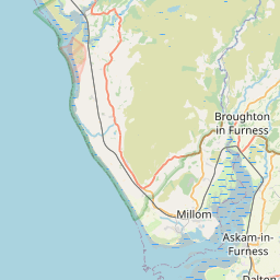
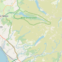
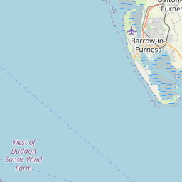
Gawthwaite Map, Satellite view of Gawthwaite, Cumbria, England
Gawthwaite is located in Cumbria County, South Lakeland District, North West, England, United Kingdom.
Location informations of Gawthwaite
Latitude of city of Gawthwaite is 54.25403 and longitude of city of Gawthwaite is -3.12003. Gawthwaite has 1 postcode / zip code, in county of Cumbria.The County of Gawthwaite is Cumbria.
Postcode / zip code of Gawthwaite
LA12 8Administrative division of Gawthwaite
County :CumbriaGPS coordinates of Gawthwaite
Latitude : 54.25403Longitude : -3.12003
Online Map of Gawthwaite - road map, satellite view and street view


Leaflet | © OpenStreetMap contributors
Search distance between two cities
The weather for Gawthwaite in the United Kingdom
Get today and tomorrow's weather forecasts for Gawthwaite. Find out the weather forecast for the week ahead and the weekend for Gawthwaite in the UK.Gawthwaite weather forecast 15 days
What is the nearest train station to Gawthwaite?
List of Railway Stations near to GawthwaiteThe nearest railway stations to Gawthwaite are listed below. Tickets are available at the train station ticket office or ticket machines.
| Name | Distances from Gawthwaite |
|---|---|
| Kirkby-In-Furness Station | 4.98 Km |
| Foxfield Station | 6.26 Km |
| Ulverston Station | 7.09 Km |
| Green Road Station | 8.22 Km |
| Askam Station | 9.09 Km |
| Millom Station | 10.93 Km |
| Dalton Station | 11.74 Km |
| Cark and Cartmel Station | 12.71 Km |
| Silecroft Station | 14.28 Km |
| Grange-Over-Sands Station | 15.54 Km |
What is the nearest Public Transport Stops to Gawthwaite?
List of Stops near to GawthwaiteGetting there by public transport (nearest train, tube, overground line station and bus stops). The nearest stops to Gawthwaite are listed below.
| Stop Name | Distances from Gawthwaite |
|---|---|
| Village Notice Board Bus Stop (at) | 21 m |
| Beckstones Farm road end Bus Stop (at) | 1.91 Km |
| Moor House road end Bus Stop (at) | 2.10 Km |
| allotment gardens Bus Stop (o/s) | 2.70 Km |
| Old Spade Forge Bus Stop (opp) | 2.70 Km |
| Old Spade Forge Bus Stop (o/s) | 2.70 Km |
| allotment gardens Bus Stop (opp) | 2.71 Km |
| The Red Lion Bus Stop (at) | 2.73 Km |
| The Red Lion Bus Stop (o/s) | 2.75 Km |
| Smithy Corner Bus Stop (at) | 2.96 Km |
Historic Places to Visit near Gawthwaite
List of Historic places near to Gawthwaite
| Name | Distances from Gawthwaite |
|---|---|
| Blawith, St Johns Church | 3.96 Km |
| Hoad Monument | 6.23 Km |
| Swarthmoor Hall | 7.61 Km |
| Duddon Iron Furnace | 8.20 Km |
| Lakeland Motor Museum | 8.50 Km |
| Swinside Stone Circle | 10.03 Km |
| Brantwood | 10.38 Km |
| Coniston Water | 10.71 Km |
| Stott Park Bobbin Mill | 10.74 Km |
| Ulpha, St Johns Church | 11.13 Km |
| Fell Foot Park | 11.24 Km |
| Grizedale Forest Park | 11.46 Km |
| Holker Hall | 11.50 Km |
| Dalton Castle | 11.72 Km |
| Graythwaite Hall Garden | 11.94 Km |
| Cartmel Priory Gatehouse | 12.28 Km |
| Cartmel Priory Church | 12.28 Km |
| Old Man of Coniston | 12.98 Km |
| Ruskin Museum, Coniston | 13.19 Km |
| Steam Yacht Gondola | 13.31 Km |
| Furness Abbey | 14.16 Km |
| Bow Bridge | 14.22 Km |
| Hill Top | 14.73 Km |
Cities or Towns near Gawthwaite
List of places near to
| Name | Distance |
|---|---|
| Wood Gate | 1.19 Km |
| Lowick Green | 2.36 Km |
| Beanthwaite | 2.41 Km |
| Lowick Bridge | 2.56 Km |
| Broughton Beck | 2.82 Km |
| Grizebeck | 3.24 Km |
| Spark Bridge | 3.36 Km |
| Chapels | 3.57 Km |
| Blawith | 3.85 Km |
| Friars' Ground | 4.04 Km |
| Low Nibthwaite | 4.08 Km |
| Wall End | 4.21 Km |
| Penny Bridge | 4.31 Km |
| Tottlebank | 4.37 Km |
| Beck Side | 4.41 Km |
| Head Crag | 4.66 Km |
| Colton | 4.67 Km |
| Mansriggs | 4.68 Km |
| Water Yeat | 4.71 Km |
| Kirkby-in-Furness | 4.72 Km |
| Four Lane Ends | 4.72 Km |
| Bandrake Head | 4.82 Km |
| Sand Side | 4.85 Km |
| Greenodd | 4.89 Km |
| Wreaks End | 4.90 Km |
| Woodland | 5.09 Km |
| Newland Bottom | 5.26 Km |
| Oxen Park | 5.34 Km |
| High Nibthwaite | 5.36 Km |
| Arrad Foot | 5.37 Km |
| Soutergate | 5.58 Km |
| Bouth | 5.80 Km |
| Eccle Riggs | 5.85 Km |
| Town Bank | 5.99 Km |
| Newland | 6.02 Km |
| Foxfield | 6.07 Km |
| Rosside | 6.33 Km |
| Broughton in Furness | 6.39 Km |
| Ulverston | 6.76 Km |
| Haverthwaite | 6.86 Km |
| Ickenthwaite | 7.10 Km |
| Lower Hawthwaite | 7.29 Km |
| Rowe Head | 7.36 Km |
| Dragley Beck | 7.38 Km |
| Pennington | 7.44 Km |
| Loppergarth | 7.51 Km |
| Broughton Mills | 7.56 Km |
| South Ulverston | 7.57 Km |
| Low Wood | 7.58 Km |
| Swarthmoor | 7.63 Km |