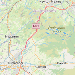
Darvel Town Map, Satellite view of Darvel, Ayrshire and Arran, Scotland
Darvel is located in Ayrshire and Arran County, East Ayrshire, Scotland, Scotland, United Kingdom.
Location informations of Darvel
Latitude of city of Darvel is 55.60977 and longitude of city of Darvel is -4.28104. Darvel has 1 postcode / zip code, in county of Ayrshire and Arran.The County of Darvel is Ayrshire and Arran.
Postcode / zip code of Darvel
KA17 0Administrative division of Darvel
County :Ayrshire and ArranGPS coordinates of Darvel
Latitude : 55.60977Longitude : -4.28104
Online Map of Darvel - road map, satellite view and street view


Leaflet | © OpenStreetMap contributors
Search distance between two cities
The weather for Darvel in the United Kingdom
Get today and tomorrow's weather forecasts for Darvel. Find out the weather forecast for the week ahead and the weekend for Darvel in the UK.Darvel weather forecast 15 days
What is the nearest train station to Darvel?
List of Railway Stations near to DarvelThe nearest railway stations to Darvel are listed below. Tickets are available at the train station ticket office or ticket machines.
| Name | Distances from Darvel |
|---|---|
| Kilmarnock Station | 13.67 Km |
| Auchinleck Station | 15.54 Km |
| Kilmaurs Station | 15.96 Km |
| Stewarton Station | 16.91 Km |
| Hairmyres Station | 17.35 Km |
| Thorntonhall Station | 17.77 Km |
| East Kilbride Station | 18.49 Km |
| Busby Station | 19.00 Km |
| Dunlop Station | 19.43 Km |
| Clarkston Station | 19.97 Km |
What is the nearest Public Transport Stops to Darvel?
List of Stops near to DarvelGetting there by public transport (nearest train, tube, overground line station and bus stops). The nearest stops to Darvel are listed below.
| Stop Name | Distances from Darvel |
|---|---|
| Green Street Bus Stop (before) | 45 m |
| Green Street Bus Stop (opp) | 99 m |
| Temple Street Bus Stop (before) | 116 m |
| Temple Street Bus Stop (opp) | 197 m |
| Kirkland Road Bus Stop (before) | 291 m |
| Fleming Street Bus Stop (before) | 342 m |
| Murdoch Road Bus Stop (before) | 353 m |
| Fleming Street Bus Stop (after) | 391 m |
| Roxburgh Gardens Bus Stop (after) | 527 m |
| Roxburgh Gardens Bus Stop (opp) | 530 m |
Historic Places to Visit near Darvel
List of Historic places near to Darvel
| Name | Distances from Darvel |
|---|---|
| Sorn Castle | 10.65 Km |
| Burns House Museum | 12.12 Km |
| Dean Castle | 12.81 Km |
| Rowallan Castle | 13.83 Km |
Cities or Towns near Darvel
List of places near to
| Name | Distance |
|---|---|
| Priestland | 1.39 Km |
| Newmilns | 2.72 Km |
| Greenholm | 3.17 Km |
| Gilfoot | 3.94 Km |
| Sornhill | 5.78 Km |
| Galston | 6.29 Km |
| Drumclog | 7.66 Km |
| Moscow | 8.22 Km |
| Auchmillan | 9.36 Km |
| Gilmourton | 9.54 Km |
| Crossroads | 9.98 Km |
| Waterside | 10.06 Km |
| Caldermill | 10.68 Km |
| Hurlford | 10.86 Km |
| Sorn | 11.03 Km |
| Crookedholm | 11.43 Km |
| Laigh Fenwick | 11.47 Km |
| Fenwick | 11.74 Km |
| Mauchline | 12.12 Km |
| Catrine | 12.13 Km |
| New Farm Loch | 12.35 Km |
| Whiteflat | 12.60 Km |
| Bellfield | 12.92 Km |
| Beansburn | 13.12 Km |
| Longpark | 13.30 Km |
| Hillhead | 13.40 Km |
| Onthank | 13.41 Km |
| Kilmarnock | 13.41 Km |
| Laigh Carnduff | 13.49 Km |
| Riccarton | 13.72 Km |
| Knockinlaw | 13.76 Km |
| Haugh | 13.79 Km |
| Shortlees | 13.88 Km |
| Altonhill | 13.97 Km |
| Auldhouse | 14.09 Km |
| Caprington | 14.14 Km |
| Craigie | 14.38 Km |
| Grange | 14.39 Km |
| Bonnyton | 14.60 Km |
| Eaglesham | 14.65 Km |