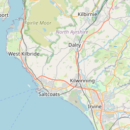
Hillhead Map, Satellite view of Hillhead, Ayrshire and Arran, Scotland
Hillhead is located in Ayrshire and Arran County, East Ayrshire, Scotland, Scotland, United Kingdom.
Location informations of Hillhead
Latitude of city of Hillhead is 55.61695 and longitude of city of Hillhead is -4.49397. Hillhead has 1 postcode / zip code, in county of Ayrshire and Arran.The County of Hillhead is Ayrshire and Arran.
Postcode / zip code of Hillhead
KA3 1Administrative division of Hillhead
County :Ayrshire and ArranGPS coordinates of Hillhead
Latitude : 55.61695Longitude : -4.49397
Online Map of Hillhead - road map, satellite view and street view


Leaflet | © OpenStreetMap contributors
Search distance between two cities
The weather for Hillhead in the United Kingdom
Get today and tomorrow's weather forecasts for Hillhead. Find out the weather forecast for the week ahead and the weekend for Hillhead in the UK.Hillhead weather forecast 15 days
What is the nearest train station to Hillhead?
List of Railway Stations near to HillheadThe nearest railway stations to Hillhead are listed below. Tickets are available at the train station ticket office or ticket machines.
| Name | Distances from Hillhead |
|---|---|
| Kilmarnock Station | 613 m |
| Kilmaurs Station | 3.21 Km |
| Stewarton Station | 7.41 Km |
| Dunlop Station | 10.83 Km |
| Irvine Station | 11.40 Km |
| Barassie Station | 11.67 Km |
| Troon Station | 13.07 Km |
| Prestwick Internat'nl Airport Station | 14.18 Km |
| Kilwinning Station | 14.24 Km |
| Prestwick Station | 14.91 Km |
Glasgow Prestwick Airport , UK (13.30 Km)
What is the nearest Public Transport Stops to Hillhead?
List of Stops near to HillheadGetting there by public transport (nearest train, tube, overground line station and bus stops). The nearest stops to Hillhead are listed below.
| Stop Name | Distances from Hillhead |
|---|---|
| Cuthbert Place Bus Stop (opp) | 27 m |
| Dean Lane Bus Stop (before) | 110 m |
| Blair Cottage Bus Stop (opp) | 145 m |
| Dean Street Bus Stop (after) | 192 m |
| Dean Street Bus Stop (before) | 224 m |
| Wellington Street Bus Stop (After) | 238 m |
| Dean Lane Bus Stop (after) | 277 m |
| Wellington Place Bus Stop (before) | 281 m |
| Campbeltown Drive Bus Stop (opp) | 305 m |
| Kirn Road Bus Stop (After) | 329 m |
Historic Places to Visit near Hillhead
List of Historic places near to Hillhead
| Name | Distances from Hillhead |
|---|---|
| Dean Castle | 0.96 Km |
| Rowallan Castle | 3.73 Km |
| Dundonald Castle | 7.71 Km |
| Irvine Burns Club | 10.95 Km |
| Bachelors Club | 11.52 Km |
| Eglinton Castle | 11.52 Km |
| Scottish Maritime Museum | 11.61 Km |
| Burns House Museum | 13.31 Km |
| Kilwinning Abbey | 13.48 Km |
| Dalgarven Mill | 14.38 Km |
Cities or Towns near Hillhead
List of places near to
| Name | Distance |
|---|---|
| Longpark | 0.44 Km |
| Beansburn | 0.58 Km |
| Knockinlaw | 0.59 Km |
| Altonhill | 0.62 Km |
| Kilmarnock | 0.77 Km |
| Onthank | 0.97 Km |
| New Farm Loch | 1.07 Km |
| Bonnyton | 1.32 Km |
| Grange | 1.34 Km |
| Kirktoun | 2.32 Km |
| Crookedholm | 2.38 Km |
| Riccarton | 2.50 Km |
| Caprington | 3.12 Km |
| Hurlford | 3.15 Km |
| Kilmaurs | 3.17 Km |
| Knockentiber | 3.21 Km |
| Bellfield | 3.24 Km |
| Shortlees | 3.50 Km |
| Crosshouse | 3.72 Km |
| Earlston | 4.12 Km |
| Gatehead / Port-nah-Abhainne | 4.44 Km |
| Busbiehill | 4.58 Km |
| Laigh Fenwick | 5.13 Km |
| Moscow | 5.81 Km |
| Fenwick | 5.88 Km |
| Springside | 6.04 Km |
| Crossroads | 6.16 Km |
| Cunninghamhead | 6.29 Km |
| Craigie | 6.37 Km |
| Coodham | 6.83 Km |
| Waterside | 7.26 Km |
| Stewarton | 7.28 Km |
| Galston | 7.40 Km |
| Bogend | 7.43 Km |
| Drybridge | 7.56 Km |
| Dundonald | 7.73 Km |
| Dreghorn | 8.03 Km |
| Whitelees | 8.05 Km |
| Perceton | 8.12 Km |
| Bourtreehill | 8.30 Km |
| Symington | 8.43 Km |
| Broomlands | 8.51 Km |
| Sourlie | 8.94 Km |
| Torranyard | 9.03 Km |
| Girdle Toll | 9.04 Km |
| Sornhill | 9.21 Km |
| Doura | 9.29 Km |
| Kingsford | 9.49 Km |
| Stanecastle | 9.53 Km |
| Gilfoot | 9.56 Km |