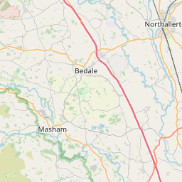
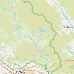
Carlesmoor Map, Satellite view of Carlesmoor, North Yorkshire, England
Carlesmoor is located in North Yorkshire County, Harrogate District, Yorkshire and the Humber, England, United Kingdom.
Location informations of Carlesmoor
Latitude of city of Carlesmoor is 54.15698 and longitude of city of Carlesmoor is -1.71821. Carlesmoor has 1 postcode / zip code, in county of North Yorkshire.The County of Carlesmoor is North Yorkshire.
Postcode / zip code of Carlesmoor
HG4 3Administrative division of Carlesmoor
County :North YorkshireGPS coordinates of Carlesmoor
Latitude : 54.15698Longitude : -1.71821
Online Map of Carlesmoor - road map, satellite view and street view


Leaflet | © OpenStreetMap contributors
Search distance between two cities
The weather for Carlesmoor in the United Kingdom
Get today and tomorrow's weather forecasts for Carlesmoor. Find out the weather forecast for the week ahead and the weekend for Carlesmoor in the UK.Carlesmoor weather forecast 15 days
What is the nearest train station to Carlesmoor?
List of Railway Stations near to CarlesmoorThe nearest railway stations to Carlesmoor are listed below. Tickets are available at the train station ticket office or ticket machines.
| Name | Distances from Carlesmoor |
|---|---|
| Harrogate Station | 21.69 Km |
| Starbeck Station | 22.56 Km |
| Knaresborough Station | 23.06 Km |
| Hornbeam Park Station | 23.32 Km |
| Thirsk Station | 23.84 Km |
| Pannal Station | 25.17 Km |
| Ben Rhydding Station | 26.23 Km |
| Northallerton Station | 26.59 Km |
| Ilkley Station | 26.70 Km |
| Weeton Station | 27.49 Km |
What is the nearest Public Transport Stops to Carlesmoor?
List of Stops near to CarlesmoorGetting there by public transport (nearest train, tube, overground line station and bus stops). The nearest stops to Carlesmoor are listed below.
| Stop Name | Distances from Carlesmoor |
|---|---|
| Church Bus Stop (SE-bound) | 4.30 Km |
| Church Bus Stop (W-bound) | 4.32 Km |
| Post Office Bus Stop (W-bound) | 4.74 Km |
| Post Office Bus Stop (E-bound) | 4.74 Km |
| St James Church Bus Stop (NW-bound) | 5.28 Km |
| St James Church Bus Stop (SE-bound) | 5.29 Km |
| The Grantley Arms Bus Stop (N-bound) | 5.95 Km |
| The Grantley Arms Bus Stop (S-bound) | 5.96 Km |
| The Galphay Arms Bus Stop (N-bound) | 6.77 Km |
| The Galphay Arms Bus Stop (SE-bound) | 6.78 Km |
Historic Places to Visit near Carlesmoor
List of Historic places near to Carlesmoor
| Name | Distances from Carlesmoor |
|---|---|
| Hackfall Woods | 6.08 Km |
| Brimham Rocks | 9.47 Km |
| Marmion Tower | 9.77 Km |
| Studley Royal, St Mary Church | 9.95 Km |
| Fountains Abbey | 10.01 Km |
| Studley Royal Water Garden | 10.01 Km |
| Jervaulx Abbey | 12.27 Km |
| Markenfield Hall | 12.51 Km |
| Snape Castle Chapel | 13.54 Km |
| Norton Conyers | 13.63 Km |
| Thorp Perrow Arboretum | 13.70 Km |
| Braithwaite Hall | 14.10 Km |
Cities or Towns near Carlesmoor
List of places near to
| Name | Distance |
|---|---|
| Swetton | 1.00 Km |
| Greygarth | 1.21 Km |
| Dallow | 2.37 Km |
| Belford | 2.77 Km |
| Wake Hill | 3.16 Km |
| Ringbeck | 3.30 Km |
| Stainmoor | 4.13 Km |
| Laverton | 4.31 Km |
| Kirkby Malzeard | 4.73 Km |
| Ilton | 4.84 Km |
| Grewelthorpe | 5.28 Km |
| Warthermarske | 5.94 Km |
| High Grantley | 5.94 Km |
| Low Grantley | 6.08 Km |
| Eavestone | 6.42 Km |
| Leighton | 6.42 Km |
| Bouthwaite | 6.59 Km |
| Low Swinton | 6.61 Km |
| Galphay | 6.81 Km |
| High Swinton | 6.90 Km |
| Winksley | 6.93 Km |
| Wath | 6.97 Km |
| Ramsgill | 7.04 Km |
| Healey | 7.14 Km |
| Grantley Hall | 7.19 Km |
| Risplith | 7.51 Km |
| Silver Hill | 7.56 Km |
| Azerley | 7.60 Km |
| Fearby | 7.61 Km |
| Heathfield | 7.77 Km |
| Mickley | 8.07 Km |
| Gollinglith Foot | 8.12 Km |
| Pateley Bridge | 8.27 Km |
| Lofthouse | 8.31 Km |
| Masham | 8.33 Km |
| Blazefield | 8.34 Km |
| Bridgehouse Gate | 8.42 Km |
| Sawley | 8.57 Km |
| Wilsill | 8.89 Km |
| Ladies Riggs | 8.93 Km |
| Bewerley | 8.94 Km |
| Glasshouses | 8.99 Km |
| Aldfield | 9.04 Km |
| Binsoe | 9.12 Km |
| Ashfold Side | 9.20 Km |
| Warsill | 9.22 Km |
| Smelthouses | 9.26 Km |
| Middlesmoor | 9.28 Km |
| Studley Royal | 9.46 Km |
| Colsterdale | 9.53 Km |