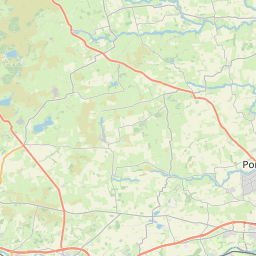
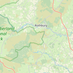
Brenkley Map, Satellite view of Brenkley, Tyne and Wear, England
Brenkley is located in Tyne and Wear County, Newcastle upon Tyne District, North East, England, United Kingdom.
Location informations of Brenkley
Latitude of city of Brenkley is 55.07020 and longitude of city of Brenkley is -1.65843. Brenkley has 1 postcode / zip code, in county of Tyne and Wear.The County of Brenkley is Tyne and Wear.
Postcode / zip code of Brenkley
NE13 6Administrative division of Brenkley
County :Tyne and WearGPS coordinates of Brenkley
Latitude : 55.07020Longitude : -1.65843
Online Map of Brenkley - road map, satellite view and street view


Leaflet | © OpenStreetMap contributors
Search distance between two cities
The weather for Brenkley in the United Kingdom
Get today and tomorrow's weather forecasts for Brenkley. Find out the weather forecast for the week ahead and the weekend for Brenkley in the UK.Brenkley weather forecast 15 days
What is the nearest train station to Brenkley?
List of Railway Stations near to BrenkleyThe nearest railway stations to Brenkley are listed below. Tickets are available at the train station ticket office or ticket machines.
| Name | Distances from Brenkley |
|---|---|
| Cramlington Station | 4.28 Km |
| Morpeth Station | 10.37 Km |
| Manors Station | 11.36 Km |
| Newcastle Station | 11.62 Km |
| Pegswood Station | 12.04 Km |
| Blaydon Station | 12.11 Km |
| MetroCentre Station | 12.40 Km |
| Dunston Station | 13.40 Km |
| Wylam Station | 14.51 Km |
| Heworth Station | 14.73 Km |
Newcastle Airport , UK (4.21 Km)
What is the nearest Public Transport Stops to Brenkley?
List of Stops near to BrenkleyGetting there by public transport (nearest train, tube, overground line station and bus stops). The nearest stops to Brenkley are listed below.
| Stop Name | Distances from Brenkley |
|---|---|
| Milkhope Farm Bus Stop (opp) | 952 m |
| Milkhope Farm Bus Stop (near) | 962 m |
| Brenkley Road End Bus Stop (Northbound) | 1.06 Km |
| Shotton Edge South Bus Stop (nb) | 1.08 Km |
| Shotton Edge South Bus Stop (sb) | 1.10 Km |
| Brenkley Road End Bus Stop (Southbound) | 1.11 Km |
| South Lodge Bus Stop (nb) | 1.27 Km |
| South Lodge Bus Stop (sb) | 1.36 Km |
| Holiday Inn Bus Stop (N-Bound) | 1.42 Km |
| Holiday Inn Bus Stop (SE-Bound) | 1.48 Km |
Historic Places to Visit near Brenkley
List of Historic places near to Brenkley
| Name | Distances from Brenkley |
|---|---|
| North Northumberland Heritage Coast | 9.35 Km |
| Denton Hall Turret (Hadrians Wall) | 9.84 Km |
| Seaton Delaval, Our Lady Church | 10.02 Km |
| Benwell Roman Temple (Hadrians Wall) | 10.37 Km |
| Seaton Delaval Hall | 10.53 Km |
| Morpeth Castle | 10.63 Km |
| Whalton Manor Garden | 10.70 Km |
| Holy Jesus Hospital | 11.43 Km |
| Heddon-on-the-Wall (Hadrians Wall) | 11.59 Km |
| Bessie Surtees House | 11.70 Km |
| Low Elswick Church Tower | 11.95 Km |
| Segedunum Roman Fort (Hadrians Wall) | 12.20 Km |
| Belsay Castle | 13.32 Km |
| Belsay Hall and Garden | 13.46 Km |
| George Stephensons Birthplace | 13.74 Km |
Cities or Towns near Brenkley
List of places near to