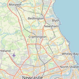
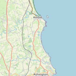
Mayfield Dale Map, Satellite view of Mayfield Dale, Northumberland, England
Mayfield Dale is located in Northumberland County, Northumberland, North East, England, United Kingdom.
Location informations of Mayfield Dale
Latitude of city of Mayfield Dale is 55.08436 and longitude of city of Mayfield Dale is -1.57587. Mayfield Dale has 1 postcode / zip code, in county of Northumberland.The County of Mayfield Dale is Northumberland.
Postcode / zip code of Mayfield Dale
NE23 6Administrative division of Mayfield Dale
County :NorthumberlandGPS coordinates of Mayfield Dale
Latitude : 55.08436Longitude : -1.57587
Online Map of Mayfield Dale - road map, satellite view and street view


Leaflet | © OpenStreetMap contributors
Search distance between two cities
The weather for Mayfield Dale in the United Kingdom
Get today and tomorrow's weather forecasts for Mayfield Dale. Find out the weather forecast for the week ahead and the weekend for Mayfield Dale in the UK.Mayfield Dale weather forecast 15 days
What is the nearest train station to Mayfield Dale?
List of Railway Stations near to Mayfield DaleThe nearest railway stations to Mayfield Dale are listed below. Tickets are available at the train station ticket office or ticket machines.
| Name | Distances from Mayfield Dale |
|---|---|
| Cramlington Station | 1.50 Km |
| Morpeth Station | 11.03 Km |
| Pegswood Station | 11.29 Km |
| Manors Station | 12.54 Km |
| Newcastle Station | 13.16 Km |
| Heworth Station | 14.82 Km |
| MetroCentre Station | 15.09 Km |
| Dunston Station | 15.52 Km |
| Blaydon Station | 15.80 Km |
| Widdrington Station | 17.64 Km |
Newcastle Airport , UK (9.03 Km)
What is the nearest Public Transport Stops to Mayfield Dale?
List of Stops near to Mayfield DaleGetting there by public transport (nearest train, tube, overground line station and bus stops). The nearest stops to Mayfield Dale are listed below.
| Stop Name | Distances from Mayfield Dale |
|---|---|
| Cornhill Road Bus Stop (opp) | 59 m |
| Cornhill Road Bus Stop (near) | 152 m |
| Mayfield Avenue Bus Stop (opp) | 212 m |
| Allensgreen Bus Stop (northbound) | 232 m |
| Allensgreen Bus Stop (southbound) | 262 m |
| Mayfield Avenue Bus Stop (near) | 266 m |
| Telephone Exchange Bus Stop (southbound) | 327 m |
| Telephone Exchange Bus Stop (northbound) | 356 m |
| Clifton Road Bus Stop (E-bound) | 374 m |
| Clifton Road Bus Stop (W-bound) | 374 m |
Historic Places to Visit near Mayfield Dale
List of Historic places near to Mayfield Dale
| Name | Distances from Mayfield Dale |
|---|---|
| Seaton Delaval, Our Lady Church | 4.77 Km |
| Seaton Delaval Hall | 5.18 Km |
| North Northumberland Heritage Coast | 10.27 Km |
| Segedunum Roman Fort (Hadrians Wall) | 11.05 Km |
| Morpeth Castle | 11.39 Km |
| Tynemouth Castle and Priory | 12.40 Km |
| Holy Jesus Hospital | 12.70 Km |
| Bessie Surtees House | 13.00 Km |
| Jarrow Hall | 13.10 Km |
| Benwell Roman Temple (Hadrians Wall) | 13.13 Km |
| Jarrow Monastery | 13.23 Km |
| Denton Hall Turret (Hadrians Wall) | 13.41 Km |
| Low Elswick Church Tower | 14.07 Km |
| Whalton Manor Garden | 14.66 Km |
Cities or Towns near Mayfield Dale
List of places near to