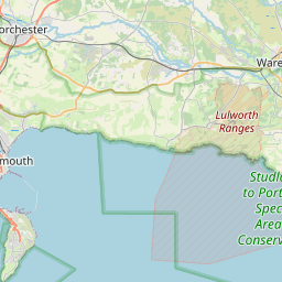
Woolgarston Map, Satellite view of Woolgarston, Dorset, England
Woolgarston is located in Dorset County, Purbeck District, South West, England, United Kingdom.
Location informations of Woolgarston
Latitude of city of Woolgarston is 50.63223 and longitude of city of Woolgarston is -2.02059. Woolgarston has 1 postcode / zip code, in county of Dorset.The County of Woolgarston is Dorset.
Postcode / zip code of Woolgarston
BH20 5Administrative division of Woolgarston
County :DorsetGPS coordinates of Woolgarston
Latitude : 50.63223Longitude : -2.02059
Online Map of Woolgarston - road map, satellite view and street view


Leaflet | © OpenStreetMap contributors
Search distance between two cities
The weather for Woolgarston in the United Kingdom
Get today and tomorrow's weather forecasts for Woolgarston. Find out the weather forecast for the week ahead and the weekend for Woolgarston in the UK.Woolgarston weather forecast 15 days
What is the nearest train station to Woolgarston?
List of Railway Stations near to WoolgarstonThe nearest railway stations to Woolgarston are listed below. Tickets are available at the train station ticket office or ticket machines.
| Name | Distances from Woolgarston |
|---|---|
| Wareham Station | 9.49 Km |
| Holton Heath Station | 9.68 Km |
| Poole Station | 10.05 Km |
| Hamworthy Station | 10.34 Km |
| Parkstone Station | 11.31 Km |
| Branksome Station | 12.71 Km |
| Wool Station | 15.19 Km |
| Bournemouth Station | 15.25 Km |
| Pokesdown Station | 17.62 Km |
| Christchurch Station | 20.38 Km |
What is the nearest Public Transport Stops to Woolgarston?
List of Stops near to WoolgarstonGetting there by public transport (nearest train, tube, overground line station and bus stops). The nearest stops to Woolgarston are listed below.
| Stop Name | Distances from Woolgarston |
|---|---|
| Crossroads Bus Stop (SE-bound) | 1.03 Km |
| Crossroads Bus Stop (NW-bound) | 1.03 Km |
| Westacre Farm Bus Stop (E-bound) | 1.12 Km |
| Maytide Bus Stop (E-bound) | 1.12 Km |
| Westacre Farm Bus Stop (W-bound) | 1.14 Km |
| Greystones Bus Stop (W-bound) | 1.15 Km |
| Harman's Cross (Swanage Railway) | 1.41 Km |
| New Buildings Bus Stop (E-bound) | 1.45 Km |
| Harman's Cross (Swanage Railway) (Platform 2) | 1.46 Km |
| New Buildings Bus Stop (opp) | 1.46 Km |
Historic Places to Visit near Woolgarston
List of Historic places near to Woolgarston
| Name | Distances from Woolgarston |
|---|---|
| Corfe Castle, St Edward the Martyr Church | 2.67 Km |
| Corfe Castle | 2.69 Km |
| Worth Matravers, St Nicholas Church | 4.07 Km |
| Studland, St Nicholas Church | 5.09 Km |
| St Aldhelms Chapel | 6.34 Km |
| Brownsea Island | 7.73 Km |
| Compton Acres | 10.54 Km |
| Lulworth Castle | 13.12 Km |
| East Lulworth, St Andrews Church | 13.24 Km |
| Lulworth Heritage Centre | 13.40 Km |
| Russell-Cotes Art Gallery and Museum | 14.21 Km |
Cities or Towns near Woolgarston
List of places near to
| Name | Distance |
|---|---|
| Little Woolgarston | 1.04 Km |
| Harman's Cross | 1.15 Km |
| Mount Pleasant | 2.55 Km |
| Corfe Castle | 2.69 Km |
| Langton Matravers | 2.79 Km |
| Acton | 2.94 Km |
| Coombe | 3.17 Km |
| Kingston | 3.53 Km |
| Ulwell | 3.59 Km |
| Herston | 3.92 Km |
| Worth Matravers | 4.22 Km |
| New Swanage | 4.44 Km |
| Church Knowle | 4.60 Km |
| Norden | 4.87 Km |
| Studland | 4.91 Km |
| Glebeland Estate | 5.08 Km |
| Swanage | 5.27 Km |
| Cocknowle | 5.44 Km |
| Durlston | 5.69 Km |
| East Creech | 5.97 Km |
| Furzebrook | 6.01 Km |
| Arne | 6.87 Km |
| Stoborough Heath | 7.01 Km |
| Creech Bottom | 7.17 Km |
| Ridge | 7.22 Km |
| Stoborough Green | 7.26 Km |
| Kimmeridge | 7.30 Km |
| Creech | 7.36 Km |
| Steeple | 7.52 Km |
| Stoborough | 7.91 Km |
| Sandbanks | 8.34 Km |
| Wareham | 8.68 Km |
| Lower Hamworthy | 9.04 Km |
| Lake | 9.14 Km |
| Northport | 9.38 Km |
| Old Town | 9.42 Km |
| Ham Hill | 9.65 Km |
| Rockley Sands | 9.72 Km |
| Lilliput | 9.80 Km |
| Hamworthy | 9.86 Km |
| Sandford | 9.98 Km |
| Worgret | 10.01 Km |
| East Holme | 10.05 Km |
| Poole | 10.06 Km |
| East Holton | 10.25 Km |
| Turlin Moor | 10.38 Km |
| Tyneham | 10.48 Km |
| Canford Cliffs | 10.52 Km |
| Sterte | 10.57 Km |
| Longfleet | 10.71 Km |