Wingmore Map, Satellite view of Wingmore, Kent, England
Wingmore is located in Kent County, Folkestone and Hythe District, South East, England, United Kingdom.
Location informations of Wingmore
Latitude of city of Wingmore is 51.17634 and longitude of city of Wingmore is 1.12846. Wingmore has 1 postcode / zip code, in county of Kent.The County of Wingmore is Kent.
Postcode / zip code of Wingmore
CT4 6Administrative division of Wingmore
County :KentGPS coordinates of Wingmore
Latitude : 51.17634Longitude : 1.12846
Online Map of Wingmore - road map, satellite view and street view

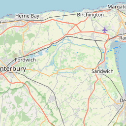
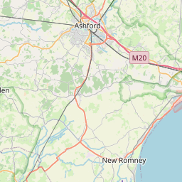
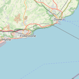

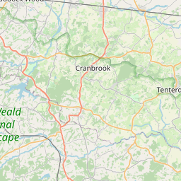


Leaflet | © OpenStreetMap contributors
Search distance between two cities
The weather for Wingmore in the United Kingdom
Get today and tomorrow's weather forecasts for Wingmore. Find out the weather forecast for the week ahead and the weekend for Wingmore in the UK.Wingmore weather forecast 15 days
What is the nearest train station to Wingmore?
List of Railway Stations near to WingmoreThe nearest railway stations to Wingmore are listed below. Tickets are available at the train station ticket office or ticket machines.
| Name | Distances from Wingmore |
|---|---|
| Shepherd's Well Station | 7.20 Km |
| Snowdown Station | 7.35 Km |
| Aylesham Station | 7.99 Km |
| Adisham Station | 8.73 Km |
| Bekesbourne Station | 9.47 Km |
| Folkestone West Station | 10.36 Km |
| Kearsney Station | 10.45 Km |
| Sandling Station | 10.51 Km |
| Folkestone Central Station | 10.78 Km |
| Westenhanger Station | 11.03 Km |
Lympne Airport , UK (13.40 Km)
What is the nearest Public Transport Stops to Wingmore?
List of Stops near to WingmoreGetting there by public transport (nearest train, tube, overground line station and bus stops). The nearest stops to Wingmore are listed below.
| Stop Name | Distances from Wingmore |
|---|---|
| Bladbean Turning Bus Stop (opp) | 17 m |
| Bladbean Turning Bus Stop (adj) | 29 m |
| Palm Tree House Bus Stop (adj) | 751 m |
| Palm Tree House Bus Stop (opp) | 766 m |
| Worldswonder Farm Bus Stop (adj) | 1.09 Km |
| Worldswonder Farm Bus Stop (opp) | 1.11 Km |
| Grooms Cottage Bus Stop (o/s) | 1.41 Km |
| Bladbean Stud Farm Bus Stop (opp) | 1.48 Km |
| Vineyard Bus Stop (adj) | 1.60 Km |
| Vineyard Bus Stop (opp) | 1.61 Km |
Historic Places to Visit near Wingmore
List of Historic places near to Wingmore
Cities or Towns near Wingmore
List of places near to
| Name | Distance |
|---|---|
| Bladbean | 0.78 Km |
| Breach | 1.59 Km |
| North Elham | 1.95 Km |
| Lodge Lees | 2.20 Km |
| Palmstead | 2.67 Km |
| Elham | 2.76 Km |
| Denton | 2.85 Km |
| Exted | 2.88 Km |
| Derringstone | 3.20 Km |
| Shelvin | 3.44 Km |
| Wootton | 3.56 Km |
| Park Side | 3.63 Km |
| Marley | 3.64 Km |
| Selsted | 3.65 Km |
| Westwood | 3.72 Km |
| Wheelbarrow Town | 3.92 Km |
| Barham | 3.95 Km |
| Gravel Castle | 4.05 Km |
| Lynsore Bottom | 4.17 Km |
| Acrise | 4.23 Km |
| Swingfield Minnis | 4.31 Km |
| Stelling Minnis | 4.32 Km |
| Bossingham | 4.39 Km |
| Ottinge | 4.60 Km |
| Out Elmstead | 4.65 Km |
| Ridge Row | 4.71 Km |
| Kingston | 4.80 Km |
| Rhodes Minnis | 5.08 Km |
| Upper Hardres Court | 5.12 Km |
| Shuttlesfield | 5.41 Km |
| Swingfield Street | 5.46 Km |
| Densole | 5.46 Km |
| Upper Hardres | 5.49 Km |
| Yewtree Cross | 5.53 Km |
| Womenswold | 5.62 Km |
| Woolage Green | 5.62 Km |
| Sixmile | 5.75 Km |
| Woolage Village | 5.97 Km |
| North Lyminge | 5.98 Km |
| Bishopsbourne | 6.05 Km |
| Pett Bottom | 6.15 Km |
| Ileden | 6.19 Km |
| Lyminge | 6.19 Km |
| Halfway Street | 6.40 Km |
| Maxted Street | 6.44 Km |
| Woodland | 6.53 Km |
| Hemsted | 6.63 Km |
| Lymbridge Green | 6.69 Km |
| Paddlesworth | 6.82 Km |
| Ansdore | 7.06 Km |