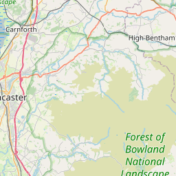
Whittingham Map, Satellite view of Whittingham, Lancashire, England
Whittingham is located in Lancashire County, Preston District, North West, England, United Kingdom.
Location informations of Whittingham
Latitude of city of Whittingham is 53.82272 and longitude of city of Whittingham is -2.64604. Whittingham has 1 postcode / zip code, in county of Lancashire.The County of Whittingham is Lancashire.
Postcode / zip code of Whittingham
PR3 2Administrative division of Whittingham
County :LancashireGPS coordinates of Whittingham
Latitude : 53.82272Longitude : -2.64604
Online Map of Whittingham - road map, satellite view and street view


Leaflet | © OpenStreetMap contributors
Search distance between two cities
The weather for Whittingham in the United Kingdom
Get today and tomorrow's weather forecasts for Whittingham. Find out the weather forecast for the week ahead and the weekend for Whittingham in the UK.Whittingham weather forecast 15 days
What is the nearest train station to Whittingham?
List of Railway Stations near to WhittinghamThe nearest railway stations to Whittingham are listed below. Tickets are available at the train station ticket office or ticket machines.
| Name | Distances from Whittingham |
|---|---|
| Preston Station | 8.38 Km |
| Bamber Bridge Station | 10.70 Km |
| Lostock Hall Station | 11.28 Km |
| Ramsgreave and Wilpshire Station | 12.02 Km |
| Salwick Station | 12.13 Km |
| Pleasington Station | 12.20 Km |
| Cherry Tree Station | 13.05 Km |
| Langho Station | 13.11 Km |
| Mill Hill (Lancashire) Station | 13.57 Km |
| Blackburn Station | 13.86 Km |
What is the nearest Public Transport Stops to Whittingham?
List of Stops near to WhittinghamGetting there by public transport (nearest train, tube, overground line station and bus stops). The nearest stops to Whittingham are listed below.
| Stop Name | Distances from Whittingham |
|---|---|
| Brabiner Lane Bus Stop (opp) | 723 m |
| Brabiner Lane Bus Stop (by) | 731 m |
| Whittingham Hospital The Lodge Bus Stop (opp) | 808 m |
| Whittingham Hospital The Lodge Bus Stop (adj) | 814 m |
| Camforth Hall Lane Bus Stop (by) | 913 m |
| Whittingham House Bus Stop (by) | 950 m |
| Whittingham Hospital Bus Stop (o/s) | 990 m |
| Whittingham Lane Bus Stop (by) | 1.09 Km |
| Whittingham Lane West Bus Stop (by) | 1.13 Km |
| Stags Head Bus Stop (opp) | 1.51 Km |
Historic Places to Visit near Whittingham
List of Historic places near to Whittingham
| Name | Distances from Whittingham |
|---|---|
| Ribchester Roman Museum and Fort | 7.58 Km |
| Ribchester, St Wilfrids Church | 7.60 Km |
| Samlesbury Hall | 7.64 Km |
| Chipping, St Bartholomews Church | 8.30 Km |
| Penwortham, St Marys Church | 9.26 Km |
| Hoghton Tower | 11.07 Km |
| Stonyhurst College | 11.73 Km |
| Old Langho Church | 12.54 Km |
| Blackburn, Holy Trinity Church | 13.74 Km |
| Browsholme Hall | 13.87 Km |
| Great Mitton, All Hallows Church | 14.13 Km |
Cities or Towns near Whittingham
List of places near to
| Name | Distance |
|---|---|
| Cumeragh Village | 0.82 Km |
| Goosnargh | 1.70 Km |
| Brook | 1.79 Km |
| Haighton Green | 2.02 Km |
| Grimsargh | 2.20 Km |
| New Town | 2.53 Km |
| Cow Hill | 2.79 Km |
| Longridge | 2.97 Km |
| Haighton Top | 3.22 Km |
| Pudding Pie Nook | 3.65 Km |
| Fulwood Row | 3.96 Km |
| Red Scar | 3.97 Km |
| Grange | 4.45 Km |
| Inglewhite | 4.50 Km |
| Elston | 4.60 Km |
| Brookfield | 4.61 Km |
| Sherwood | 4.86 Km |
| Broughton | 5.28 Km |
| Whitechapel | 5.28 Km |
| Ribbleton Hall | 5.42 Km |
| Hothersall | 5.50 Km |
| Ward Green Cross | 5.63 Km |
| Sharoe Green | 5.63 Km |
| Fulwood | 5.66 Km |
| Ribbleton | 5.68 Km |
| Holme Slack | 5.77 Km |
| Barton | 6.15 Km |
| Farringdon Park | 6.32 Km |
| Hesketh Lane | 6.46 Km |
| Balderstone | 6.46 Km |
| Deepdale | 6.59 Km |
| Myerscough Smithy | 6.59 Km |
| Nooklands | 6.70 Km |
| Turner Green | 6.73 Km |
| Lightfoot Green | 6.74 Km |
| Knowle Green | 6.88 Km |
| Gallows Hill | 6.90 Km |
| Fishwick | 6.91 Km |
| Samlesbury | 6.91 Km |
| Matshead | 6.93 Km |
| Newsham | 7.14 Km |
| Cadley | 7.19 Km |
| Bilsborrow | 7.27 Km |
| Brock | 7.27 Km |
| Claughton | 7.31 Km |
| Tanterton | 7.33 Km |
| Nog Tow | 7.50 Km |
| Adelphi | 7.51 Km |
| Woodplumpton | 7.52 Km |
| Ribchester | 7.56 Km |