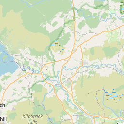
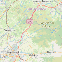
Whitecrook Map, Satellite view of Whitecrook, Dunbartonshire, Scotland
Whitecrook is located in Dunbartonshire County, West Dunbartonshire, Scotland, Scotland, United Kingdom.
Location informations of Whitecrook
Latitude of city of Whitecrook is 55.89705 and longitude of city of Whitecrook is -4.39114. Whitecrook has 1 postcode / zip code, in county of Dunbartonshire.The County of Whitecrook is Dunbartonshire.
Postcode / zip code of Whitecrook
G81 1Administrative division of Whitecrook
County :DunbartonshireGPS coordinates of Whitecrook
Latitude : 55.89705Longitude : -4.39114
Online Map of Whitecrook - road map, satellite view and street view


Leaflet | © OpenStreetMap contributors
Search distance between two cities
The weather for Whitecrook in the United Kingdom
Get today and tomorrow's weather forecasts for Whitecrook. Find out the weather forecast for the week ahead and the weekend for Whitecrook in the UK.Whitecrook weather forecast 15 days
What is the nearest train station to Whitecrook?
List of Railway Stations near to WhitecrookThe nearest railway stations to Whitecrook are listed below. Tickets are available at the train station ticket office or ticket machines.
| Name | Distances from Whitecrook |
|---|---|
| Yoker Station | 580 m |
| Drumry Station | 910 m |
| Clydebank Station | 921 m |
| Singer Station | 1.48 Km |
| Garscadden Station | 1.93 Km |
| Drumchapel Station | 1.96 Km |
| Scotstounhill Station | 2.73 Km |
| Dalmuir Station | 2.77 Km |
| Westerton Station | 3.61 Km |
| Bearsden Station | 4.31 Km |
Glasgow International Airport , UK (3.83 Km)
Glasgow City Heliport , UK (7.09 Km)
What is the nearest Public Transport Stops to Whitecrook?
List of Stops near to WhitecrookGetting there by public transport (nearest train, tube, overground line station and bus stops). The nearest stops to Whitecrook are listed below.
| Stop Name | Distances from Whitecrook |
|---|---|
| MacDonald Crescent Bus Stop (before) | 45 m |
| North Elgin Street Bus Stop (After) | 64 m |
| Abbott Crescent Bus Stop (Near) | 208 m |
| Andrew Drive Bus Stop (opp) | 213 m |
| Brown Avenue Bus Stop (opp) | 225 m |
| McDonald Crescent Bus Stop (opp) | 230 m |
| Andrew Drive Bus Stop (at) | 246 m |
| McDonald Crescent Bus Stop (at) | 276 m |
| King Street Bus Stop (at) | 308 m |
| King Street Bus Stop (after) | 315 m |
Historic Places to Visit near Whitecrook
List of Historic places near to Whitecrook
| Name | Distances from Whitecrook |
|---|---|
| Bearsden Bath House | 4.63 Km |
| Barochan Cross | 5.38 Km |
| Paisley Abbey | 5.38 Km |
| Paisley Museum | 6.34 Km |
| Botanic Gardens, Glasgow | 6.66 Km |
| Crookston Castle | 7.23 Km |
| Pollok House | 9.80 Km |
| Dumbarton Castle | 11.46 Km |
| Weavers Cottage | 12.11 Km |
| Holmwood House | 12.56 Km |
| Greenbank Garden | 14.14 Km |
| Finlaystone House & Garden | 14.69 Km |
Cities or Towns near Whitecrook
List of places near to
| Name | Distance |
|---|---|
| Linnvale | 0.74 Km |
| Blythswood | 1.19 Km |
| Yoker | 1.24 Km |
| Kilbowie | 1.39 Km |
| Drumry | 1.46 Km |
| Old Drumchapel | 1.80 Km |
| Radnor Park | 1.89 Km |
| Renfrew | 1.94 Km |
| Drumchapel | 1.96 Km |
| Knightswood | 2.09 Km |
| Blairdardie | 2.23 Km |
| Scotstounhill | 2.56 Km |
| Parkhall | 2.60 Km |
| Clydebank | 2.64 Km |
| Dalmuir | 2.71 Km |
| Garnieland | 2.81 Km |
| Hardgate | 3.03 Km |
| Scotstoun | 3.14 Km |
| High Knightswood | 3.16 Km |
| Victory Gardens | 3.18 Km |
| Bourne Court | 3.19 Km |
| Duntocher | 3.33 Km |
| East Freeland | 3.35 Km |
| Porterfield | 3.36 Km |
| Town Centre | 3.56 Km |
| Faifley | 3.63 Km |
| Jordanhill | 3.64 Km |
| Park Mains | 3.67 Km |
| Netherton | 3.75 Km |
| Mountblow | 3.82 Km |
| West Freeland | 3.93 Km |
| Anniesland | 4.02 Km |
| Rashielee | 4.16 Km |
| Temple | 4.17 Km |
| East Craigend | 4.23 Km |
| Inchinnan | 4.23 Km |
| Shieldhall | 4.31 Km |
| Bearsden | 4.36 Km |
| Whiteinch | 4.40 Km |
| North Barr | 4.44 Km |
| Erskine Harbour | 4.67 Km |
| Gallowhill | 4.71 Km |
| Erskine | 4.71 Km |
| Gockston | 4.71 Km |
| North Cardonald | 4.78 Km |
| Broomhill | 4.86 Km |
| Bargarran | 4.91 Km |
| West Craigend | 4.99 Km |
| Dawsholm | 5.09 Km |
| Linthouse | 5.14 Km |