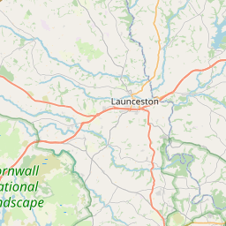
Whitchurch Map, Satellite view of Whitchurch, Devon, England
Whitchurch is located in Devon County, West Devon District, South West, England, United Kingdom.
Location informations of Whitchurch
Latitude of city of Whitchurch is 50.53376 and longitude of city of Whitchurch is -4.13024. Whitchurch has 1 postcode / zip code, in county of Devon.The County of Whitchurch is Devon.
Postcode / zip code of Whitchurch
PL19 9Administrative division of Whitchurch
County :DevonGPS coordinates of Whitchurch
Latitude : 50.53376Longitude : -4.13024
Online Map of Whitchurch - road map, satellite view and street view


Leaflet | © OpenStreetMap contributors
Search distance between two cities
The weather for Whitchurch in the United Kingdom
Get today and tomorrow's weather forecasts for Whitchurch. Find out the weather forecast for the week ahead and the weekend for Whitchurch in the UK.Whitchurch weather forecast 15 days
What is the nearest train station to Whitchurch?
List of Railway Stations near to WhitchurchThe nearest railway stations to Whitchurch are listed below. Tickets are available at the train station ticket office or ticket machines.
| Name | Distances from Whitchurch |
|---|---|
| Gunnislake Station | 6.60 Km |
| Calstock Station | 6.85 Km |
| Bere Alston Station | 7.30 Km |
| Bere Ferrers Station | 9.86 Km |
| Saltash Station | 15.12 Km |
| St.Budeaux Victoria Road Station | 15.20 Km |
| St.Budeaux Ferry Road Station | 15.25 Km |
| Keyham Station | 16.38 Km |
| Dockyard Station | 17.16 Km |
| Plymouth Station | 17.36 Km |
Plymouth City Airport , UK (12.46 Km)
What is the nearest Public Transport Stops to Whitchurch?
List of Stops near to WhitchurchGetting there by public transport (nearest train, tube, overground line station and bus stops). The nearest stops to Whitchurch are listed below.
| Stop Name | Distances from Whitchurch |
|---|---|
| Post Office Bus Stop (adj) | 73 m |
| Post Office Bus Stop (opp) | 85 m |
| Whitchurch Halt Bus Stop (NW-bound) | 441 m |
| Whitchurch Halt Bus Stop (SE-bound) | 443 m |
| Buzzard Way Bus Stop (SE-bound) | 464 m |
| Buzzard Way Bus Stop (NW-bound) | 475 m |
| Woodtown Bus Stop (SE-bound) | 526 m |
| Woodtown Bus Stop (NW-bound) | 531 m |
| Tiddybrook Meadows Bus Stop (SE-bound) | 589 m |
| Priory Close Bus Stop (NW-bound) | 661 m |
Historic Places to Visit near Whitchurch
List of Historic places near to Whitchurch
| Name | Distances from Whitchurch |
|---|---|
| Garden House | 4.49 Km |
| Morwellham Quay | 5.43 Km |
| Buckland Abbey | 5.78 Km |
| Merrivale Prehistoric Site | 6.78 Km |
| Cotehele, Chapel in the Woods | 7.77 Km |
| Brentor Church | 7.81 Km |
| Cotehele | 8.00 Km |
| Cotehele Mill | 8.61 Km |
| Princetown, St Michaels Church | 9.67 Km |
| Bere Ferrers, St Andrews Church | 9.70 Km |
| Drizzlecombe Stone Rows | 11.24 Km |
| Dupath Well | 12.15 Km |
| Lydford Gorge | 12.28 Km |
| Lydford Castle | 12.34 Km |
| Coombe Trenchard House and Garden | 13.56 Km |
| Bradstone, St Nonnas Church | 13.60 Km |
Cities or Towns near Whitchurch
List of places near to
| Name | Distance |
|---|---|
| Middlemoor | 0.69 Km |
| Grenofen | 1.05 Km |
| Walreddon | 1.85 Km |
| Tavistock | 2.09 Km |
| Horrabridge | 3.47 Km |
| Lumburn | 3.72 Km |
| Wilminstone | 3.91 Km |
| Buckland Monachorum | 4.16 Km |
| Sampford Spiney | 4.19 Km |
| Gulworthy | 4.42 Km |
| Harrowbeer | 4.74 Km |
| Crapstone | 4.99 Km |
| Walkhampton | 5.12 Km |
| Morwellham Quay | 5.30 Km |
| Peter Tavy | 5.47 Km |
| Chaddlehanger | 5.55 Km |
| Rushford | 5.55 Km |
| Yelverton | 5.63 Km |
| Axtown | 5.75 Km |
| Lake | 5.87 Km |
| Dousland | 5.89 Km |
| Chipshop | 5.97 Km |
| Gunnislake | 5.97 Km |
| Lamerton | 6.03 Km |
| Lower Dimson | 6.25 Km |
| Merrivale | 6.27 Km |
| Middle Dimson | 6.38 Km |
| Chub Tor | 6.55 Km |
| Higher Dimson | 6.61 Km |
| Tuckermarsh | 6.67 Km |
| Dimson | 6.70 Km |
| North Dimson | 6.70 Km |
| Roborough Down | 6.72 Km |
| Calstock | 6.82 Km |
| Milton Combe | 6.85 Km |
| Mary Tavy | 6.90 Km |
| Drakewalls | 6.90 Km |
| Cudlipptown | 7.01 Km |
| Albaston | 7.19 Km |
| Bere Alston | 7.30 Km |
| Meavy | 7.33 Km |
| Bickham | 7.38 Km |
| St Ann's Chapel | 7.66 Km |
| Clearbrook | 7.70 Km |
| Portington | 7.78 Km |
| Chilsworthy | 7.81 Km |
| Hoo Meavy | 7.84 Km |
| Horndon | 7.97 Km |
| Lopwell | 8.03 Km |
| Kingsett | 8.23 Km |