Westwood Map, Satellite view of Westwood, Cambridgeshire, England
Westwood is located in Cambridgeshire County, City of Peterborough, Eastern, England, United Kingdom.
Location informations of Westwood
Latitude of city of Westwood is 52.58506 and longitude of city of Westwood is -0.27199. Westwood has 1 postcode / zip code, in county of Cambridgeshire.The County of Westwood is Cambridgeshire.
Postcode / zip code of Westwood
PE3 7Administrative division of Westwood
County :CambridgeshireGPS coordinates of Westwood
Latitude : 52.58506Longitude : -0.27199
Online Map of Westwood - road map, satellite view and street view


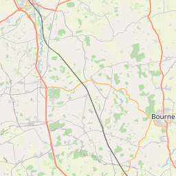


Leaflet | © OpenStreetMap contributors
Search distance between two cities
The weather for Westwood in the United Kingdom
Get today and tomorrow's weather forecasts for Westwood. Find out the weather forecast for the week ahead and the weekend for Westwood in the UK.Westwood weather forecast 15 days
What is the nearest train station to Westwood?
List of Railway Stations near to WestwoodThe nearest railway stations to Westwood are listed below. Tickets are available at the train station ticket office or ticket machines.
| Name | Distances from Westwood |
|---|---|
| Peterborough Station | 1.87 Km |
| Whittlesea Station | 11.07 Km |
| Stamford Station | 15.69 Km |
| Spalding Station | 23.95 Km |
| March Station | 24.70 Km |
| Huntingdon Station | 29.02 Km |
Peterborough Business Airport , UK (13.08 Km)
RAF Wittering , UK (14.14 Km)
What is the nearest Public Transport Stops to Westwood?
List of Stops near to WestwoodGetting there by public transport (nearest train, tube, overground line station and bus stops). The nearest stops to Westwood are listed below.
| Stop Name | Distances from Westwood |
|---|---|
| Everdon Way Bus Stop (adj) | 84 m |
| Everdon Way Bus Stop (opp) | 94 m |
| Cranford Drive Bus Stop (nr) | 140 m |
| Dingley Court Bus Stop (adj) | 179 m |
| St Judes Church Bus Stop (adj) | 221 m |
| St Judes Church Bus Stop (opp) | 273 m |
| City Hospital Bretton Gate Bus Stop (Near) | 282 m |
| City Hospital Mental Health Unit Bus Stop (Adj) | 323 m |
| Hartwell Court Bus Stop (opp) | 349 m |
| Wilton Drive Bus Stop (adj) | 396 m |
Historic Places to Visit near Westwood
List of Historic places near to Westwood
| Name | Distances from Westwood |
|---|---|
| Longthorpe Tower | 1.93 Km |
| Peterborough Museum and Art Gallery | 2.31 Km |
| Flag Fen | 5.71 Km |
| Conington, All Saints Church | 7.30 Km |
| Elton Hall | 10.87 Km |
| Nassington, St Mary & All Saints Church | 11.31 Km |
| Prebendal Manor | 11.47 Km |
| Thorney Abbey | 11.83 Km |
| Croyland Abbey | 12.42 Km |
| Fotheringhay Castle | 12.99 Km |
| Fotheringhay, St Mary & All Saints Church | 13.07 Km |
| Burghley House | 13.81 Km |
Cities or Towns near Westwood
List of places near to
| Name | Distance |
|---|---|
| Ravensthorpe | 0.93 Km |
| Bretton | 1.12 Km |
| New England | 1.42 Km |
| Millfield | 1.70 Km |
| Longthorpe | 1.78 Km |
| Walton | 2.10 Km |
| Peterborough | 2.43 Km |
| Paston | 2.71 Km |
| New Fletton | 2.93 Km |
| Eastfield | 2.98 Km |
| Woodston | 3.03 Km |
| Dogsthorpe | 3.04 Km |
| Eastgate | 3.12 Km |
| Orton Longueville | 3.18 Km |
| Gunthorpe | 3.26 Km |
| Marholm | 3.28 Km |
| Old Fletton | 3.56 Km |
| Orton Waterville | 3.96 Km |
| Fengate | 3.96 Km |
| Newark | 4.19 Km |
| Orton Malborne | 4.20 Km |
| Orton Wistow | 4.37 Km |
| Werrington | 4.46 Km |
| Orton Brimbles | 4.53 Km |
| Hampton Hargate | 4.77 Km |
| Orton Goldhay | 4.85 Km |
| Lynch Wood | 4.89 Km |
| Castor | 4.95 Km |
| Stanground | 5.09 Km |
| Orton Northgate | 5.27 Km |
| Orton Southgate | 5.45 Km |
| Ailsworth | 5.56 Km |
| Alwalton | 5.58 Km |
| Hampton Vale | 5.68 Km |
| Milking Nook | 5.84 Km |
| Glinton | 6.19 Km |
| Farcet | 6.27 Km |
| Eye | 6.37 Km |
| Peakirk | 6.41 Km |
| Chesterton | 6.41 Km |
| Eye Green | 6.58 Km |
| Upton | 6.60 Km |
| Newborough | 6.84 Km |
| Water Newton | 7.04 Km |
| Etton | 7.09 Km |
| King's Dyke | 7.38 Km |
| Helpston | 7.40 Km |
| Yaxley | 7.47 Km |
| Sutton | 7.66 Km |
| Sibson | 8.08 Km |