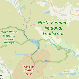
Westgate Map, Satellite view of Westgate, Durham, England
Westgate is located in Durham County, County Durham, North East, England, United Kingdom.
Location informations of Westgate
Latitude of city of Westgate is 54.73806 and longitude of city of Westgate is -2.14564. Westgate has 1 postcode / zip code, in county of Durham.The County of Westgate is Durham.
Postcode / zip code of Westgate
DL13 1Administrative division of Westgate
County :DurhamGPS coordinates of Westgate
Latitude : 54.73806Longitude : -2.14564
Online Map of Westgate - road map, satellite view and street view


Leaflet | © OpenStreetMap contributors
Search distance between two cities
The weather for Westgate in the United Kingdom
Get today and tomorrow's weather forecasts for Westgate. Find out the weather forecast for the week ahead and the weekend for Westgate in the UK.Westgate weather forecast 15 days
What is the nearest train station to Westgate?
List of Railway Stations near to WestgateThe nearest railway stations to Westgate are listed below. Tickets are available at the train station ticket office or ticket machines.
| Name | Distances from Westgate |
|---|---|
| Riding Mill Station | 25.94 Km |
| Hexham Station | 26.38 Km |
| Corbridge Station | 26.65 Km |
| Haydon Bridge Station | 27.16 Km |
| Stocksfield Station | 27.47 Km |
| Appleby Station | 28.08 Km |
| Bardon Mill Station | 29.27 Km |
What is the nearest Public Transport Stops to Westgate?
List of Stops near to WestgateGetting there by public transport (nearest train, tube, overground line station and bus stops). The nearest stops to Westgate are listed below.
| Stop Name | Distances from Westgate |
|---|---|
| Institute Bus Stop (NE-bound) | 81 m |
| Institute Bus Stop (SW-bound) | 116 m |
| St Andrews Place Bus Stop (W-bound) | 258 m |
| St Andrews Place Bus Stop (E-bound) | 280 m |
| Front Street Bus Stop (W-bound) | 1.34 Km |
| Front Street Bus Stop (E-bound) | 1.35 Km |
| New Park House Farm Bus Stop (W-bound) | 1.69 Km |
| New Park House Farm Bus Stop (E-bound) | 1.71 Km |
| War Memorial Bus Stop (SE-bound) | 2.24 Km |
| War Memorial Bus Stop (NW-bound) | 2.25 Km |
Historic Places to Visit near Westgate
List of Historic places near to Westgate
| Name | Distances from Westgate |
|---|---|
| High Force | 10.09 Km |
| Low Force | 10.21 Km |
| Wynch Bridge | 10.21 Km |
| Blanchland Abbey | 13.61 Km |
Cities or Towns near Westgate
List of places near to
| Name | Distance |
|---|---|
| Daddry Shield | 1.24 Km |
| Brotherlee | 1.75 Km |
| St John's Chapel | 2.21 Km |
| East Blackdene | 2.66 Km |
| New Ho | 3.23 Km |
| West Blackdene | 4.18 Km |
| Ireshopeburn | 4.34 Km |
| Eastgate | 4.47 Km |
| Lintzgarth | 5.03 Km |
| Wearhead | 5.07 Km |
| Rookhope | 5.64 Km |
| Cowshill | 5.84 Km |
| Burtree Ford | 5.85 Km |
| Copthill | 6.13 Km |
| Northgrain | 6.27 Km |
| Heatherycleugh | 6.93 Km |
| Cornriggs | 7.06 Km |
| Green Head | 7.18 Km |
| Lanehead | 7.41 Km |
| Ettersgill | 8.59 Km |
| Allenheads | 8.61 Km |
| Stanhope | 8.68 Km |
| Langdon Beck | 8.75 Km |
| Crawleyside | 8.81 Km |
| Forest-in-Teesdale | 9.22 Km |
| Byerhope | 9.36 Km |
| Bowlees | 9.63 Km |
| Killhope | 9.63 Km |
| Dirt Pot | 9.69 Km |
| Boltshope Park | 10.09 Km |
| Ramshaw | 10.18 Km |
| Newbiggin | 10.39 Km |
| Bollihope | 10.40 Km |
| Hill End | 10.94 Km |
| Townfield | 11.07 Km |
| Holwick | 11.09 Km |
| Hunstanworth | 11.68 Km |
| Frosterley | 11.75 Km |
| Aukside | 11.90 Km |
| White Kirkley | 11.96 Km |
| Middle Side | 11.98 Km |
| Snaisgill | 12.15 Km |
| Spartylea | 12.25 Km |
| Dent Bank | 12.29 Km |
| High Dyke | 12.50 Km |
| Coalcleugh | 12.57 Km |
| Lane Head | 12.65 Km |
| Hudegate | 12.76 Km |
| Baybridge | 12.92 Km |
| Middleton-in-Teesdale | 13.30 Km |