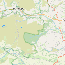
West Butsfield Map, Satellite view of West Butsfield, Durham, England
West Butsfield is located in Durham County, County Durham, North East, England, United Kingdom.
Location informations of West Butsfield
Latitude of city of West Butsfield is 54.79901 and longitude of city of West Butsfield is -1.84436. West Butsfield has 1 postcode / zip code, in county of Durham.The County of West Butsfield is Durham.
Postcode / zip code of West Butsfield
DL13 4Administrative division of West Butsfield
County :DurhamGPS coordinates of West Butsfield
Latitude : 54.79901Longitude : -1.84436
Online Map of West Butsfield - road map, satellite view and street view


Leaflet | © OpenStreetMap contributors
Search distance between two cities
The weather for West Butsfield in the United Kingdom
Get today and tomorrow's weather forecasts for West Butsfield. Find out the weather forecast for the week ahead and the weekend for West Butsfield in the UK.West Butsfield weather forecast 15 days
What is the nearest train station to West Butsfield?
List of Railway Stations near to West ButsfieldThe nearest railway stations to West Butsfield are listed below. Tickets are available at the train station ticket office or ticket machines.
| Name | Distances from West Butsfield |
|---|---|
| Durham Station | 16.98 Km |
| Stocksfield Station | 17.10 Km |
| Chester-Le-Street Station | 18.15 Km |
| Riding Mill Station | 18.53 Km |
| Prudhoe Station | 18.60 Km |
| Bishop Auckland Station | 19.06 Km |
| Wylam Station | 19.66 Km |
| Blaydon Station | 20.37 Km |
| MetroCentre Station | 21.12 Km |
| Dunston Station | 21.20 Km |
What is the nearest Public Transport Stops to West Butsfield?
List of Stops near to West ButsfieldGetting there by public transport (nearest train, tube, overground line station and bus stops). The nearest stops to West Butsfield are listed below.
| Stop Name | Distances from West Butsfield |
|---|---|
| West Butsfield Bus Stop (W-bound) | 95 m |
| West Butsfield Bus Stop (E-bound) | 98 m |
| East Butsfield Bus Stop (N-bound) | 1.31 Km |
| East Butsfield Bus Stop (S-bound) | 1.31 Km |
| Punch Bowl Bus Stop (NE-bound) | 2.29 Km |
| Punch Bowl Bus Stop (SW-bound) | 2.30 Km |
| Pondfield Villa Bus Stop (NW-bound) | 2.39 Km |
| Glebeside Bus Stop (NE-bound) | 2.40 Km |
| Pondfield Villa Bus Stop (SE-bound) | 2.40 Km |
| Glebeside Bus Stop (SW-bound) | 2.41 Km |
Historic Places to Visit near West Butsfield
List of Historic places near to West Butsfield
| Name | Distances from West Butsfield |
|---|---|
| Shotley, St Andrews Church | 11.71 Km |
| Derwentcote Steel Furnace | 12.08 Km |
| Blanchland Abbey | 14.51 Km |
Cities or Towns near West Butsfield
List of places near to
| Name | Distance |
|---|---|
| East Butsfield | 1.37 Km |
| Satley | 2.30 Km |
| Rowley | 3.31 Km |
| Knitsley | 3.86 Km |
| High Stoop | 4.43 Km |
| Castleside | 4.49 Km |
| Cornsay | 4.60 Km |
| Moorside | 4.88 Km |
| Delves | 5.02 Km |
| Waskerley | 5.04 Km |
| Healeyfield | 5.07 Km |
| Templetown | 5.11 Km |
| Inkerman | 5.19 Km |
| The Grove | 5.26 Km |
| Horsleyhope | 5.27 Km |
| Allensford | 5.72 Km |
| Tow Law | 5.96 Km |
| Crookhall | 6.07 Km |
| Consett | 6.07 Km |
| Iveston | 6.27 Km |
| Hedley Hill | 6.37 Km |
| Cornsay Colliery | 6.53 Km |
| Blackhill | 6.75 Km |
| Bridgehill | 6.88 Km |
| Lanchester | 6.98 Km |
| Leadgate | 7.18 Km |
| East Hedleyhope | 7.25 Km |
| Deanery View | 7.28 Km |
| Ornsby Hill | 7.31 Km |
| Benfieldside | 7.35 Km |
| Sunniside | 7.53 Km |
| Quebec | 7.61 Km |
| Muggleswick | 7.76 Km |
| Thornley | 7.78 Km |
| Stony Heap | 7.91 Km |
| Shotley Bridge | 7.97 Km |
| Malton | 8.00 Km |
| Wolsingham | 8.08 Km |
| Snods Edge | 8.45 Km |
| Greencroft | 8.51 Km |
| Maiden Law | 8.66 Km |
| Carterway Heads | 8.90 Km |
| Medomsley Edge | 9.01 Km |
| Pontop | 9.02 Km |
| Waterhouses | 9.04 Km |
| Shotleyfield | 9.30 Km |
| East Law | 9.46 Km |
| Esh | 9.49 Km |
| Esh Winning | 9.56 Km |
| Medomsley | 9.56 Km |