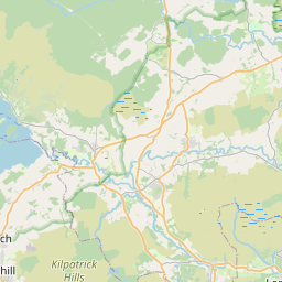
Wardpark Map, Satellite view of Wardpark, Dunbartonshire, Scotland
Wardpark is located in Dunbartonshire County, North Lanarkshire, Scotland, Scotland, United Kingdom.
Location informations of Wardpark
Latitude of city of Wardpark is 55.97595 and longitude of city of Wardpark is -3.96566. Wardpark has 1 postcode / zip code, in county of Dunbartonshire.The County of Wardpark is Dunbartonshire.
Postcode / zip code of Wardpark
G68 0Administrative division of Wardpark
County :DunbartonshireGPS coordinates of Wardpark
Latitude : 55.97595Longitude : -3.96566
Online Map of Wardpark - road map, satellite view and street view


Leaflet | © OpenStreetMap contributors
Search distance between two cities
The weather for Wardpark in the United Kingdom
Get today and tomorrow's weather forecasts for Wardpark. Find out the weather forecast for the week ahead and the weekend for Wardpark in the UK.Wardpark weather forecast 15 days
What is the nearest train station to Wardpark?
List of Railway Stations near to WardparkThe nearest railway stations to Wardpark are listed below. Tickets are available at the train station ticket office or ticket machines.
| Name | Distances from Wardpark |
|---|---|
| Cumbernauld Station | 3.88 Km |
| Greenfaulds Station | 4.84 Km |
| Croy Station | 4.92 Km |
| Camelon Station | 9.80 Km |
| Larbert Station | 9.88 Km |
| Caldercruix Station | 10.92 Km |
| Falkirk High Station | 10.93 Km |
| Falkirk Grahamston Station | 11.62 Km |
| Drumgelloch Station | 12.12 Km |
| Gartcosh Station | 12.29 Km |
What is the nearest Public Transport Stops to Wardpark?
List of Stops near to WardparkGetting there by public transport (nearest train, tube, overground line station and bus stops). The nearest stops to Wardpark are listed below.
| Stop Name | Distances from Wardpark |
|---|---|
| Napier Place Bus Stop (Opp) | 42 m |
| Napier Crescent Bus Stop (Opp) | 171 m |
| Wardpark Roundabout Bus Stop (After) | 579 m |
| Wardpark Roundabout Bus Stop (Before) | 594 m |
| Wyndford Road Bus Stop (Opp) | 604 m |
| Wyndford Road Bus Stop (before) | 615 m |
| Napier Road Bus Stop (opp) | 773 m |
| Tollpark Road Bus Stop (Opp) | 781 m |
| Tollpark Road Bus Stop (before) | 802 m |
| Napier Road Bus Stop (Opp) | 835 m |
Historic Places to Visit near Wardpark
List of Historic places near to Wardpark
| Name | Distances from Wardpark |
|---|---|
| Dullatur | 1.38 Km |
| Antonine Wall, Castlecary Roman Fort | 1.78 Km |
| Antonine Wall, Seabegs Wood | 4.05 Km |
| Colzium Estate and Garden | 4.66 Km |
| Croy Hill Roman Fortlet | 5.11 Km |
| Antonine Wall, Rough Castle | 6.50 Km |
| Bar Hill Fort | 7.02 Km |
| Watling Lodge (Antonine Wall) | 9.11 Km |
| Callendar House | 12.53 Km |
| Battle of Bannockburn Heritage Centre | 13.15 Km |
| Westquarter Dovecot | 13.87 Km |
Cities or Towns near Wardpark
List of places near to
| Name | Distance |
|---|---|
| Castlecary | 1.08 Km |
| Coneypark | 1.47 Km |
| Auchincloch | 1.62 Km |
| Banknock | 1.68 Km |
| Cumbernauld Village | 1.69 Km |
| Westerwood | 1.79 Km |
| Kelvinhead | 2.02 Km |
| Haggs | 2.13 Km |
| Abronhill | 2.26 Km |
| Carrickstone | 2.38 Km |
| Allandale | 2.69 Km |
| Longcroft | 2.71 Km |
| Braeface | 2.71 Km |
| Kildrum | 2.81 Km |
| Banton | 2.92 Km |
| Dullatur | 2.94 Km |
| Carbrain | 3.40 Km |
| High Banton | 3.45 Km |
| Seafar | 3.64 Km |
| Parkfoot | 3.76 Km |
| Cumbernauld | 3.86 Km |
| Dennyloanhead | 4.16 Km |
| Lenziemill | 4.25 Km |
| Balloch | 4.36 Km |
| Craigmarloch | 4.46 Km |
| Milnquarter | 4.46 Km |
| Bankhead | 4.60 Km |
| Greenfaulds | 4.82 Km |
| South Barrwood | 4.82 Km |
| Greenhill | 4.91 Km |
| North Barrwood | 4.96 Km |
| Croy | 4.97 Km |
| Head of Muir | 5.00 Km |
| Bonnyfield | 5.07 Km |
| Barrwood | 5.14 Km |
| Luggiebank | 5.15 Km |
| Auchinstarry | 5.45 Km |
| Blairlinn | 5.47 Km |
| Bonnybridge | 5.48 Km |
| Condorrat | 5.67 Km |
| Fankerton | 5.69 Km |
| Stoneywood | 5.71 Km |
| Kilsyth | 5.75 Km |
| Highland Park | 5.80 Km |
| Smithstone | 5.83 Km |
| High Bonnybridge | 5.88 Km |
| Westfield | 6.05 Km |
| Balmalloch | 6.13 Km |
| High Balmalloch | 6.28 Km |
| Denny | 6.34 Km |