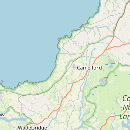
Warbstow Map, Satellite view of Warbstow, Cornwall, England
Warbstow is located in Cornwall County, Cornwall, South West, England, United Kingdom.
Location informations of Warbstow
Latitude of city of Warbstow is 50.68743 and longitude of city of Warbstow is -4.54008. Warbstow has 1 postcode / zip code, in county of Cornwall.The County of Warbstow is Cornwall.
Postcode / zip code of Warbstow
PL15 8Administrative division of Warbstow
County :CornwallGPS coordinates of Warbstow
Latitude : 50.68743Longitude : -4.54008
Online Map of Warbstow - road map, satellite view and street view


Leaflet | © OpenStreetMap contributors
Search distance between two cities
The weather for Warbstow in the United Kingdom
Get today and tomorrow's weather forecasts for Warbstow. Find out the weather forecast for the week ahead and the weekend for Warbstow in the UK.Warbstow weather forecast 15 days
What is the nearest train station to Warbstow?
List of Railway Stations near to WarbstowThe nearest railway stations to Warbstow are listed below. Tickets are available at the train station ticket office or ticket machines.
| Name | Distances from Warbstow |
|---|---|
| Coombe Junction Halt Station | 27.17 Km |
| Liskeard Station | 27.21 Km |
| Bodmin Parkway Station | 28.23 Km |
| Gunnislake Station | 29.58 Km |
| St.Keyne Wishing Well Halt Station | 29.89 Km |
What is the nearest Public Transport Stops to Warbstow?
List of Stops near to WarbstowGetting there by public transport (nearest train, tube, overground line station and bus stops). The nearest stops to Warbstow are listed below.
| Stop Name | Distances from Warbstow |
|---|---|
| Bus Shelter Bus Stop (W-bound) | 224 m |
| Bus Shelter Bus Stop (W-bound) | 241 m |
| Bus Shelter Bus Stop (opp) | 248 m |
| Treneglos Turning Bus Stop (SW-bound) | 1.37 Km |
| Kenyon Outstation Bus Stop (NE-bound) | 1.56 Km |
| Lane End Cottage Bus Stop (NE-bound) | 1.58 Km |
| Balmain Bus Stop (opp) | 1.63 Km |
| Balmain Bus Stop (SW-bound) | 1.65 Km |
| Trussell Bus Stop (opp) | 1.87 Km |
| Trussell Bus Stop (S-bound) | 1.89 Km |
Historic Places to Visit near Warbstow
List of Historic places near to Warbstow
Cities or Towns near Warbstow
List of places near to
| Name | Distance |
|---|---|
| Warbstow Cross | 0.20 Km |
| Downinney | 0.61 Km |
| Fonston | 1.21 Km |
| Canworthy Water | 1.91 Km |
| Trelash | 2.02 Km |
| Trussell | 2.13 Km |
| Broad Langdon | 2.15 Km |
| Splatt | 2.49 Km |
| Treneglos | 2.54 Km |
| Canworthy | 2.82 Km |
| Tremaine | 3.46 Km |
| Trengune | 3.61 Km |
| Three Hammers | 3.88 Km |
| Hallworthy | 3.94 Km |
| Otterham | 4.01 Km |
| Tresmeer | 4.05 Km |
| Caroe | 4.25 Km |
| Collamoor Head | 4.28 Km |
| Cold Northcott | 4.29 Km |
| Caudworthy | 4.39 Km |
| South Wheatley | 4.49 Km |
| Maxworthy | 4.81 Km |
| Troswell | 4.90 Km |
| Badgall | 4.95 Km |
| Higher Troswell | 4.96 Km |
| Torrpark | 4.98 Km |
| Kents | 5.03 Km |
| Treglasta | 5.12 Km |
| Jacobstow | 5.15 Km |
| Otterham Station | 5.27 Km |
| Billacott | 5.28 Km |
| Tregeare | 5.40 Km |
| Wainhouse Corner | 5.40 Km |
| Marshgate | 5.60 Km |
| Pencuke | 5.79 Km |
| Trebeath | 5.87 Km |
| Trillacott | 5.91 Km |
| Brazacott | 5.94 Km |
| Tremail | 6.03 Km |
| Trevivian | 6.25 Km |
| Tresparrett | 6.29 Km |
| St Clether | 6.35 Km |
| Davidstow | 6.36 Km |
| Tresparrett Posts | 6.38 Km |
| Rosecare | 6.61 Km |
| Badharlick | 6.92 Km |
| Laneast | 6.96 Km |
| Higher Crackington | 7.00 Km |
| Lower Crackington | 7.07 Km |
| Hill | 7.08 Km |