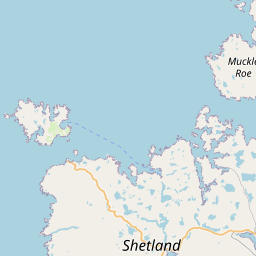
Upper Kergord Map, Satellite view of Upper Kergord, Shetland, Scotland
Upper Kergord is located in Shetland County, Shetland Islands, Scotland, Scotland, United Kingdom.
Location informations of Upper Kergord
Latitude of city of Upper Kergord is 60.29065 and longitude of city of Upper Kergord is -1.26929. Upper Kergord has 1 postcode / zip code, in county of Shetland.The County of Upper Kergord is Shetland.
Postcode / zip code of Upper Kergord
ZE2 9Administrative division of Upper Kergord
County :ShetlandGPS coordinates of Upper Kergord
Latitude : 60.29065Longitude : -1.26929
Online Map of Upper Kergord - road map, satellite view and street view


Leaflet | © OpenStreetMap contributors
Search distance between two cities
The weather for Upper Kergord in the United Kingdom
Get today and tomorrow's weather forecasts for Upper Kergord. Find out the weather forecast for the week ahead and the weekend for Upper Kergord in the UK.Upper Kergord weather forecast 15 days
Lerwick / Tingwall Airport , UK (11.04 Km)
What is the nearest Public Transport Stops to Upper Kergord?
List of Stops near to Upper KergordGetting there by public transport (nearest train, tube, overground line station and bus stops). The nearest stops to Upper Kergord are listed below.
| Stop Name | Distances from Upper Kergord |
|---|---|
| Road End Bus Stop (at) | 1.86 Km |
| Road End Bus Stop (opp) | 1.87 Km |
| Village Bus Stop (at) | 3.06 Km |
| Junction Bus Stop (opp) | 3.91 Km |
| Junction Bus Stop (at) | 3.93 Km |
| Catfirth Rd End Bus Stop (at) | 4.17 Km |
| Catfirth Rd End Bus Stop (opp) | 4.19 Km |
| Cott Rd End Bus Stop (E-bound) | 4.26 Km |
| Cott Rd End Bus Stop (W-bound) | 4.27 Km |
| Cott Rd End Bus Stop (N-bound) | 4.29 Km |
Historic Places to Visit near Upper Kergord
List of Historic places near to Upper Kergord
| Name | Distances from Upper Kergord |
|---|---|
| Stanydale Temple | 13.46 Km |
| Bod of Gremista & Shetland Textile Museum | 14.59 Km |
Cities or Towns near Upper Kergord
List of places near to
| Name | Distance |
|---|---|
| Weisdale | 3.75 Km |
| East Burrafirth | 4.09 Km |
| Stenswall | 4.12 Km |
| Catfirth | 4.18 Km |
| Quoys of Catfirth | 4.46 Km |
| Cuckron | 4.99 Km |
| South Nesting | 5.19 Km |
| Stromfirth | 5.31 Km |
| Heglibister | 5.38 Km |
| Gonfirth | 6.06 Km |
| Girlsta | 6.25 Km |
| Freester | 6.26 Km |
| Aith | 6.35 Km |
| Sound | 6.38 Km |
| Dury | 6.38 Km |
| Skellister | 6.50 Km |
| East Houlland | 6.61 Km |
| Voe | 6.61 Km |
| Benston | 6.69 Km |
| Vassa | 6.74 Km |
| Garth | 6.84 Km |
| Tresta | 6.85 Km |
| Kalliness | 6.86 Km |
| Lea Gardens | 7.05 Km |
| Braewick | 7.10 Km |
| Railsbrough | 7.19 Km |
| Cova | 7.27 Km |
| Hellister | 7.34 Km |
| Cott | 7.38 Km |
| Wadbister | 7.48 Km |
| Tumblin | 7.48 Km |
| Grobsness | 7.60 Km |
| Brettabister | 7.69 Km |
| Gletness | 7.90 Km |
| Hamars | 7.99 Km |
| Laxo | 8.15 Km |
| Twatt | 8.22 Km |
| Billister | 8.37 Km |
| Bixter | 8.44 Km |
| Eswick | 8.71 Km |
| Housabister | 8.82 Km |
| Sandsound | 9.08 Km |
| Flugarth | 9.20 Km |
| Haggersta | 9.20 Km |
| Semblister | 9.21 Km |
| Clousta | 9.27 Km |
| Omunsgarth | 9.41 Km |
| Skelberry | 9.80 Km |
| Neap | 9.83 Km |
| Laxfirth | 9.85 Km |