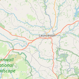
Tutwell Map, Satellite view of Tutwell, Cornwall, England
Tutwell is located in Cornwall County, Cornwall, South West, England, United Kingdom.
Location informations of Tutwell
Latitude of city of Tutwell is 50.55980 and longitude of city of Tutwell is -4.27425. Tutwell has 1 postcode / zip code, in county of Cornwall.The County of Tutwell is Cornwall.
Postcode / zip code of Tutwell
PL17 8Administrative division of Tutwell
County :CornwallGPS coordinates of Tutwell
Latitude : 50.55980Longitude : -4.27425
Online Map of Tutwell - road map, satellite view and street view


Leaflet | © OpenStreetMap contributors
Search distance between two cities
The weather for Tutwell in the United Kingdom
Get today and tomorrow's weather forecasts for Tutwell. Find out the weather forecast for the week ahead and the weekend for Tutwell in the UK.Tutwell weather forecast 15 days
What is the nearest train station to Tutwell?
List of Railway Stations near to TutwellThe nearest railway stations to Tutwell are listed below. Tickets are available at the train station ticket office or ticket machines.
| Name | Distances from Tutwell |
|---|---|
| Gunnislake Station | 6.22 Km |
| Calstock Station | 8.29 Km |
| Bere Alston Station | 9.77 Km |
| Bere Ferrers Station | 13.74 Km |
| Saltash Station | 17.57 Km |
| Menheniot Station | 17.66 Km |
| St.Germans Station | 18.56 Km |
| St.Budeaux Victoria Road Station | 18.59 Km |
| Liskeard Station | 18.67 Km |
| St.Budeaux Ferry Road Station | 18.67 Km |
What is the nearest Public Transport Stops to Tutwell?
List of Stops near to TutwellGetting there by public transport (nearest train, tube, overground line station and bus stops). The nearest stops to Tutwell are listed below.
| Stop Name | Distances from Tutwell |
|---|---|
| The Royal Inn Bus Stop (N-bound) | 1.36 Km |
| The Royal Inn Bus Stop (opp) | 1.37 Km |
| Holwell Cattery Bus Stop (E-bound) | 1.48 Km |
| Holwell Cattery Bus Stop (opp) | 1.53 Km |
| Phone Box Bus Stop (NE-bound) | 1.85 Km |
| Phone Box Bus Stop (opp) | 1.85 Km |
| Brookside Cottage Bus Stop (N-bound) | 2.14 Km |
| Latchley Farm Bus Stop (NW-bound) | 2.95 Km |
| Recreation Ground Bus Stop (N-bound) | 3.26 Km |
| Recreation Ground Bus Stop (opp) | 3.27 Km |
Historic Places to Visit near Tutwell
List of Historic places near to Tutwell
| Name | Distances from Tutwell |
|---|---|
| Bradstone, St Nonnas Church | 5.15 Km |
| Dupath Well | 6.67 Km |
| Cotehele | 7.99 Km |
| Cotehele Mill | 8.06 Km |
| Cotehele, Chapel in the Woods | 8.09 Km |
| Morwellham Quay | 8.17 Km |
| Brentor Church | 8.83 Km |
| Ken-Caro Garden | 10.02 Km |
| Launceston Castle | 10.56 Km |
| Launceston, St Mary Magdalene Church | 10.58 Km |
| Lawrence House Museum | 10.72 Km |
| Launceston Priory | 11.11 Km |
| Coombe Trenchard House and Garden | 11.45 Km |
| Garden House | 12.89 Km |
| Buckland Abbey | 13.32 Km |
| Cheesewring | 13.59 Km |
| The Hurlers Stone Circles | 13.77 Km |
| Bere Ferrers, St Andrews Church | 14.16 Km |
| Longstone Cross (Long Tom) | 14.40 Km |
| Trethevy Quoit | 14.56 Km |
| Lydford Gorge | 14.96 Km |
| Lydford Castle | 14.97 Km |
Cities or Towns near Tutwell
List of places near to
| Name | Distance |
|---|---|
| Horsebridge | 1.39 Km |
| Higher Hampt | 1.56 Km |
| Townlake | 1.71 Km |
| Lidwell | 1.73 Km |
| Sydenham Damerel | 1.86 Km |
| Pempwell | 1.91 Km |
| Goosewell | 2.08 Km |
| Luckett | 2.16 Km |
| Higher Land | 2.71 Km |
| Kingston | 2.80 Km |
| Old Mill | 2.83 Km |
| Latchley | 2.91 Km |
| Carthamartha | 3.02 Km |
| Stoke Climsland | 3.18 Km |
| Venterdon | 3.33 Km |
| Portington | 3.37 Km |
| Rezare | 3.45 Km |
| Bealsmill | 3.57 Km |
| Coxpark | 3.62 Km |
| Downgate | 3.67 Km |
| Dunterton | 3.78 Km |
| Milton Abbot | 3.89 Km |
| Clitters | 3.92 Km |
| Chilsworthy | 4.21 Km |
| Holmbush | 4.24 Km |
| Monkscross | 4.34 Km |
| Treburley | 4.46 Km |
| Woodabridge | 4.48 Km |
| Felldownhead | 4.49 Km |
| Chipshop | 4.72 Km |
| Bradstone | 4.99 Km |
| North Dimson | 5.19 Km |
| Trekenner | 5.31 Km |
| Timbrelham | 5.32 Km |
| Rising Sun | 5.33 Km |
| Kelly Bray | 5.37 Km |
| Lower Dimson | 5.46 Km |
| Dimson | 5.54 Km |
| Middle Dimson | 5.57 Km |
| St Ann's Chapel | 5.58 Km |
| Kelly | 5.60 Km |
| Higher Dimson | 5.69 Km |
| Longcross | 5.76 Km |
| Gunnislake | 5.82 Km |
| Drakewalls | 5.93 Km |
| Lamerton | 5.96 Km |
| Rushford | 5.96 Km |
| Meadwell | 6.04 Km |
| Lezant | 6.05 Km |
| Bray Shop | 6.06 Km |