Topham Map, Satellite view of Topham, South Yorkshire, England
Topham is located in South Yorkshire County, Doncaster District, Yorkshire and the Humber, England, United Kingdom.
Location informations of Topham
Latitude of city of Topham is 53.64877 and longitude of city of Topham is -1.05859. Topham has 1 postcode / zip code, in county of South Yorkshire.The County of Topham is South Yorkshire.
Postcode / zip code of Topham
DN14 9Administrative division of Topham
County :South YorkshireGPS coordinates of Topham
Latitude : 53.64877Longitude : -1.05859
Online Map of Topham - road map, satellite view and street view
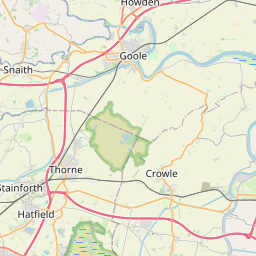
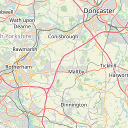
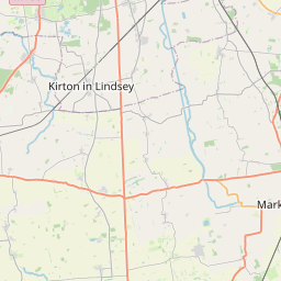

Leaflet | © OpenStreetMap contributors
Search distance between two cities
The weather for Topham in the United Kingdom
Get today and tomorrow's weather forecasts for Topham. Find out the weather forecast for the week ahead and the weekend for Topham in the UK.Topham weather forecast 15 days
What is the nearest train station to Topham?
List of Railway Stations near to TophamThe nearest railway stations to Topham are listed below. Tickets are available at the train station ticket office or ticket machines.
| Name | Distances from Topham |
|---|---|
| Snaith Station | 5.32 Km |
| Hensall Station | 6.65 Km |
| Thorne North Station | 6.75 Km |
| Hatfield and Stainforth Station | 7.07 Km |
| Rawcliffe Station | 7.84 Km |
| Thorne South Station | 8.49 Km |
| Whitley Bridge Station | 8.63 Km |
| Kirk Sandall Station | 9.49 Km |
| Adwick Station | 11.70 Km |
| Bentley (S. Yorks) Station | 13.15 Km |
What is the nearest Public Transport Stops to Topham?
List of Stops near to TophamGetting there by public transport (nearest train, tube, overground line station and bus stops). The nearest stops to Topham are listed below.
| Stop Name | Distances from Topham |
|---|---|
| Starkbridge Lane Bus Stop (adj) | 730 m |
| Starkbridge Lane Bus Stop (opp) | 740 m |
| Chapel Lane Bus Stop (adj) | 743 m |
| Chapel Lane Bus Stop (opp) | 751 m |
| Old George Inn Bus Stop (opp) | 769 m |
| Stringer Lane Bus Stop (opp) | 888 m |
| Chapel Row Bus Stop (adj) | 890 m |
| Stringer Lane Bus Stop (adj) | 894 m |
| Chapel Row Bus Stop (opp) | 901 m |
| West Lane Bus Stop | 1.03 Km |
Historic Places to Visit near Topham
List of Historic places near to Topham
| Name | Distances from Topham |
|---|---|
| Kirk Sandall, St Oswalds Church | 9.65 Km |
Cities or Towns near Topham
List of places near to
| Name | Distance |
|---|---|
| Sykehouse | 0.75 Km |
| Eskholme | 1.39 Km |
| Mawson Green | 2.32 Km |
| Pollington | 2.58 Km |
| Fenwick | 3.24 Km |
| Kirkhouse Green | 3.65 Km |
| Pincheon Green | 3.71 Km |
| Balne | 3.99 Km |
| Moss | 4.01 Km |
| Fosterhouses | 4.24 Km |
| Wormley Hill | 4.36 Km |
| Great Heck | 4.76 Km |
| Far Bank | 4.79 Km |
| Braithwaite | 4.91 Km |
| West Cowick | 5.00 Km |
| Gowdall | 5.01 Km |
| Fishlake | 5.04 Km |
| Snaith | 5.14 Km |
| Stainforth | 5.68 Km |
| East Cowick | 5.73 Km |
| South Bramwith | 5.74 Km |
| Kirk Bramwith | 5.78 Km |
| Hangsman Hill | 5.88 Km |
| Little Heck | 5.88 Km |
| Trumfleet | 6.10 Km |
| High Eggborough | 6.79 Km |
| Hensall | 6.81 Km |
| Whitley | 7.16 Km |
| Askern | 7.17 Km |
| Walden Stubbs | 7.28 Km |
| Carlton | 7.28 Km |
| Hirst Courtney | 7.30 Km |
| Moorends | 7.41 Km |
| Whitley Thorpe | 7.51 Km |
| Thorpe in Balne | 7.56 Km |
| Thorne | 7.68 Km |
| Canal Side | 7.82 Km |
| Temple Hirst | 7.86 Km |
| Instoneville | 7.89 Km |
| Norton | 8.05 Km |
| Barnby Dun | 8.09 Km |
| Rawcliffe | 8.41 Km |
| Hut Green | 8.47 Km |
| Rawcliffe Bridge | 8.50 Km |
| Whitley Bridge | 8.55 Km |
| Eggborough | 8.63 Km |
| Wike Well End | 8.63 Km |
| Hatfield | 8.77 Km |
| Sutton | 8.81 Km |
| Campsall | 8.86 Km |