Tickham Map, Satellite view of Tickham, Kent, England
Tickham is located in Kent County, Swale District, South East, England, United Kingdom.
Location informations of Tickham
Latitude of city of Tickham is 51.31298 and longitude of city of Tickham is 0.81136. Tickham has 1 postcode / zip code, in county of Kent.The County of Tickham is Kent.
Postcode / zip code of Tickham
ME9 0Administrative division of Tickham
County :KentGPS coordinates of Tickham
Latitude : 51.31298Longitude : 0.81136
Online Map of Tickham - road map, satellite view and street view


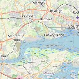

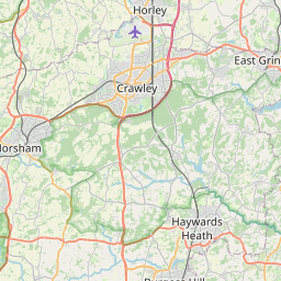


Leaflet | © OpenStreetMap contributors
Search distance between two cities
The weather for Tickham in the United Kingdom
Get today and tomorrow's weather forecasts for Tickham. Find out the weather forecast for the week ahead and the weekend for Tickham in the UK.Tickham weather forecast 15 days
What is the nearest train station to Tickham?
List of Railway Stations near to TickhamThe nearest railway stations to Tickham are listed below. Tickets are available at the train station ticket office or ticket machines.
| Name | Distances from Tickham |
|---|---|
| Teynham Station | 2.29 Km |
| Faversham Station | 5.54 Km |
| Sittingbourne Station | 6.23 Km |
| Kemsley Station | 7.62 Km |
| Swale Station | 9.58 Km |
| Selling Station | 9.84 Km |
| Newington Station | 10.89 Km |
| Lenham Station | 11.32 Km |
| Charing Station | 11.75 Km |
| Queenborough Station | 12.19 Km |
What is the nearest Public Transport Stops to Tickham?
List of Stops near to TickhamGetting there by public transport (nearest train, tube, overground line station and bus stops). The nearest stops to Tickham are listed below.
| Stop Name | Distances from Tickham |
|---|---|
| Lewson Street Road Bus Stop (opp) | 616 m |
| The Plough Bus Stop (o/s) | 618 m |
| Lewson Street Road Bus Stop (adj) | 625 m |
| Monks Farm Bus Stop (o/s) | 967 m |
| Lewson Street Bus Stop (adj) | 1.23 Km |
| Lewson Street Bus Stop (opp) | 1.24 Km |
| Crossroads Bus Stop (W-bound) | 1.30 Km |
| Crossroads Bus Stop (E-bound) | 1.39 Km |
| Bogle Road Bus Stop (adj) | 1.44 Km |
| Bogle Road Bus Stop (opp) | 1.46 Km |
Historic Places to Visit near Tickham
List of Historic places near to Tickham
| Name | Distances from Tickham |
|---|---|
| Faversham Stone Chapel | 3.22 Km |
| Doddington Place Gardens | 3.70 Km |
| Luddenham, St Marys Church | 3.87 Km |
| Kingsdown, St Catherines Church | 4.10 Km |
| Belmont House | 4.76 Km |
| Chart Gunpowder Mills | 5.60 Km |
| Maison Dieu | 5.62 Km |
| Faversham, St Mary of Charity Church | 5.84 Km |
| Goodnestone, St Bartholomews Church | 8.60 Km |
| Goodnestone Park Gardens | 8.60 Km |
| Bredgar & Wormshill Light Railway | 8.87 Km |
| Mount Ephraim Gardens | 10.52 Km |
| Lenham, St Marys Church | 10.62 Km |
| Charing, St Peter and St Paul | 11.45 Km |
| Charing Palace | 12.58 Km |
| Chilham Castle | 12.80 Km |
| Chilham, St Mary | 12.99 Km |
| Leeds Castle | 14.42 Km |
Cities or Towns near Tickham
List of places near to
| Name | Distance |
|---|---|
| Lewson Street | 0.61 Km |
| Loyterton | 0.63 Km |
| Norton Ash | 1.35 Km |
| Bogle | 1.46 Km |
| Teynham | 1.73 Km |
| Cellarhill | 1.73 Km |
| Lynsted | 1.75 Km |
| Deerton Street | 1.96 Km |
| Barrow Green | 2.34 Km |
| Erriottwood | 2.59 Km |
| Teynham Street | 2.82 Km |
| Radfield | 2.82 Km |
| Upper Rodmersham | 3.28 Km |
| Newnham | 3.29 Km |
| Four Oaks | 3.32 Km |
| North Eastling | 3.38 Km |
| Bax | 3.43 Km |
| Bapchild | 3.52 Km |
| Rodmersham | 3.54 Km |
| Painter's Forstal | 3.63 Km |
| Conyer | 3.70 Km |
| Luddenham | 3.96 Km |
| Ospringe | 4.19 Km |
| Eastling | 4.29 Km |
| Whitehill | 4.33 Km |
| Doddington | 4.44 Km |
| Seed | 4.50 Km |
| Dungate | 4.55 Km |
| Rodmersham Green | 4.55 Km |
| Snipeshill | 4.75 Km |
| Tonge Corner | 4.82 Km |
| Highsted | 4.87 Km |
| Blacketts | 4.89 Km |
| Davington | 4.97 Km |
| Oare | 5.01 Km |
| Plumford | 5.04 Km |
| Bluetown | 5.18 Km |
| Uplees | 5.26 Km |
| Preston | 5.35 Km |
| Murston | 5.41 Km |
| Yewhedges | 5.43 Km |
| The Brents | 5.49 Km |
| Little Frith | 5.56 Km |
| Frith | 5.56 Km |
| Wilgate Green | 5.58 Km |
| Faversham | 5.59 Km |
| Copton | 5.62 Km |
| Hollybushes | 5.71 Km |
| Hockley | 5.72 Km |
| Selgrove | 5.94 Km |