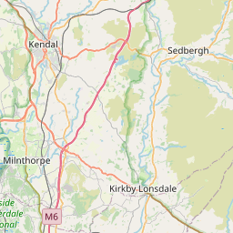
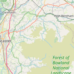
Thornton in Lonsdale Map, Satellite view of Thornton in Lonsdale, North Yorkshire, England
Thornton in Lonsdale is located in North Yorkshire County, Craven District, Yorkshire and the Humber, England, United Kingdom.
Location informations of Thornton in Lonsdale
Latitude of city of Thornton in Lonsdale is 54.15755 and longitude of city of Thornton in Lonsdale is -2.48343. Thornton in Lonsdale has 1 postcode / zip code, in county of North Yorkshire.The County of Thornton in Lonsdale is North Yorkshire.
Postcode / zip code of Thornton in Lonsdale
LA6 3Administrative division of Thornton in Lonsdale
County :North YorkshireGPS coordinates of Thornton in Lonsdale
Latitude : 54.15755Longitude : -2.48343
Online Map of Thornton in Lonsdale - road map, satellite view and street view


Leaflet | © OpenStreetMap contributors
Search distance between two cities
The weather for Thornton in Lonsdale in the United Kingdom
Get today and tomorrow's weather forecasts for Thornton in Lonsdale. Find out the weather forecast for the week ahead and the weekend for Thornton in Lonsdale in the UK.Thornton in Lonsdale weather forecast 15 days
What is the nearest train station to Thornton in Lonsdale?
List of Railway Stations near to Thornton in LonsdaleThe nearest railway stations to Thornton in Lonsdale are listed below. Tickets are available at the train station ticket office or ticket machines.
| Name | Distances from Thornton in Lonsdale |
|---|---|
| Bentham Station | 5.00 Km |
| Clapham (North Yorkshire) Station | 7.50 Km |
| Wennington Station | 7.75 Km |
| Ribblehead Station | 9.62 Km |
| Horton In Ribblesdale Station | 11.85 Km |
| Giggleswick Station | 15.87 Km |
| Dent Station | 15.92 Km |
| Settle Station | 16.62 Km |
| Carnforth Station | 19.00 Km |
| Garsdale Station | 20.89 Km |
What is the nearest Public Transport Stops to Thornton in Lonsdale?
List of Stops near to Thornton in LonsdaleGetting there by public transport (nearest train, tube, overground line station and bus stops). The nearest stops to Thornton in Lonsdale are listed below.
| Stop Name | Distances from Thornton in Lonsdale |
|---|---|
| Community Centre Bus Stop (32004552) | 1.02 Km |
| The Bridge Inn Bus Stop (SE-bound) | 1.06 Km |
| The Bridge Inn Bus Stop (NW-bound) | 1.09 Km |
| Community Centre Bus Stop (adj) | 1.13 Km |
| Westgate le Bus Stop (adj) | 1.38 Km |
| Westgate Lane Bus Stop (opp) | 1.39 Km |
| Garage Bus Stop (SE-bound) | 1.50 Km |
| Garage Bus Stop (NW-bound) | 1.50 Km |
| Parkmore Camp Site Bus Stop (opp) | 2.12 Km |
| Caravan Park Bus Stop (adj) | 2.12 Km |
Historic Places to Visit near Thornton in Lonsdale
List of Historic places near to Thornton in Lonsdale
| Name | Distances from Thornton in Lonsdale |
|---|---|
| Ingleton, St Marys Church | 1.11 Km |
Cities or Towns near Thornton in Lonsdale
List of places near to
| Name | Distance |
|---|---|
| Lower Westhouse | 1.03 Km |
| Ingleton | 1.11 Km |
| Westhouse | 1.34 Km |
| Masongill | 2.62 Km |
| Burton in Lonsdale | 3.20 Km |
| Ireby | 3.66 Km |
| Cold Cotes | 3.98 Km |
| Greystonegill | 4.13 Km |
| Over Leck | 4.64 Km |
| High Bentham | 4.73 Km |
| Leck | 5.29 Km |
| Low Bentham | 5.43 Km |
| Newby | 5.52 Km |
| Newby Cote | 5.60 Km |
| Old Wennington | 5.64 Km |
| Green Close | 5.72 Km |
| Cowan Bridge | 5.77 Km |
| Overtown | 6.17 Km |
| Chapel-le-Dale | 6.29 Km |
| Cantsfield | 6.49 Km |
| Mewith Head | 6.74 Km |
| Green | 7.26 Km |
| Nether Burrow | 7.29 Km |
| Over Burrow | 7.31 Km |
| Clapham | 7.43 Km |
| Wennington | 7.67 Km |
| Wrayton | 7.68 Km |
| Tunstall | 7.68 Km |
| High Casterton | 7.86 Km |
| Keasden | 7.98 Km |
| Casterton | 8.56 Km |
| Tatham | 8.68 Km |
| Newton | 8.86 Km |
| Kirkby Lonsdale | 8.89 Km |
| Melling | 8.94 Km |
| Whittington | 9.00 Km |
| Low Biggins | 9.18 Km |
| Ribblehead | 9.52 Km |
| High Biggins | 9.62 Km |
| Austwick | 9.66 Km |
| Lowgill | 9.80 Km |
| Gauber | 10.05 Km |
| Selside | 10.09 Km |
| Kearstwick | 10.18 Km |
| Wray | 10.29 Km |
| Arkholme | 10.33 Km |
| Barbon | 10.48 Km |
| Wharfe | 10.55 Km |
| Dovenanter | 10.61 Km |
| Deepdale | 11.19 Km |