Stone Common Map, Satellite view of Stone Common, Suffolk, England
Stone Common is located in Suffolk County, Suffolk Coastal District, Eastern, England, United Kingdom.
Location informations of Stone Common
Latitude of city of Stone Common is 52.16192 and longitude of city of Stone Common is 1.44606. Stone Common has 1 postcode / zip code, in county of Suffolk.The County of Stone Common is Suffolk.
Postcode / zip code of Stone Common
IP12 2Administrative division of Stone Common
County :SuffolkGPS coordinates of Stone Common
Latitude : 52.16192Longitude : 1.44606
Online Map of Stone Common - road map, satellite view and street view
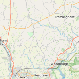

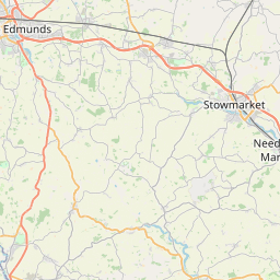

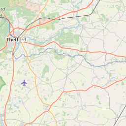

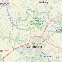


Leaflet | © OpenStreetMap contributors
Search distance between two cities
The weather for Stone Common in the United Kingdom
Get today and tomorrow's weather forecasts for Stone Common. Find out the weather forecast for the week ahead and the weekend for Stone Common in the UK.Stone Common weather forecast 15 days
What is the nearest train station to Stone Common?
List of Railway Stations near to Stone CommonThe nearest railway stations to Stone Common are listed below. Tickets are available at the train station ticket office or ticket machines.
| Name | Distances from Stone Common |
|---|---|
| Wickham Market Station | 3.45 Km |
| Saxmundham Station | 6.61 Km |
| Melton Station | 9.75 Km |
| Woodbridge Station | 11.83 Km |
| Darsham Station | 13.43 Km |
| Halesworth Station | 20.96 Km |
| Westerfield Station | 21.14 Km |
| Derby Road Station | 21.84 Km |
| Trimley Station | 22.36 Km |
| Felixstowe Station | 22.63 Km |
What is the nearest Public Transport Stops to Stone Common?
List of Stops near to Stone CommonGetting there by public transport (nearest train, tube, overground line station and bus stops). The nearest stops to Stone Common are listed below.
| Stop Name | Distances from Stone Common |
|---|---|
| Youth Hostel Bus Stop (opp) | 1.07 Km |
| Youth Hostel Bus Stop (nr) | 1.09 Km |
| Tunstall Green Bus Stop (adj) | 1.94 Km |
| Tunstall Green Bus Stop (opp) | 1.94 Km |
| Green Man Bus Stop (E-bound) | 2.04 Km |
| Green Man Bus Stop (W-bound) | 2.04 Km |
| Green Man Bus Stop (Adjacent) | 2.07 Km |
| The Lion Bus Stop (adj) | 2.09 Km |
| The Lion Bus Stop (opp) | 2.10 Km |
| Green Man Bus Stop (Opposite) | 2.10 Km |
Historic Places to Visit near Stone Common
List of Historic places near to Stone Common
Cities or Towns near Stone Common
List of places near to
| Name | Distance |
|---|---|
| Blaxhall | 0.68 Km |
| Tunstall | 2.04 Km |
| Little Glemham | 2.07 Km |
| Farnham | 3.03 Km |
| Stratford St Andrew | 3.11 Km |
| Campsea Ashe | 3.46 Km |
| Gromford | 3.52 Km |
| Marlesford | 3.56 Km |
| The Street | 3.70 Km |
| Snape | 3.74 Km |
| Snape Watering | 3.83 Km |
| Ash Corner | 4.00 Km |
| Benhall Street | 4.04 Km |
| Church Common | 4.10 Km |
| Lower Hacheston | 4.32 Km |
| Rendlesham | 4.44 Km |
| Benhall Green | 4.97 Km |
| Sternfield | 4.99 Km |
| Great Glemham | 5.01 Km |
| Silverlace Green | 5.23 Km |
| Iken | 5.29 Km |
| Hacheston | 5.34 Km |
| Chillesford | 5.66 Km |
| Friday Street | 5.69 Km |
| Wickham Market | 5.76 Km |
| Parham | 6.01 Km |
| Butley | 6.14 Km |
| Mill Green | 6.16 Km |
| Friston | 6.28 Km |
| Mill Hole | 6.34 Km |
| Saxmundham | 6.55 Km |
| Pettistree | 6.64 Km |
| Eyke | 6.66 Km |
| Sweffling | 6.67 Km |
| North Green | 6.79 Km |
| Sudbourne | 6.85 Km |
| Spratt's Street | 6.94 Km |
| Easton | 7.33 Km |
| California | 7.43 Km |
| High Street | 7.47 Km |
| Rendham | 7.54 Km |
| Capel Green | 7.64 Km |
| Ufford | 7.76 Km |
| Butley Low Corner | 7.78 Km |
| Carlton | 7.80 Km |
| Knodishall | 8.20 Km |
| Butley High Corner | 8.25 Km |
| Cransford | 8.25 Km |
| Kelsale | 8.27 Km |
| Letheringham | 8.37 Km |