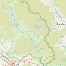
Stead Map, Satellite view of Stead, West Yorkshire, England
Stead is located in West Yorkshire County, Bradford District, Yorkshire and the Humber, England, United Kingdom.
Location informations of Stead
Latitude of city of Stead is 53.91245 and longitude of city of Stead is -1.78518. Stead has 1 postcode / zip code, in county of West Yorkshire.The County of Stead is West Yorkshire.
Postcode / zip code of Stead
LS29 8Administrative division of Stead
County :West YorkshireGPS coordinates of Stead
Latitude : 53.91245Longitude : -1.78518
Online Map of Stead - road map, satellite view and street view


Leaflet | © OpenStreetMap contributors
Search distance between two cities
The weather for Stead in the United Kingdom
Get today and tomorrow's weather forecasts for Stead. Find out the weather forecast for the week ahead and the weekend for Stead in the UK.Stead weather forecast 15 days
What is the nearest train station to Stead?
List of Railway Stations near to SteadThe nearest railway stations to Stead are listed below. Tickets are available at the train station ticket office or ticket machines.
| Name | Distances from Stead |
|---|---|
| Ben Rhydding Station | 1.68 Km |
| Burley-In-Wharfedale Station | 2.14 Km |
| Ilkley Station | 2.77 Km |
| Menston Station | 3.95 Km |
| Guiseley Station | 6.13 Km |
| Crossflatts Station | 7.17 Km |
| Baildon Station | 7.22 Km |
| Bingley Station | 7.88 Km |
| Saltaire Station | 8.23 Km |
| Shipley Station | 8.86 Km |
Leeds Bradford Airport , UK (9.67 Km)
What is the nearest Public Transport Stops to Stead?
List of Stops near to SteadGetting there by public transport (nearest train, tube, overground line station and bus stops). The nearest stops to Stead are listed below.
| Stop Name | Distances from Stead |
|---|---|
| Coutances Way Saxon Lodge Bus Stop (before) | 1.15 Km |
| Coutances Way Saxon Lodge Bus Stop (opp) | 1.18 Km |
| Wheatley Lane Bus Stop | 1.32 Km |
| Wheatley Ln Wheatley Grove Bus Stop (adj) | 1.41 Km |
| Wheatley Lane Bus Stop (N bound) | 1.49 Km |
| Treatment Works Bus Stop (adj) | 1.52 Km |
| Treatment Works Bus Stop (opp) | 1.53 Km |
| Wheatley Ln Ben Rhydding Drive Bus Stop (at) | 1.56 Km |
| Bolling Road Wheatley Ln Bus Stop (before) | 1.61 Km |
| Esscroft Cottage Bus Stop (adj) | 1.61 Km |
Historic Places to Visit near Stead
List of Historic places near to Stead
| Name | Distances from Stead |
|---|---|
| Farnley Hall | 7.43 Km |
| East Riddlesden Hall | 7.54 Km |
| Bolton Abbey | 10.26 Km |
| Stainburn, St Marys Church | 10.63 Km |
| The Strid | 12.78 Km |
| Colour Experience | 13.13 Km |
| National Media Museum | 13.67 Km |
| Barden Bridge | 14.16 Km |
| Barden Tower | 14.25 Km |
| Bronte Parsonage Museum | 14.38 Km |
| Haworth, St Michaels Church | 14.38 Km |
Cities or Towns near Stead
List of places near to
| Name | Distance |
|---|---|
| Ben Rhydding | 1.75 Km |
| Burley Woodhead | 1.96 Km |
| Burley in Wharfedale | 2.31 Km |
| Denton | 2.70 Km |
| Ilkley | 2.82 Km |
| Askwith | 3.35 Km |
| Middleton | 3.40 Km |
| Menston | 3.49 Km |
| Weston | 3.74 Km |
| Hawksworth | 4.53 Km |
| Chevin End | 4.63 Km |
| Ousel Hole | 5.28 Km |
| Low Springs | 5.30 Km |
| Clifton | 5.38 Km |
| Kelcliffe | 5.43 Km |
| Botany | 5.44 Km |
| Lane Head | 5.44 Km |
| Tranmere Park | 5.52 Km |
| Green End | 5.70 Km |
| Newall | 5.76 Km |
| Eldwick Beck | 5.89 Km |
| Nesfield | 5.95 Km |
| Otley | 5.99 Km |
| Peas Acre | 6.04 Km |
| Micklethwaite | 6.09 Km |
| West Morton | 6.22 Km |
| East Morton | 6.27 Km |
| Eldwick | 6.27 Km |
| Guiseley | 6.36 Km |
| Langbar | 6.59 Km |
| Baildon | 6.68 Km |
| Church Hill | 6.74 Km |
| Greenbottom | 6.81 Km |
| Tong Park | 6.81 Km |
| Addingham Moorside | 6.84 Km |
| Small Banks | 6.86 Km |
| Priestthorpe | 6.87 Km |
| Cambridge | 6.89 Km |
| Crossflatts | 7.04 Km |
| Barley Cote | 7.11 Km |
| Tarn | 7.15 Km |
| Low Baildon | 7.16 Km |
| Park | 7.16 Km |
| Esholt | 7.20 Km |
| West Carlton | 7.27 Km |
| Brook Hill | 7.28 Km |
| Addingham | 7.29 Km |
| Riddlesden | 7.37 Km |
| Gilstead | 7.39 Km |
| Crow Nest | 7.42 Km |