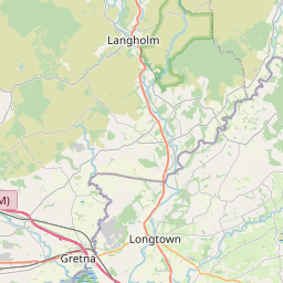
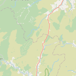
Stapleton Map, Satellite view of Stapleton, Cumbria, England
Stapleton is located in Cumbria County, Carlisle District, North West, England, United Kingdom.
Location informations of Stapleton
Latitude of city of Stapleton is 55.03504 and longitude of city of Stapleton is -2.77681. Stapleton has 1 postcode / zip code, in county of Cumbria.The County of Stapleton is Cumbria.
Postcode / zip code of Stapleton
CA6 6Administrative division of Stapleton
County :CumbriaGPS coordinates of Stapleton
Latitude : 55.03504Longitude : -2.77681
Online Map of Stapleton - road map, satellite view and street view


Leaflet | © OpenStreetMap contributors
Search distance between two cities
The weather for Stapleton in the United Kingdom
Get today and tomorrow's weather forecasts for Stapleton. Find out the weather forecast for the week ahead and the weekend for Stapleton in the UK.Stapleton weather forecast 15 days
What is the nearest train station to Stapleton?
List of Railway Stations near to StapletonThe nearest railway stations to Stapleton are listed below. Tickets are available at the train station ticket office or ticket machines.
| Name | Distances from Stapleton |
|---|---|
| Brampton (Cumbria) Station | 12.35 Km |
| Wetheral Station | 17.17 Km |
| Gretna Green Station | 18.77 Km |
| Carlisle Station | 18.91 Km |
| Haltwhistle Station | 21.33 Km |
| Dalston Station | 24.99 Km |
| Armathwaite Station | 25.08 Km |
| Bardon Mill Station | 28.25 Km |
Carlisle Airport , UK (11.04 Km)
RAF Spadeadam , UK (14.55 Km)
What is the nearest Public Transport Stops to Stapleton?
List of Stops near to StapletonGetting there by public transport (nearest train, tube, overground line station and bus stops). The nearest stops to Stapleton are listed below.
| Stop Name | Distances from Stapleton |
|---|---|
| The Crossings Inn Bus Stop (o/s) | 1.60 Km |
| Kinkry Hill Bank Bus Stop (near) | 3.69 Km |
| Badgers Rake Bus Stop (near) | 3.99 Km |
| Crossroads Bus Stop (at) | 4.99 Km |
| Black Lion Bus Stop (o/s) | 5.06 Km |
| Greenholme Bus Stop (near) | 5.08 Km |
| Parkgate Cottages Bus Stop (opp) | 5.32 Km |
| Sleetbeck Road crossroads Bus Stop (near) | 5.53 Km |
| Nickies Hill Chapel Bus Stop (o/s) | 5.58 Km |
| Nickies Hill Chapel Bus Stop (near) | 5.59 Km |
Historic Places to Visit near Stapleton
List of Historic places near to Stapleton
| Name | Distances from Stapleton |
|---|---|
| Bewcastle Cross | 6.77 Km |
| Bewcastle, St Cuthberts Church | 6.83 Km |
| Kirklinton Hall | 7.95 Km |
| Hare Hill (Hadrians Wall) | 8.93 Km |
| Lanercost Priory | 9.14 Km |
| Pike Hill Signal Tower (Hadrians Wall) | 9.81 Km |
| Brampton Old Church | 9.89 Km |
| Banks East Turret (Hadrians Wall) | 9.91 Km |
| Leahill Turret and Piper Sike Turret (Hadrians Wall) | 10.07 Km |
| Brampton, St Martins Church | 10.66 Km |
| Naworth Castle | 10.71 Km |
| Birdoswald Fort and Hadrians Wall | 12.49 Km |
| Harrows Scar Milecastle (Hadrians Wall) | 12.58 Km |
| Willowford Roman Bridge (Hadrians Wall) | 12.73 Km |
| Willowford (Hadrians Wall) | 13.14 Km |
| Poltross Burn Milecastle (Hadrians Wall) | 14.00 Km |
| Warwick on Eden, St Leonards Church | 14.95 Km |
Cities or Towns near Stapleton
List of places near to
| Name | Distance |
|---|---|
| Longrigg | 0.73 Km |
| Lyneholmeford | 1.54 Km |
| Mallsburn | 2.96 Km |
| Roadhead | 3.77 Km |
| Kirkcambeck | 3.81 Km |
| Haggbeck | 4.00 Km |
| Boltonfellend | 4.14 Km |
| Kinkry Hill | 4.19 Km |
| Mossedge | 4.24 Km |
| Roughsike | 4.54 Km |
| Prior Rigg | 4.92 Km |
| Hethersgill | 5.00 Km |
| Sleetbeck | 5.05 Km |
| Oakshaw Ford | 5.16 Km |
| Shawfoot | 5.93 Km |
| Shopford | 6.76 Km |
| Bewcastle | 6.81 Km |
| Scuggate | 6.90 Km |
| Catlowdy | 6.98 Km |
| Walton | 7.17 Km |
| Easton | 7.38 Km |
| Uppertown | 7.65 Km |
| Warwicksland | 8.00 Km |
| Penton | 8.12 Km |
| Laversdale Lane | 8.24 Km |
| Skitby | 8.39 Km |
| Kirklinton | 8.43 Km |
| Hetherside | 8.51 Km |
| Smithfield | 8.61 Km |
| Burtholme | 8.71 Km |
| Newtown | 8.94 Km |
| The Flatt | 9.05 Km |
| Banks | 9.12 Km |
| Brownrigg | 9.19 Km |
| Great Easby | 9.31 Km |
| Laversdale | 9.33 Km |
| Lanercost | 9.39 Km |
| Bushfield | 9.51 Km |
| Moat | 9.63 Km |
| Boothby | 9.76 Km |
| Irthington | 9.81 Km |
| Scaleby | 9.86 Km |
| Carwinley | 9.96 Km |
| Oldwall | 10.03 Km |
| Scalebyhill | 10.28 Km |
| Barclose | 10.57 Km |
| Burnhill | 10.67 Km |
| Brampton | 10.67 Km |
| Caulside | 10.73 Km |
| Bleatarn | 10.98 Km |