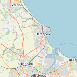
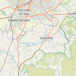
Stanghow Map, Satellite view of Stanghow, North Yorkshire, England
Stanghow is located in North Yorkshire County, Redcar and Cleveland, North East, England, United Kingdom.
Location informations of Stanghow
Latitude of city of Stanghow is 54.53130 and longitude of city of Stanghow is -0.96030. Stanghow has 1 postcode / zip code, in county of North Yorkshire.The County of Stanghow is North Yorkshire.
Postcode / zip code of Stanghow
TS12 3Administrative division of Stanghow
County :North YorkshireGPS coordinates of Stanghow
Latitude : 54.53130Longitude : -0.96030
Online Map of Stanghow - road map, satellite view and street view


Leaflet | © OpenStreetMap contributors
Search distance between two cities
The weather for Stanghow in the United Kingdom
Get today and tomorrow's weather forecasts for Stanghow. Find out the weather forecast for the week ahead and the weekend for Stanghow in the UK.Stanghow weather forecast 15 days
What is the nearest train station to Stanghow?
List of Railway Stations near to StanghowThe nearest railway stations to Stanghow are listed below. Tickets are available at the train station ticket office or ticket machines.
| Name | Distances from Stanghow |
|---|---|
| Commondale Station | 5.64 Km |
| Saltburn Station | 5.87 Km |
| Castleton Moor Station | 7.19 Km |
| Marske Station | 7.30 Km |
| Longbeck Station | 7.87 Km |
| Danby Station | 7.91 Km |
| Kildale Station | 9.16 Km |
| Redcar East Station | 10.50 Km |
| Great Ayton Station | 11.03 Km |
| Lealholm Station | 11.72 Km |
What is the nearest Public Transport Stops to Stanghow?
List of Stops near to StanghowGetting there by public transport (nearest train, tube, overground line station and bus stops). The nearest stops to Stanghow are listed below.
| Stop Name | Distances from Stanghow |
|---|---|
| Community Centre Bus Stop (A) | 12 m |
| Community Centre Bus Stop (B) | 31 m |
| Cedarhurst Drive Bus Stop (A) | 574 m |
| Cedarhurst Drive Bus Stop (B) | 583 m |
| Whitwell Place Bus Stop (4) | 702 m |
| Whitwell Place Bus Stop (A) | 712 m |
| Meadow Dale Court Bus Stop (A) | 738 m |
| The Tavern Bus Stop (3) | 788 m |
| Meadow Dale Court Bus Stop (B) | 803 m |
| St Chad's Bus Stop (B) | 913 m |
Historic Places to Visit near Stanghow
List of Historic places near to Stanghow
| Name | Distances from Stanghow |
|---|---|
| Skelton-in-Cleveland Old Church | 3.90 Km |
| Roseberry Topping | 10.29 Km |
| Ormesby Hall | 14.34 Km |
Cities or Towns near Stanghow
List of places near to
| Name | Distance |
|---|---|
| Lingdale | 0.73 Km |
| Margrove Park | 1.88 Km |
| Boosbeck | 2.01 Km |
| Moorsholm | 2.03 Km |
| Charltons | 2.57 Km |
| Kilton Thorpe | 2.63 Km |
| Slapewath | 2.87 Km |
| North Skelton | 2.89 Km |
| Skelton Green | 2.97 Km |
| New Skelton | 3.38 Km |
| Skelton | 3.62 Km |
| Kilton | 3.75 Km |
| Liverton | 3.78 Km |
| Gerrick | 4.18 Km |
| Liverton Mines | 4.43 Km |
| Brotton | 4.44 Km |
| Carlin How | 4.90 Km |
| New Brotton | 5.01 Km |
| Commondale | 5.23 Km |
| Loftus | 5.45 Km |
| Upleatham | 5.61 Km |
| Saltburn-by-the-Sea | 5.75 Km |
| Skinningrove | 5.77 Km |
| East Loftus | 5.86 Km |
| Guisborough | 5.87 Km |
| Old Saltburn | 5.99 Km |
| Scaling | 7.36 Km |
| Hutton Village | 7.41 Km |
| Dunsdale | 7.41 Km |
| Easington | 7.43 Km |
| Danby | 7.59 Km |
| New Marske | 7.63 Km |
| Castleton | 7.68 Km |
| Marske-by-the-Sea | 7.75 Km |
| Hutton Gate | 7.86 Km |
| Ainthorpe | 8.20 Km |
| Roxby | 8.89 Km |
| Pinchinthorpe | 8.99 Km |
| Yearby | 9.06 Km |
| Kildale | 9.07 Km |
| Boulby | 9.24 Km |
| Borrowby | 9.64 Km |
| Westerdale | 9.66 Km |
| Wilton | 9.82 Km |
| Houlsyke | 9.91 Km |
| Kirkleatham | 10.43 Km |
| Newton under Roseberry | 10.65 Km |
| Battersby | 10.90 Km |
| Lazenby | 10.93 Km |
| Cowbar | 11.08 Km |