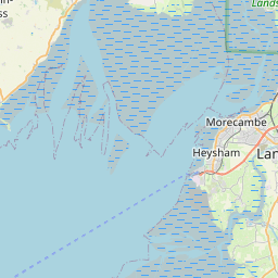
Staining Map, Satellite view of Staining, Lancashire, England
Staining is located in Lancashire County, Fylde District, North West, England, United Kingdom.
Location informations of Staining
Latitude of city of Staining is 53.81731 and longitude of city of Staining is -2.99130. Staining has 1 postcode / zip code, in county of Lancashire.The County of Staining is Lancashire.
Postcode / zip code of Staining
FY3 0Administrative division of Staining
County :LancashireGPS coordinates of Staining
Latitude : 53.81731Longitude : -2.99130
Online Map of Staining - road map, satellite view and street view


Leaflet | © OpenStreetMap contributors
Search distance between two cities
The weather for Staining in the United Kingdom
Get today and tomorrow's weather forecasts for Staining. Find out the weather forecast for the week ahead and the weekend for Staining in the UK.Staining weather forecast 15 days
What is the nearest train station to Staining?
List of Railway Stations near to StainingThe nearest railway stations to Staining are listed below. Tickets are available at the train station ticket office or ticket machines.
| Name | Distances from Staining |
|---|---|
| Layton Station | 3.23 Km |
| Poulton-Le-Fylde Station | 3.46 Km |
| Blackpool North Station | 3.84 Km |
| Blackpool South Station | 4.31 Km |
| Blackpool Pleasure Beach Station | 5.25 Km |
| Squires Gate Station | 5.90 Km |
| Moss Side Station | 6.63 Km |
| St.Annes-On-The-Sea Station | 7.57 Km |
| Kirkham and Wesham Station | 7.88 Km |
| Ansdell and Fairhaven Station | 8.43 Km |
Blackpool International Airport , UK (5.63 Km)
Warton Airport , UK (10.73 Km)
What is the nearest Public Transport Stops to Staining?
List of Stops near to StainingGetting there by public transport (nearest train, tube, overground line station and bus stops). The nearest stops to Staining are listed below.
| Stop Name | Distances from Staining |
|---|---|
| Meadow Park Bus Stop (opp) | 49 m |
| Meadow Park Bus Stop (by) | 122 m |
| Primary School Bus Stop (o/s) | 147 m |
| Castle Lane Bus Stop (by) | 200 m |
| Bibby Drive Bus Stop (opp) | 360 m |
| Bibby Drive Bus Stop (by) | 373 m |
| Moons Farm Bus Stop (o/s) | 553 m |
| Moons Farm Bus Stop (opp) | 637 m |
| Staining Road Bus Stop (o/s) | 764 m |
| Normoss Avenue Bus Stop (by) | 872 m |
Historic Places to Visit near Staining
List of Historic places near to Staining
| Name | Distances from Staining |
|---|---|
| Poulton-le-Fylde, St Chads Church | 3.39 Km |
| Lytham Hall | 7.91 Km |
| Pilling, Old St Johns Church | 13.85 Km |
Cities or Towns near Staining
List of places near to
| Name | Distance |
|---|---|
| Newton | 0.83 Km |
| Hardhorn Village | 1.36 Km |
| Normoss | 1.57 Km |
| High Cross | 1.58 Km |
| Little Marton | 1.59 Km |
| Mythop | 1.70 Km |
| Hardhorn | 1.80 Km |
| Mereside | 2.34 Km |
| Little Marton Moss Side | 2.34 Km |
| Sandham's Green | 2.36 Km |
| Little Layton | 2.59 Km |
| Little Carleton | 2.71 Km |
| Great Marton | 2.81 Km |
| Layton | 2.88 Km |
| Marton Moss Side | 2.94 Km |
| Hoohill | 3.15 Km |
| Poulton-le-Fylde | 3.19 Km |
| Queenstown | 3.26 Km |
| Peel Hill | 3.33 Km |
| Walker's Hill | 3.40 Km |
| Little Poulton | 3.43 Km |
| Revoe | 3.52 Km |
| Hawes Side | 3.64 Km |
| Warbreck | 3.65 Km |
| Singleton | 3.77 Km |
| Weeton | 3.92 Km |
| Common Edge | 3.96 Km |
| Blackpool | 3.97 Km |
| Carleton | 4.03 Km |
| North Shore | 4.16 Km |
| Little Singleton | 4.17 Km |
| Great Marton Moss | 4.17 Km |
| Breedy Butts | 4.38 Km |
| Skippool | 4.58 Km |
| Great Plumpton | 4.61 Km |
| South Shore | 4.65 Km |
| Little Plumpton | 4.73 Km |
| Bispham | 4.88 Km |
| Squires Gate | 4.92 Km |
| Marton Fold | 4.96 Km |
| Peel | 5.06 Km |
| Greenhalgh | 5.13 Km |
| Norcross | 5.30 Km |
| Little Thornton | 5.41 Km |
| Lower Ballam | 5.42 Km |
| Westby | 5.56 Km |
| Whiteholme | 5.85 Km |
| Thornton | 5.93 Km |
| Higher Ballam | 5.98 Km |
| Thistleton | 6.01 Km |