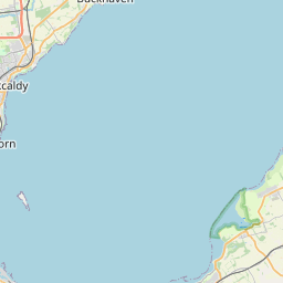
St Monans / St Monance Map, Satellite view of St Monans / St Monance, Fife, Scotland
St Monans / St Monance is located in Fife County, Fife, Scotland, Scotland, United Kingdom.
Location informations of St Monans / St Monance
Latitude of city of St Monans / St Monance is 56.20623 and longitude of city of St Monans / St Monance is -2.76553. St Monans / St Monance has 1 postcode / zip code, in county of Fife.The County of St Monans / St Monance is Fife.
Postcode / zip code of St Monans / St Monance
KY10 2Administrative division of St Monans / St Monance
County :FifeGPS coordinates of St Monans / St Monance
Latitude : 56.20623Longitude : -2.76553
Online Map of St Monans / St Monance - road map, satellite view and street view


Leaflet | © OpenStreetMap contributors
Search distance between two cities
The weather for St Monans / St Monance in the United Kingdom
Get today and tomorrow's weather forecasts for St Monans / St Monance. Find out the weather forecast for the week ahead and the weekend for St Monans / St Monance in the UK.St Monans / St Monance weather forecast 15 days
What is the nearest train station to St Monans / St Monance?
List of Railway Stations near to St Monans / St MonanceThe nearest railway stations to St Monans / St Monance are listed below. Tickets are available at the train station ticket office or ticket machines.
| Name | Distances from St Monans / St Monance |
|---|---|
| North Berwick Station | 16.73 Km |
| Cupar Station | 19.42 Km |
| Springfield Station | 20.29 Km |
| Leuchars Station | 20.38 Km |
| Drem Station | 22.40 Km |
| Markinch Station | 22.60 Km |
| Ladybank Station | 23.29 Km |
| Glenrothes with Thornton Station | 23.86 Km |
| Longniddry Station | 26.66 Km |
| Kirkcaldy Station | 26.98 Km |
What is the nearest Public Transport Stops to St Monans / St Monance?
List of Stops near to St Monans / St MonanceGetting there by public transport (nearest train, tube, overground line station and bus stops). The nearest stops to St Monans / St Monance are listed below.
| Stop Name | Distances from St Monans / St Monance |
|---|---|
| Bowling Green Bus Stop (adj) | 96 m |
| Station Road Bus Stop (Adj 44) | 100 m |
| Duck Wynd Bus Stop (Adj) | 166 m |
| Station Road Bus Stop (adj) | 189 m |
| George Terrace Bus Stop (Opp) | 207 m |
| Station Road Bus Stop (opp) | 229 m |
| Elm Grove Bus Stop (adj 12) | 331 m |
| Elm Grove Bus Stop (opp 12) | 373 m |
| Inverie Street Turning Circle Bus Stop (adj) | 414 m |
| Abercrombie Farm Bus Stop (adj) | 1.32 Km |
Historic Places to Visit near St Monans / St Monance
List of Historic places near to St Monans / St Monance
| Name | Distances from St Monans / St Monance |
|---|---|
| St Monans Auld Kirk | 0.46 Km |
| Newark Castle, Fife | 0.97 Km |
| Balcaskie House | 1.72 Km |
| St Fillans Cave | 2.48 Km |
| Kellie Castle | 3.64 Km |
| Lundin Links Standing Stones | 12.02 Km |
| Isle of May Priory, St Adrians Chapel | 13.61 Km |
| Blackfriars Chapel | 14.84 Km |
| St Andrews, West Port | 14.85 Km |
| Kirkheugh, St Marys Church | 14.90 Km |
Cities or Towns near St Monans / St Monance
List of places near to
| Name | Distance |
|---|---|
| Abercrombie | 1.34 Km |
| Balbuthie | 2.22 Km |
| Pittenweem | 2.33 Km |
| Newton of Balcormo | 3.06 Km |
| Arncroach | 3.56 Km |
| Elie | 3.88 Km |
| Barnyards | 3.90 Km |
| Kilconquhar | 3.97 Km |
| Anstruther Wester | 4.18 Km |
| Anstruther Easter | 4.42 Km |
| Carnbee | 4.63 Km |
| Earlsferry | 4.92 Km |
| Cellardyke | 5.17 Km |
| Colinsburgh | 5.25 Km |
| Kilrenny | 5.76 Km |
| Largoward | 8.26 Km |
| Beleybridge | 8.37 Km |
| Drumeldrie | 8.50 Km |
| Lathones | 8.60 Km |
| Dunino | 9.43 Km |
| Stravithie | 9.74 Km |
| Radernie | 9.89 Km |
| Lawhead | 10.20 Km |
| Upper Largo / Kirkton of Largo | 10.27 Km |
| Crail | 10.39 Km |
| Upper Kenley | 10.46 Km |
| Lower Largo | 10.59 Km |
| Peat Inn | 10.83 Km |
| Drummochy | 11.10 Km |
| New Gilston | 11.40 Km |
| Lundin Links | 11.57 Km |
| Prior Muir | 11.64 Km |
| Kilduncan | 11.77 Km |
| Kingsbarns | 12.22 Km |
| Woodside | 12.25 Km |
| Boarhills | 12.97 Km |
| Denhead | 13.05 Km |
| Baldinnie | 13.65 Km |
| Leven Links | 13.98 Km |
| Scoonie | 14.07 Km |
| Mount Melville | 14.08 Km |
| Leven | 14.30 Km |
| Sillerhole | 14.48 Km |
| Innerleven | 14.92 Km |
| St Andrews | 14.92 Km |
| Broom | 14.94 Km |