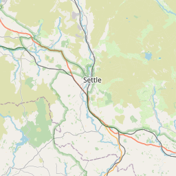
Spring Green Map, Satellite view of Spring Green, Lancashire, England
Spring Green is located in Lancashire County, Pendle District, North West, England, United Kingdom.
Location informations of Spring Green
Latitude of city of Spring Green is 53.88764 and longitude of city of Spring Green is -2.10038. Spring Green has 1 postcode / zip code, in county of Lancashire.The County of Spring Green is Lancashire.
Postcode / zip code of Spring Green
BD22 0Administrative division of Spring Green
County :LancashireGPS coordinates of Spring Green
Latitude : 53.88764Longitude : -2.10038
Online Map of Spring Green - road map, satellite view and street view


Leaflet | © OpenStreetMap contributors
Search distance between two cities
The weather for Spring Green in the United Kingdom
Get today and tomorrow's weather forecasts for Spring Green. Find out the weather forecast for the week ahead and the weekend for Spring Green in the UK.Spring Green weather forecast 15 days
What is the nearest train station to Spring Green?
List of Railway Stations near to Spring GreenThe nearest railway stations to Spring Green are listed below. Tickets are available at the train station ticket office or ticket machines.
| Name | Distances from Spring Green |
|---|---|
| Colne Station | 6.47 Km |
| Cononley Station | 6.67 Km |
| Skipton Station | 9.29 Km |
| Nelson Station | 9.46 Km |
| Gargrave Station | 10.10 Km |
| Steeton and Silsden Station | 10.29 Km |
| Brierfield Station | 11.39 Km |
| Keighley Station | 13.21 Km |
| Burnley Central Station | 14.13 Km |
| Burnley Barracks Station | 14.93 Km |
What is the nearest Public Transport Stops to Spring Green?
List of Stops near to Spring GreenGetting there by public transport (nearest train, tube, overground line station and bus stops). The nearest stops to Spring Green are listed below.
| Stop Name | Distances from Spring Green |
|---|---|
| Black Lane Ends Bus Stop (by) | 627 m |
| Reservoir Bus Stop (opp) | 1.94 Km |
| Reservoir Bus Stop (by) | 1.95 Km |
| Green Syke Turn Round Bus Stop (E-bound) | 2.15 Km |
| Waterworks Bus Stop (by) | 2.18 Km |
| Waterworks Bus Stop (opp) | 2.20 Km |
| MONKROYD Boundary Bus Stop (by) | 2.21 Km |
| Green Syke Bus Stop (NE-bound) | 2.24 Km |
| Green Syke Bus Stop (SW-bound) | 2.24 Km |
| Monkroyd Bungalow Bus Stop (o/s) | 2.34 Km |
Historic Places to Visit near Spring Green
List of Historic places near to Spring Green
| Name | Distances from Spring Green |
|---|---|
| Pendle Heritage Centre | 8.27 Km |
| Bracewell, St Michaels Church | 8.72 Km |
| Top Withens | 9.32 Km |
| Skipton Castle | 10.37 Km |
| Haworth, St Michaels Church | 11.33 Km |
| Bronte Parsonage Museum | 11.33 Km |
| Gisburn, St Marys Church | 11.81 Km |
| Burnley, St Peters Church | 13.96 Km |
| Gibsons Mill | 14.13 Km |
| East Riddlesden Hall | 14.45 Km |
| Hardcastle Crags | 14.73 Km |
| Towneley Hall Art Gallery and Museum | 14.95 Km |
Cities or Towns near Spring Green
List of places near to
| Name | Distance |
|---|---|
| Stone Head | 1.00 Km |
| Raygill | 2.23 Km |
| Monkroyd | 2.30 Km |
| Park | 2.46 Km |
| Ickornshaw | 2.60 Km |
| Gill | 2.99 Km |
| Laneshaw Bridge | 3.06 Km |
| Middleton | 3.18 Km |
| Kelbrook | 3.37 Km |
| Lothersdale | 3.41 Km |
| Green End | 3.65 Km |
| Sough | 3.75 Km |
| Cowling | 3.88 Km |
| Earby | 4.12 Km |
| Wycoller | 4.13 Km |
| North Holme | 4.23 Km |
| Cotton Tree | 4.35 Km |
| Lane Ends | 4.41 Km |
| Booth Bridge | 4.47 Km |
| Winewall | 4.62 Km |
| Foulridge | 4.64 Km |
| Salterforth | 4.98 Km |
| Park Close | 5.08 Km |
| Trawden | 5.24 Km |
| Carry Bridge | 5.35 Km |
| Colne | 5.37 Km |
| Colne Edge | 5.37 Km |
| Hollin Hall | 5.38 Km |
| Hey | 5.54 Km |
| Waterside | 5.70 Km |
| Thornton-in-Craven | 5.83 Km |
| Long Ing | 6.13 Km |
| Elslack | 6.16 Km |
| Lenches | 6.17 Km |
| Glusburn Green | 6.22 Km |
| Church Clough | 6.39 Km |
| Coates | 6.42 Km |
| Cononley | 6.47 Km |
| Glusburn | 6.49 Km |
| Barnoldswick | 6.58 Km |
| Town Head | 6.61 Km |
| Primet Bridge | 6.65 Km |
| Bunkers Hill | 6.67 Km |
| Aire View | 6.69 Km |
| Cononley Woodside | 6.75 Km |
| Wapping | 6.76 Km |
| Croft | 6.95 Km |
| Greenfield | 7.01 Km |
| Sutton-in-Craven | 7.09 Km |
| Carleton-in-Craven | 7.25 Km |