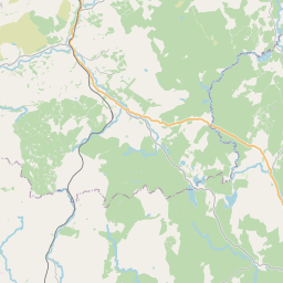
Spittal Map, Satellite view of Spittal, Wigtown, Scotland
Spittal is located in Wigtown County, Dumfries and Galloway, Scotland, Scotland, United Kingdom.
Location informations of Spittal
Latitude of city of Spittal is 54.88617 and longitude of city of Spittal is -4.55306. Spittal has 1 postcode / zip code, in county of Wigtown.The County of Spittal is Wigtown.
Postcode / zip code of Spittal
DG8 0Administrative division of Spittal
County :WigtownGPS coordinates of Spittal
Latitude : 54.88617Longitude : -4.55306
Online Map of Spittal - road map, satellite view and street view


Leaflet | © OpenStreetMap contributors
Search distance between two cities
The weather for Spittal in the United Kingdom
Get today and tomorrow's weather forecasts for Spittal. Find out the weather forecast for the week ahead and the weekend for Spittal in the UK.Spittal weather forecast 15 days
What is the nearest train station to Spittal?
List of Railway Stations near to SpittalThe nearest railway stations to Spittal are listed below. Tickets are available at the train station ticket office or ticket machines.
| Name | Distances from Spittal |
|---|---|
| Barrhill Station | 27.61 Km |
What is the nearest Public Transport Stops to Spittal?
List of Stops near to SpittalGetting there by public transport (nearest train, tube, overground line station and bus stops). The nearest stops to Spittal are listed below.
| Stop Name | Distances from Spittal |
|---|---|
| Newton Stewart Rd Bus Stop (Opp Shelter) | 4.81 Km |
| Newton Stewart Rd Bus Stop (Shelter) | 4.82 Km |
| Main Street Bus Stop (no 7) | 4.83 Km |
| Main Street Bus Stop (opp no 7) | 4.83 Km |
| Church Bus Stop (o/s church) | 4.98 Km |
| Church Bus Stop (opp Church) | 4.99 Km |
| The Crossings Bus Stop (road end) | 5.55 Km |
| The Crossings Bus Stop (opp road end) | 5.56 Km |
| Carsegowan Bus Stop (opp Farm) | 5.74 Km |
| Carsegowan Bus Stop (farm) | 5.75 Km |
Historic Places to Visit near Spittal
List of Historic places near to Spittal
| Name | Distances from Spittal |
|---|---|
| Torhouse Stone Circle | 2.15 Km |
| Druchtag Motte | 11.06 Km |
| Galloway Forest Park | 11.36 Km |
| Chapel Finian | 12.07 Km |
| Drumtroddan Cup and Ring Marked Rocks | 12.86 Km |
| Drumtroddan Standing Stones | 13.26 Km |
| Wood of Cree | 13.33 Km |
| Carsluith Castle | 13.48 Km |
| Sorbie Tower | 13.71 Km |
Cities or Towns near Spittal
List of places near to
| Name | Distance |
|---|---|
| Kirkcowan | 4.59 Km |
| Causeway End | 6.26 Km |
| Bladnoch | 6.76 Km |
| Duncan Park | 7.12 Km |
| Wigtown | 7.25 Km |
| Lamachan View | 7.96 Km |
| Barrachan | 8.02 Km |
| Braehead | 8.11 Km |
| Carty Port | 8.34 Km |
| Kirkinner | 8.57 Km |
| Whauphill | 8.81 Km |
| Loch Head | 8.98 Km |
| Creebridge | 9.45 Km |
| North Balfern | 9.72 Km |
| Challoch | 9.88 Km |
| Minnigaff | 10.06 Km |
| Newton Stewart | 10.06 Km |
| Palnure | 10.85 Km |
| Elrig | 11.02 Km |
| Stronord | 11.10 Km |
| Creetown | 11.25 Km |
| Mochrum | 11.34 Km |
| Penninghame | 12.09 Km |
| Carsluith | 12.59 Km |
| Sorbie | 13.15 Km |
| Auchenmalg | 14.04 Km |
| Port William | 14.19 Km |
| Knowe | 14.66 Km |