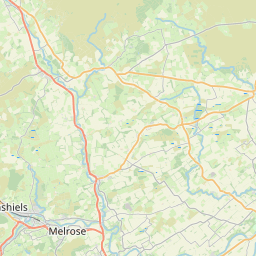
Smailholm Map, Satellite view of Smailholm, Roxburgh, Ettrick and Lauderdale, Scotland
Smailholm is located in Roxburgh, Ettrick and Lauderdale County, Scottish Borders, Scotland, Scotland, United Kingdom.
Location informations of Smailholm
Latitude of city of Smailholm is 55.61911 and longitude of city of Smailholm is -2.56239. Smailholm has 1 postcode / zip code, in county of Roxburgh, Ettrick and Lauderdale.The County of Smailholm is Roxburgh, Ettrick and Lauderdale.
Postcode / zip code of Smailholm
TD5 7Administrative division of Smailholm
County :Roxburgh, Ettrick and LauderdaleGPS coordinates of Smailholm
Latitude : 55.61911Longitude : -2.56239
Online Map of Smailholm - road map, satellite view and street view


Leaflet | © OpenStreetMap contributors
Search distance between two cities
The weather for Smailholm in the United Kingdom
Get today and tomorrow's weather forecasts for Smailholm. Find out the weather forecast for the week ahead and the weekend for Smailholm in the UK.Smailholm weather forecast 15 days
What is the nearest train station to Smailholm?
List of Railway Stations near to SmailholmThe nearest railway stations to Smailholm are listed below. Tickets are available at the train station ticket office or ticket machines.
| Name | Distances from Smailholm |
|---|---|
| Tweedbank Station | 12.47 Km |
| Galashiels Station | 15.35 Km |
| Stow Station | 20.71 Km |
What is the nearest Public Transport Stops to Smailholm?
List of Stops near to SmailholmGetting there by public transport (nearest train, tube, overground line station and bus stops). The nearest stops to Smailholm are listed below.
| Stop Name | Distances from Smailholm |
|---|---|
| Church Bus Stop (o/s) | 202 m |
| Church Bus Stop (opp) | 263 m |
| Mellerstain House Rd End Bus Stop (At) | 2.49 Km |
| Mellerstain House Rd End Bus Stop (Opp) | 2.51 Km |
| Girrick Rd End Bus Stop (At) | 2.94 Km |
| Girrick Rd End Bus Stop (Opp) | 2.97 Km |
| Blinkbonny Quarry Bus Stop (Opp) | 3.28 Km |
| Blinkbonny Quarry Bus Stop (At) | 3.30 Km |
| Post Office Cotts Bus Stop (Opp) | 3.46 Km |
| Post Office Cotts Bus Stop (At) | 3.47 Km |
Historic Places to Visit near Smailholm
List of Historic places near to Smailholm
| Name | Distances from Smailholm |
|---|---|
| Smailholm Tower | 1.91 Km |
| Mellerstain House | 2.88 Km |
| Mertoun House Gardens | 5.39 Km |
| Greenknowe Tower | 6.54 Km |
| Floors Castle | 6.61 Km |
| Dryburgh Abbey | 7.27 Km |
| Kelso Abbey | 8.48 Km |
| Waterloo Monument | 10.01 Km |
| Melrose Abbey | 10.08 Km |
| Priorwood Garden | 10.11 Km |
| Harmony Garden | 10.29 Km |
| Eildon Hills | 10.66 Km |
| Teviot Water Gardens | 10.94 Km |
| Abbotsford House | 13.96 Km |
Cities or Towns near Smailholm
List of places near to
| Name | Distance |
|---|---|
| West Third | 0.26 Km |
| East Third | 0.26 Km |
| Old Nenthorn | 2.82 Km |
| Nenthorn | 3.33 Km |
| Manorhill | 4.22 Km |
| Makerstoun | 4.44 Km |
| Clintmains | 5.06 Km |
| Fans | 5.25 Km |
| Bemersyde | 5.66 Km |
| Redpath | 6.22 Km |
| Gordon | 6.84 Km |
| Dryburgh | 6.96 Km |
| Stichill | 6.96 Km |
| Maxton | 6.98 Km |
| Huntlywood | 7.34 Km |
| Earlston | 7.48 Km |
| St Boswells | 7.48 Km |
| Roxburgh | 7.76 Km |
| Roxburgh Mains | 7.80 Km |
| East Gordon | 7.93 Km |
| Hume | 8.13 Km |
| Eildon | 8.33 Km |
| Newtown St Boswells | 8.34 Km |
| Kelso | 8.35 Km |
| Craigsford Mains | 8.44 Km |
| Heiton | 8.64 Km |
| Maxwellheugh | 8.75 Km |
| Newstead | 8.85 Km |
| Edham | 8.87 Km |
| Kirkhill | 8.90 Km |
| Legerwood | 9.17 Km |
| Ednam | 9.25 Km |
| Charlesfield | 9.28 Km |
| Greenwells | 9.47 Km |
| Whiterigg | 9.47 Km |
| Bassendean | 9.76 Km |
| Kedslie | 10.06 Km |
| Melrose | 10.16 Km |
| Gattonside | 10.34 Km |
| Chapel on Leader | 10.52 Km |
| Longnewton | 10.73 Km |
| Dingleton | 10.79 Km |
| Galadean | 10.86 Km |
| Nisbet | 10.87 Km |
| Bowden | 10.88 Km |
| Sprouston | 10.95 Km |
| Chapel Mains | 11.04 Km |
| Highcross | 11.07 Km |
| Houndslow | 11.10 Km |
| Wester Housebyres | 11.15 Km |