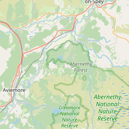
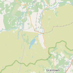
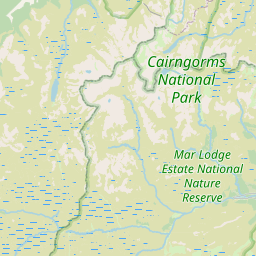
Sliemore Map, Satellite view of Sliemore, Inverness, Scotland
Sliemore is located in Inverness County, Highland, Scotland, Scotland, United Kingdom.
Location informations of Sliemore
Latitude of city of Sliemore is 57.26884 and longitude of city of Sliemore is -3.59177. Sliemore has 1 postcode / zip code, in county of Inverness.The County of Sliemore is Inverness.
Postcode / zip code of Sliemore
PH25 3Administrative division of Sliemore
County :InvernessGPS coordinates of Sliemore
Latitude : 57.26884Longitude : -3.59177
Online Map of Sliemore - road map, satellite view and street view


Leaflet | © OpenStreetMap contributors
Search distance between two cities
The weather for Sliemore in the United Kingdom
Get today and tomorrow's weather forecasts for Sliemore. Find out the weather forecast for the week ahead and the weekend for Sliemore in the UK.Sliemore weather forecast 15 days
What is the nearest train station to Sliemore?
List of Railway Stations near to SliemoreThe nearest railway stations to Sliemore are listed below. Tickets are available at the train station ticket office or ticket machines.
| Name | Distances from Sliemore |
|---|---|
| Carrbridge Station | 14.26 Km |
| Aviemore Station | 16.84 Km |
What is the nearest Public Transport Stops to Sliemore?
List of Stops near to SliemoreGetting there by public transport (nearest train, tube, overground line station and bus stops). The nearest stops to Sliemore are listed below.
| Stop Name | Distances from Sliemore |
|---|---|
| Lynebreck Rd End Bus Stop (at) | 2.25 Km |
| Lynebreck Rd End Bus Stop (opp) | 2.26 Km |
| Nethy Bridge Rd End Bus Stop (at) | 2.60 Km |
| Nethy Bridge Rd End Bus Stop (opp) | 2.61 Km |
| Causer Shelter Bus Stop (opp) | 3.07 Km |
| Causer Shelter Bus Stop (at) | 3.09 Km |
| Abernethy Primary School Bus Stop (o/s) | 3.23 Km |
| Abernethy Primary School Bus Stop (opp) | 3.26 Km |
| Balliemore Rd End Bus Stop (opp) | 3.59 Km |
| Balliemore Rd End Bus Stop (at) | 3.60 Km |
Historic Places to Visit near Sliemore
List of Historic places near to Sliemore
| Name | Distances from Sliemore |
|---|---|
| Abernethy Forest | 6.77 Km |
| Loch Garten Osprey Centre | 6.80 Km |
| Cairngorms National Park - Photos and Historic Sites | 7.10 Km |
| Cairngorms National Park | 13.08 Km |
| Carrbridge Packhorse Bridge | 13.58 Km |
Cities or Towns near Sliemore
List of places near to
| Name | Distance |
|---|---|
| Clachaig | 2.94 Km |
| Culreach | 3.51 Km |
| Nethy Bridge | 4.00 Km |
| Duackbridge | 4.46 Km |
| Broomhill | 4.94 Km |
| Gaich | 5.26 Km |
| Speybridge | 5.36 Km |
| Anagach | 5.60 Km |
| Craggan | 5.82 Km |
| Dulnain Bridge | 5.91 Km |
| Skye of Curr | 5.95 Km |
| Feabuie | 6.71 Km |
| Cullachie | 6.77 Km |
| Grantown-on-Spey | 6.97 Km |
| Croftjames | 7.00 Km |
| Dreggie | 7.74 Km |
| Lethendry | 8.08 Km |
| Cromdale | 8.12 Km |
| Bridge of Brown | 8.38 Km |
| Achnahannet | 9.30 Km |
| Drumuillie | 9.83 Km |
| Boat of Garten | 10.00 Km |
| Camerory | 10.51 Km |
| Duthil | 11.14 Km |
| Glaschoil | 11.37 Km |
| Deishar | 11.65 Km |
| Lochanhully | 12.66 Km |
| Glenmore | 12.89 Km |
| Kinveachy | 12.96 Km |
| Tomintoul | 13.08 Km |
| Carr | 13.29 Km |
| Carrbridge / Drochaid Chàrr | 13.54 Km |
| Bogroy | 14.11 Km |
| Avielochan | 14.29 Km |
| Ellan | 14.34 Km |