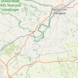
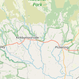
Skirpenbeck Map, Satellite view of Skirpenbeck, East Riding of Yorkshire, England
Skirpenbeck is located in East Riding of Yorkshire County, East Riding of Yorkshire, Yorkshire and the Humber, England, United Kingdom.
Location informations of Skirpenbeck
Latitude of city of Skirpenbeck is 54.00349 and longitude of city of Skirpenbeck is -0.86341. Skirpenbeck has 1 postcode / zip code, in county of East Riding of Yorkshire.The County of Skirpenbeck is East Riding of Yorkshire.
Postcode / zip code of Skirpenbeck
YO41 1Administrative division of Skirpenbeck
County :East Riding of YorkshireGPS coordinates of Skirpenbeck
Latitude : 54.00349Longitude : -0.86341
Online Map of Skirpenbeck - road map, satellite view and street view


Leaflet | © OpenStreetMap contributors
Search distance between two cities
The weather for Skirpenbeck in the United Kingdom
Get today and tomorrow's weather forecasts for Skirpenbeck. Find out the weather forecast for the week ahead and the weekend for Skirpenbeck in the UK.Skirpenbeck weather forecast 15 days
What is the nearest train station to Skirpenbeck?
List of Railway Stations near to SkirpenbeckThe nearest railway stations to Skirpenbeck are listed below. Tickets are available at the train station ticket office or ticket machines.
| Name | Distances from Skirpenbeck |
|---|---|
| Malton Station | 14.94 Km |
| York Station | 15.85 Km |
| Poppleton Station | 18.89 Km |
| Wressle Station | 25.95 Km |
| Howden Station | 26.55 Km |
| Hammerton Station | 27.51 Km |
| Selby Station | 27.83 Km |
| Driffield Station | 28.02 Km |
| Eastrington Station | 28.06 Km |
| Ulleskelf Station | 28.36 Km |
Full Sutton Airfield , UK (2.55 Km)
What is the nearest Public Transport Stops to Skirpenbeck?
List of Stops near to SkirpenbeckGetting there by public transport (nearest train, tube, overground line station and bus stops). The nearest stops to Skirpenbeck are listed below.
Historic Places to Visit near Skirpenbeck
List of Historic places near to Skirpenbeck
Cities or Towns near Skirpenbeck
List of places near to
| Name | Distance |
|---|---|
| Full Sutton | 1.69 Km |
| Buttercrambe | 1.78 Km |
| Youlthorpe | 2.44 Km |
| Bugthorpe | 2.85 Km |
| Gowthorpe | 3.04 Km |
| Scrayingham | 3.44 Km |
| Stamford Bridge | 3.56 Km |
| Fangfoss | 4.27 Km |
| High Catton | 4.34 Km |
| Leppington | 4.39 Km |
| Bossall | 4.66 Km |
| Garrowby | 4.88 Km |
| Upper Helmsley | 5.09 Km |
| Sand Hutton | 5.25 Km |
| Low Catton | 5.26 Km |
| Bolton | 5.35 Km |
| Bishop Wilton | 5.46 Km |
| Gate Helmsley | 5.54 Km |
| Acklam | 5.98 Km |
| Howsham | 6.02 Km |
| Claxton | 6.24 Km |
| Kirby Underdale | 6.25 Km |
| Wilberfoss | 6.36 Km |
| Harton | 6.43 Km |
| Yapham | 6.51 Km |
| Meltonby | 6.68 Km |
| Uncleby | 6.93 Km |
| Painsthorpe | 6.97 Km |
| Barton-le-Willows | 7.09 Km |
| Leavening | 7.19 Km |
| Warthill | 7.25 Km |
| Great Givendale | 7.35 Km |
| Holtby | 7.62 Km |
| Newton upon Derwent | 7.82 Km |
| Kexby | 7.95 Km |
| Broad Ings | 8.04 Km |
| Crambe | 8.05 Km |
| Westow | 8.28 Km |
| Barton Hill | 8.41 Km |
| Barmby Moor | 8.56 Km |
| Dunnington | 8.73 Km |
| Kirkham | 8.85 Km |
| Burythorpe | 8.86 Km |
| Flaxton | 9.04 Km |
| Whitwell-on-the-Hill | 9.10 Km |
| Stockton on the Forest | 9.14 Km |
| Firby | 9.43 Km |
| Foston | 9.50 Km |
| Pocklington | 9.80 Km |
| Millington | 9.83 Km |