Sketchley Map, Satellite view of Sketchley, Leicestershire, England
Sketchley is located in Leicestershire County, Hinckley and Bosworth District, East Midlands, England, United Kingdom.
Location informations of Sketchley
Latitude of city of Sketchley is 52.52972 and longitude of city of Sketchley is -1.37145. Sketchley has 1 postcode / zip code, in county of Leicestershire.The County of Sketchley is Leicestershire.
Postcode / zip code of Sketchley
LE10 2Administrative division of Sketchley
County :LeicestershireGPS coordinates of Sketchley
Latitude : 52.52972Longitude : -1.37145
Online Map of Sketchley - road map, satellite view and street view
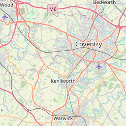


Leaflet | © OpenStreetMap contributors
Search distance between two cities
The weather for Sketchley in the United Kingdom
Get today and tomorrow's weather forecasts for Sketchley. Find out the weather forecast for the week ahead and the weekend for Sketchley in the UK.Sketchley weather forecast 15 days
What is the nearest train station to Sketchley?
List of Railway Stations near to SketchleyThe nearest railway stations to Sketchley are listed below. Tickets are available at the train station ticket office or ticket machines.
| Name | Distances from Sketchley |
|---|---|
| Hinckley Station | 587 m |
| Nuneaton Station | 6.26 Km |
| Bermuda Park Station | 7.51 Km |
| Bedworth Station | 8.58 Km |
| Narborough Station | 12.27 Km |
| Coventry Arena Station | 12.33 Km |
| Atherstone Station | 13.43 Km |
| South Wigston Station | 17.08 Km |
| Coventry Station | 17.26 Km |
| Rugby Station | 18.65 Km |
What is the nearest Public Transport Stops to Sketchley?
List of Stops near to SketchleyGetting there by public transport (nearest train, tube, overground line station and bus stops). The nearest stops to Sketchley are listed below.
| Stop Name | Distances from Sketchley |
|---|---|
| Sketchley Hill House Bus Stop (adj) | 58 m |
| Denis Road Bus Stop (opp) | 72 m |
| Denis Road Bus Stop (adj) | 87 m |
| Aldridge Road Bus Stop (adj) | 125 m |
| Applebee Road Bus Stop (opp) | 163 m |
| Applebee Road Bus Stop (adj) | 178 m |
| Aldridge Road Bus Stop (opp) | 207 m |
| John's Close Bus Stop (opp) | 320 m |
| Castle Court Bus Stop (adj) | 336 m |
| Castle Court Bus Stop (opp) | 361 m |
Historic Places to Visit near Sketchley
List of Historic places near to Sketchley
| Name | Distances from Sketchley |
|---|---|
| Bosworth Battlefield Heritage Centre | 8.12 Km |
| Arbury Hall | 9.79 Km |
Cities or Towns near Sketchley
List of places near to
| Name | Distance |
|---|---|
| Sketchley Old Village | 0.60 Km |
| The Crescent | 1.05 Km |
| Burbage | 1.20 Km |
| Hinckley | 1.27 Km |
| Hollycroft | 1.88 Km |
| Leicester Grange | 2.25 Km |
| Burton Hastings | 3.23 Km |
| Wykin | 3.44 Km |
| Aston Flamville | 3.52 Km |
| Smockington | 3.88 Km |
| Shelford | 3.89 Km |
| Bramcote | 4.23 Km |
| Wolvey Heath | 4.24 Km |
| Barwell | 4.43 Km |
| Wigston Parva | 4.69 Km |
| Wolvey | 4.79 Km |
| Copston Magna | 4.89 Km |
| St Nicolas Park | 4.94 Km |
| Elmesthorpe | 5.00 Km |
| Whitestone | 5.08 Km |
| Horeston Grange | 5.12 Km |
| Stoke Golding | 5.40 Km |
| Sharnford | 5.54 Km |
| Bramcote Mains | 5.58 Km |
| Higham on the Hill | 5.66 Km |
| Weddington | 5.84 Km |
| Attleborough | 5.88 Km |
| Dadlington | 5.98 Km |
| Stapleton | 6.03 Km |
| High Cross | 6.10 Km |
| Sapcote | 6.19 Km |
| Earl Shilton | 6.35 Km |
| Nuneaton | 6.57 Km |
| Marston Jabbett | 6.58 Km |
| Weston in Arden | 6.63 Km |
| Stoney Stanton | 6.66 Km |
| Bulkington | 6.90 Km |
| Hill Top | 6.97 Km |
| Chilvers Coton | 7.01 Km |
| Cloudesley Bush | 7.17 Km |
| Wibtoft | 7.20 Km |
| Claybrooke Magna | 7.23 Km |
| Potters Marston | 7.74 Km |
| Bermuda | 7.76 Km |
| Caldecote | 7.80 Km |
| Heath End | 7.87 Km |
| Frolesworth | 7.92 Km |
| Griff | 7.93 Km |
| Sutton Cheney | 8.01 Km |
| Withybrook | 8.06 Km |