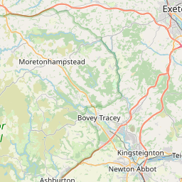
Salmonhutch Map, Satellite view of Salmonhutch, Devon, England
Salmonhutch is located in Devon County, Mid Devon District, South West, England, United Kingdom.
Location informations of Salmonhutch
Latitude of city of Salmonhutch is 50.77414 and longitude of city of Salmonhutch is -3.66780. Salmonhutch has 1 postcode / zip code, in county of Devon.The County of Salmonhutch is Devon.
Postcode / zip code of Salmonhutch
EX17 3Administrative division of Salmonhutch
County :DevonGPS coordinates of Salmonhutch
Latitude : 50.77414Longitude : -3.66780
Online Map of Salmonhutch - road map, satellite view and street view


Leaflet | © OpenStreetMap contributors
Search distance between two cities
The weather for Salmonhutch in the United Kingdom
Get today and tomorrow's weather forecasts for Salmonhutch. Find out the weather forecast for the week ahead and the weekend for Salmonhutch in the UK.Salmonhutch weather forecast 15 days
What is the nearest train station to Salmonhutch?
List of Railway Stations near to SalmonhutchThe nearest railway stations to Salmonhutch are listed below. Tickets are available at the train station ticket office or ticket machines.
| Name | Distances from Salmonhutch |
|---|---|
| Crediton Station | 1.80 Km |
| Yeoford Station | 4.18 Km |
| Newton St.Cyres Station | 5.54 Km |
| Copplestone Station | 7.40 Km |
| Morchard Road Station | 9.97 Km |
| Exeter St. David's Station | 10.08 Km |
| Exeter Central Station | 10.85 Km |
| Exeter St. Thomas Station | 11.07 Km |
| St.James' Park Station | 11.32 Km |
| Polsloe Bridge Station | 12.60 Km |
What is the nearest Public Transport Stops to Salmonhutch?
List of Stops near to SalmonhutchGetting there by public transport (nearest train, tube, overground line station and bus stops). The nearest stops to Salmonhutch are listed below.
| Stop Name | Distances from Salmonhutch |
|---|---|
| Butt Parks Bus Stop (NW-bound) | 1.59 Km |
| Lower School Bus Stop (NW-bound) | 1.62 Km |
| Westernlea Bus Stop (opp 94) | 1.66 Km |
| Spruce Park Bus Stop (SE-bound) | 1.66 Km |
| Barnfield School Bus Stop (NE-bound) | 1.68 Km |
| Winswood Bus Stop (E-bound) | 1.71 Km |
| Westernlea Bus Stop (opp 47) | 1.76 Km |
| Shop Bus Stop (SE-bound) | 1.78 Km |
| Tuckers Meadow Bus Stop (NW-bound) | 1.78 Km |
| Tuckers Meadow Bus Stop (SE-bound) | 1.79 Km |
Historic Places to Visit near Salmonhutch
List of Historic places near to Salmonhutch
| Name | Distances from Salmonhutch |
|---|---|
| Crediton, Holy Cross Church | 2.12 Km |
| Sandford, St Swithuns Church | 4.08 Km |
| Shobrooke Park | 4.21 Km |
| Upton Hellions, St Marys Church | 5.12 Km |
| Newton St Cyres, St Cyr and St Julittas Church | 5.41 Km |
| Upton Pyne, Church of Our Lady | 8.54 Km |
| Morchard Bishop, St Marys Church | 10.37 Km |
| Cadbury, St Michaels Church | 10.73 Km |
| St Nicholas Priory | 11.02 Km |
| Exeter Guildhall | 11.03 Km |
| Exeter Old Bridge | 11.04 Km |
| Exeter, St Pancras Church | 11.05 Km |
| Tuckers Hall | 11.05 Km |
| Exeter, St Olaves Church | 11.08 Km |
| Cadbury Castle Hillfort | 11.11 Km |
| The House that Moved | 11.15 Km |
| St Catherines Almshouses & Canons House | 11.28 Km |
| Exeter, St Martins Church | 11.30 Km |
| Cricklepit Mill | 11.34 Km |
| Exeters Underground Passages | 11.40 Km |
| Exeter Custom House | 11.44 Km |
| Quay House | 11.45 Km |
| Fursdon | 11.49 Km |
| Puddington, St Thomas Church | 12.20 Km |
| Castle Drogo | 12.96 Km |
| Cadeleigh, St Bartholomews Church | 12.97 Km |
| Cruwys Morchard, Holy Cross Church | 14.54 Km |
Cities or Towns near Salmonhutch
List of places near to
| Name | Distance |
|---|---|
| Uton | 0.29 Km |
| Venny Tedburn | 1.09 Km |
| Westwood | 1.64 Km |
| Fordton | 1.71 Km |
| West Town | 1.90 Km |
| Crediton | 1.95 Km |
| East Town | 2.29 Km |
| Hookway | 2.45 Km |
| Neopardy | 3.01 Km |
| Sandford | 3.93 Km |
| Yeoford | 4.19 Km |
| West Sandford | 4.29 Km |
| Tedburn St Mary | 4.46 Km |
| Town Barton | 4.47 Km |
| Lower Creedy | 4.50 Km |
| Shobrooke | 4.76 Km |
| Woodland Head | 4.95 Km |
| Woolsgrove | 4.99 Km |
| Upton Hellions | 5.09 Km |
| Knowle | 5.19 Km |
| Penstone | 5.33 Km |
| Newton St Cyres | 5.47 Km |
| Pathfinder Village | 5.51 Km |
| Colebrooke | 5.61 Km |
| Newbuildings | 5.83 Km |
| Coleford | 5.88 Km |
| Sweetham | 6.07 Km |
| Whitestone | 6.70 Km |
| East Village | 6.79 Km |
| Copplestone | 6.81 Km |
| Shute | 6.85 Km |
| Efford | 6.98 Km |
| Bilsdon | 7.00 Km |
| Halsfordwood | 7.06 Km |
| Half Moon Village | 7.10 Km |
| Prowse | 7.28 Km |
| Uppincott | 7.41 Km |
| Cheriton Bishop | 7.44 Km |
| Stockleigh Pomeroy | 7.48 Km |
| West Raddon | 7.53 Km |
| Holcombe Burnell | 7.71 Km |
| Cheriton Cross | 7.80 Km |
| Nettacott | 8.04 Km |
| Three Horse Shoes | 8.22 Km |
| Stockleigh English | 8.23 Km |
| Longdown | 8.45 Km |
| Cowley | 8.47 Km |
| Upton Pyne | 8.51 Km |
| Clannaborough | 8.57 Km |
| Nadderwater | 8.76 Km |