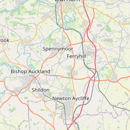
Running Waters Map, Satellite view of Running Waters, Durham, England
Running Waters is located in Durham County, County Durham, North East, England, United Kingdom.
Location informations of Running Waters
Latitude of city of Running Waters is 54.75840 and longitude of city of Running Waters is -1.49650. Running Waters has 1 postcode / zip code, in county of Durham.The County of Running Waters is Durham.
Postcode / zip code of Running Waters
DH1 2Administrative division of Running Waters
County :DurhamGPS coordinates of Running Waters
Latitude : 54.75840Longitude : -1.49650
Online Map of Running Waters - road map, satellite view and street view


Leaflet | © OpenStreetMap contributors
Search distance between two cities
The weather for Running Waters in the United Kingdom
Get today and tomorrow's weather forecasts for Running Waters. Find out the weather forecast for the week ahead and the weekend for Running Waters in the UK.Running Waters weather forecast 15 days
What is the nearest train station to Running Waters?
List of Railway Stations near to Running WatersThe nearest railway stations to Running Waters are listed below. Tickets are available at the train station ticket office or ticket machines.
| Name | Distances from Running Waters |
|---|---|
| Durham Station | 5.95 Km |
| Chester-Le-Street Station | 11.90 Km |
| Seaham Station | 13.16 Km |
| Bishop Auckland Station | 16.19 Km |
| Newton Aycliffe Station | 17.17 Km |
| Shildon Station | 17.24 Km |
| Sunderland Station | 17.90 Km |
| Heighington Station | 18.77 Km |
| Hartlepool Station | 20.21 Km |
| Heworth Station | 21.81 Km |
What is the nearest Public Transport Stops to Running Waters?
List of Stops near to Running WatersGetting there by public transport (nearest train, tube, overground line station and bus stops). The nearest stops to Running Waters are listed below.
| Stop Name | Distances from Running Waters |
|---|---|
| Chapman Bridge Bus Stop (S-bound) | 533 m |
| Chapman Bridge Bus Stop (N-bound) | 541 m |
| Three Horsehoes Bus Stop (NW-bound) | 677 m |
| Three Horsehoes Bus Stop (SE-bound) | 682 m |
| Mill Lane Bus Stop (S-bound) | 738 m |
| Mill Lane Bus Stop (N-bound) | 758 m |
| Cottages - West Bus Stop (W-bound) | 822 m |
| Cottages - West Bus Stop (E-bound) | 827 m |
| Grand View Bus Stop (N-bound) | 1.08 Km |
| Grand View Bus Stop (S-bound) | 1.13 Km |
Historic Places to Visit near Running Waters
List of Historic places near to Running Waters
| Name | Distances from Running Waters |
|---|---|
| Durham Castle | 5.48 Km |
| Crook Hall | 5.71 Km |
| Finchale Priory | 7.19 Km |
| Houghton-le-Spring, St Michael and All Angels | 9.45 Km |
| Binchester Roman Fort | 14.77 Km |
Cities or Towns near Running Waters
List of places near to
| Name | Distance |
|---|---|
| Old Cassop | 1.49 Km |
| Sherburn Hill | 1.81 Km |
| Shadforth | 1.86 Km |
| Sherburn | 1.87 Km |
| Sherburn House | 2.10 Km |
| Old Quarrington | 2.77 Km |
| Sherburn Grange | 2.82 Km |
| High Shincliffe | 2.85 Km |
| Cassop | 2.93 Km |
| West Sherburn | 3.09 Km |
| Littletown | 3.20 Km |
| Bowburn | 3.23 Km |
| Quarrington Hill | 3.30 Km |
| Shincliffe | 3.57 Km |
| Ludworth | 3.64 Km |
| Belmont | 3.67 Km |
| High Pittington | 3.72 Km |
| Old Durham | 3.93 Km |
| Thornley | 3.95 Km |
| Gilesgate Moor | 3.97 Km |
| Pittington | 4.00 Km |
| Carrville | 4.07 Km |
| Low Pittington | 4.29 Km |
| Church Kelloe | 4.39 Km |
| Gilesgate | 4.42 Km |
| Old Thornley | 4.42 Km |
| Kelloe | 4.57 Km |
| Houghall | 4.61 Km |
| Town Kelloe | 4.81 Km |
| Coxhoe | 4.85 Km |
| Haswell Plough | 4.85 Km |
| High Haswell | 4.99 Km |
| Wheatley Hill | 5.28 Km |
| The Sands | 5.45 Km |
| High Moorsley | 5.56 Km |
| Rainton Gate | 5.61 Km |
| Hetton le Hill | 5.64 Km |
| Haswell | 5.75 Km |
| Hett | 5.78 Km |
| Tursdale | 5.85 Km |
| Old Wingate | 5.89 Km |
| Durham | 5.93 Km |
| Elemore Vale | 6.03 Km |
| Fleming Field | 6.06 Km |
| Haswell Moor | 6.06 Km |
| Elvet Hill | 6.06 Km |
| Garmondsway | 6.08 Km |
| Neville's Cross | 6.16 Km |
| Metal Bridge | 6.18 Km |
| Western Hill | 6.20 Km |