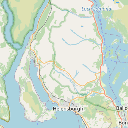
Rothesay Town Map, Satellite view of Rothesay, Argyll and Bute, Scotland
Rothesay is located in Argyll and Bute County, Argyll and Bute, Scotland, Scotland, United Kingdom.
Location informations of Rothesay
Latitude of city of Rothesay is 55.83491 and longitude of city of Rothesay is -5.05459. Rothesay has 1 postcode / zip code, in county of Argyll and Bute.The County of Rothesay is Argyll and Bute.
Postcode / zip code of Rothesay
PA20 9Administrative division of Rothesay
County :Argyll and ButeGPS coordinates of Rothesay
Latitude : 55.83491Longitude : -5.05459
Online Map of Rothesay - road map, satellite view and street view


Leaflet | © OpenStreetMap contributors
Search distance between two cities
The weather for Rothesay in the United Kingdom
Get today and tomorrow's weather forecasts for Rothesay. Find out the weather forecast for the week ahead and the weekend for Rothesay in the UK.Rothesay weather forecast 15 days
What is the nearest train station to Rothesay?
List of Railway Stations near to RothesayThe nearest railway stations to Rothesay are listed below. Tickets are available at the train station ticket office or ticket machines.
| Name | Distances from Rothesay |
|---|---|
| Wemyss Bay Station | 11.30 Km |
| Largs Station | 12.61 Km |
| Inverkip Station | 13.84 Km |
| Fairlie Station | 15.60 Km |
| IBM Station | 17.65 Km |
| Branchton Station | 19.58 Km |
| West Kilbride Station | 19.98 Km |
| Gourock Station | 20.51 Km |
| Drumfrochar Station | 21.08 Km |
| Fort Matilda Station | 21.26 Km |
What is the nearest Public Transport Stops to Rothesay?
List of Stops near to RothesayGetting there by public transport (nearest train, tube, overground line station and bus stops). The nearest stops to Rothesay are listed below.
| Stop Name | Distances from Rothesay |
|---|---|
| The Ritz Bus Stop (at) | 24 m |
| Russell Street Bus Stop (at 14) | 38 m |
| Russell Street Bus Stop (at 5) | 39 m |
| Ministers Brae junction Bus Stop (before) | 109 m |
| Castle Street Bus Stop (at 12) | 167 m |
| Glebe Terrace Bus Stop (after) | 176 m |
| Castle Street Bus Stop (at 7) | 182 m |
| King's Mill Bus Stop (at) | 193 m |
| King's Mill Bus Stop (opp) | 200 m |
| Glebe Terrace Bus Stop (opp) | 202 m |
Historic Places to Visit near Rothesay
List of Historic places near to Rothesay
| Name | Distances from Rothesay |
|---|---|
| Rothesay Castle | 0.10 Km |
| Rothesay, St Marys Chapel | 0.71 Km |
| Bute Museum | 3.26 Km |
| Mount Stuart | 5.30 Km |
| St Blanes Church | 10.96 Km |
| Largs Old Kirk | 12.41 Km |
| Skelmorlie Aisle | 12.41 Km |
| The Pencil | 13.70 Km |
| Kelburn Castle | 14.82 Km |
Cities or Towns near Rothesay
List of places near to
| Name | Distance |
|---|---|
| Ballochgoy | 0.32 Km |
| Montford | 1.79 Km |
| Ardbeg | 1.84 Km |
| Craigmore | 1.92 Km |
| Ascog | 2.26 Km |
| Port Bannatyne | 3.05 Km |
| Kerrycroy | 3.66 Km |
| Straad | 5.03 Km |
| Mount Stuart | 5.19 Km |
| Toward | 5.28 Km |
| St Colmac | 5.29 Km |
| Kildavanan | 6.45 Km |
| Meikle Kilchattan Butts | 6.93 Km |
| Newton Park | 7.62 Km |
| Kingarth | 8.34 Km |
| Innellan | 9.23 Km |
| Kilchattan Bay | 9.53 Km |
| Colintraive | 10.24 Km |
| Meigle | 10.83 Km |
| Skelmorlie | 10.90 Km |
| Inverchaolain | 11.10 Km |
| Upper Skelmorlie | 11.38 Km |
| Millport | 12.04 Km |
| Wemyss Bay | 12.06 Km |
| Largs | 12.42 Km |
| Kames | 12.93 Km |
| Bullwood | 13.31 Km |
| Tighnabruaich | 13.70 Km |
| Auchenlochan | 13.86 Km |
| Inverkip | 14.10 Km |
| Millhouse | 14.50 Km |
| Bridgend | 14.82 Km |