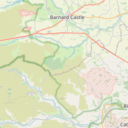
Reeth Map, Satellite view of Reeth, North Yorkshire, England
Reeth is located in North Yorkshire County, Richmondshire District, Yorkshire and the Humber, England, United Kingdom.
Location informations of Reeth
Latitude of city of Reeth is 54.38949 and longitude of city of Reeth is -1.94291. Reeth has 1 postcode / zip code, in county of North Yorkshire.The County of Reeth is North Yorkshire.
Postcode / zip code of Reeth
DL11 6Administrative division of Reeth
County :North YorkshireGPS coordinates of Reeth
Latitude : 54.38949Longitude : -1.94291
Online Map of Reeth - road map, satellite view and street view


Leaflet | © OpenStreetMap contributors
Search distance between two cities
The weather for Reeth in the United Kingdom
Get today and tomorrow's weather forecasts for Reeth. Find out the weather forecast for the week ahead and the weekend for Reeth in the UK.Reeth weather forecast 15 days
What is the nearest train station to Reeth?
List of Railway Stations near to ReethThe nearest railway stations to Reeth are listed below. Tickets are available at the train station ticket office or ticket machines.
| Name | Distances from Reeth |
|---|---|
| Garsdale Station | 25.97 Km |
| Kirkby Stephen Station | 28.48 Km |
| Darlington Station | 29.43 Km |
| Dent Station | 29.76 Km |
| North Road Station | 29.97 Km |
What is the nearest Public Transport Stops to Reeth?
List of Stops near to ReethGetting there by public transport (nearest train, tube, overground line station and bus stops). The nearest stops to Reeth are listed below.
| Stop Name | Distances from Reeth |
|---|---|
| Reeth Green Bus Stop (NW-bound) | 18 m |
| Memorial Bus Stop (S-bound) | 84 m |
| Memorial Bus Stop (N-bound) | 92 m |
| Little Bridge Bus Stop (opp) | 1.26 Km |
| Little Bridge Bus Stop (adj) | 1.27 Km |
| Martin's Farm Bus Stop (E-bound) | 2.02 Km |
| The Rookery Bus Stop (opp) | 2.04 Km |
| Washfold Lane End Bus Stop (SW-bound) | 3.52 Km |
| Arkle Town (Inbound) Bus Stop (32002062) | 3.97 Km |
| Arkle Town Road End (Outbound) Bus Stop (32002061) | 3.97 Km |
Historic Places to Visit near Reeth
List of Historic places near to Reeth
| Name | Distances from Reeth |
|---|---|
| Bolton Castle | 7.42 Km |
| Wensley, Holy Trinity Church | 11.13 Km |
| Hudswell Woods | 11.64 Km |
| Bargate | 13.30 Km |
| Georgian Theatre Royal & Museum | 13.34 Km |
| Grey Friars Tower | 13.38 Km |
| Green Howards Museum | 13.41 Km |
| Richmond Castle | 13.44 Km |
| Millgate House and Gardens | 13.46 Km |
| Richmondshire Museum | 13.48 Km |
| Richmond, St Marys Church | 13.70 Km |
| Coverham, Holy Trinity Church | 14.28 Km |
| Coverham Abbey | 14.57 Km |
| Easby, St Agathas Church | 14.74 Km |
| Bowes Castle | 14.85 Km |
| Middleham Castle | 14.85 Km |
| Easby Abbey | 14.86 Km |
| Constable Burton Hall Gardens | 14.93 Km |
Cities or Towns near Reeth
List of places near to
| Name | Distance |
|---|---|
| Low Fremington | 0.74 Km |
| High Fremington | 0.97 Km |
| Grinton | 1.28 Km |
| Healaugh | 2.05 Km |
| Hurst | 3.16 Km |
| Low Whita | 3.40 Km |
| Washfold | 3.64 Km |
| Booze | 3.91 Km |
| Arkle Town | 4.04 Km |
| Marrick | 4.06 Km |
| Kearton | 4.17 Km |
| Langthwaite | 4.55 Km |
| Helwith | 5.20 Km |
| Feetham | 5.21 Km |
| Blades | 5.35 Km |
| Skelton | 5.87 Km |
| Low Row | 6.22 Km |
| Clints | 6.78 Km |
| Marske | 6.83 Km |
| Crackpot | 6.99 Km |
| Stainton | 7.17 Km |
| Castle Bolton | 7.50 Km |
| Whaw | 7.55 Km |
| Downholme | 7.59 Km |
| West Bolton | 8.05 Km |
| Redmire | 8.14 Km |
| Preston-under-Scar | 8.82 Km |
| Gunnerside | 8.84 Km |
| Thoresby | 9.04 Km |
| Applegarth | 9.39 Km |
| East Hope | 9.64 Km |
| Satron | 9.93 Km |
| Bellerby | 10.00 Km |
| Carperby | 10.09 Km |
| Swinithwaite | 10.17 Km |
| Hudswell | 10.19 Km |
| Ivelet | 10.27 Km |
| Woodhall | 10.88 Km |
| Nappa Scar | 11.15 Km |
| Wensley | 11.18 Km |
| West Witton | 11.24 Km |
| Scargill | 11.38 Km |
| Aysgarth | 11.52 Km |
| Leyburn | 11.64 Km |
| Brokes | 11.75 Km |
| Gayles | 11.80 Km |
| Dalton | 11.83 Km |
| Barningham | 11.91 Km |
| Waithwith | 11.93 Km |
| Thwaite | 12.07 Km |