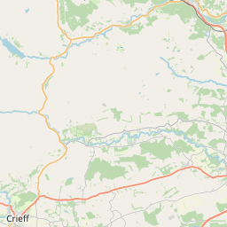
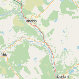
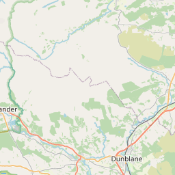
Redgorton Map, Satellite view of Redgorton, Perth and Kinross, Scotland
Redgorton is located in Perth and Kinross County, Perth and Kinross, Scotland, Scotland, United Kingdom.
Location informations of Redgorton
Latitude of city of Redgorton is 56.44289 and longitude of city of Redgorton is -3.47987. Redgorton has 1 postcode / zip code, in county of Perth and Kinross.The County of Redgorton is Perth and Kinross.
Postcode / zip code of Redgorton
PH1 3Administrative division of Redgorton
County :Perth and KinrossGPS coordinates of Redgorton
Latitude : 56.44289Longitude : -3.47987
Online Map of Redgorton - road map, satellite view and street view


Leaflet | © OpenStreetMap contributors
Search distance between two cities
The weather for Redgorton in the United Kingdom
Get today and tomorrow's weather forecasts for Redgorton. Find out the weather forecast for the week ahead and the weekend for Redgorton in the UK.Redgorton weather forecast 15 days
What is the nearest train station to Redgorton?
List of Railway Stations near to RedgortonThe nearest railway stations to Redgorton are listed below. Tickets are available at the train station ticket office or ticket machines.
| Name | Distances from Redgorton |
|---|---|
| Perth Station | 6.16 Km |
| Dunkeld and Birnam Station | 14.06 Km |
| Gleneagles Station | 24.26 Km |
| Invergowrie Station | 26.01 Km |
| Ladybank Station | 28.96 Km |
Perth/Scone Airport , UK (6.63 Km)
What is the nearest Public Transport Stops to Redgorton?
List of Stops near to RedgortonGetting there by public transport (nearest train, tube, overground line station and bus stops). The nearest stops to Redgorton are listed below.
| Stop Name | Distances from Redgorton |
|---|---|
| Northbound Bus Bay Bus Stop (at) | 482 m |
| Southbound Bus Bay Bus Stop (at) | 591 m |
| Kirkhill House Bus Stop (at) | 632 m |
| Denmarkfield Bus Stop (opp) | 773 m |
| Denmarkfield Bus Stop (at) | 827 m |
| Scarth Road Bus Stop (at) | 938 m |
| Scarth Road Bus Stop (opp) | 958 m |
| Luncarty House Bus Stop (at) | 1.15 Km |
| Hatton Road Bus Stop (opp) | 1.17 Km |
| Marshall Way Bus Stop (at) | 1.20 Km |
Historic Places to Visit near Redgorton
List of Historic places near to Redgorton
| Name | Distances from Redgorton |
|---|---|
| Scone Palace | 3.41 Km |
| Huntingtower Castle | 3.78 Km |
| Stanley Mills | 5.03 Km |
| Black Watch Regimental Museum | 5.12 Km |
| Perth Museum and Art Gallery | 5.92 Km |
| JD Fergusson Gallery | 6.06 Km |
| St Johns Kirk, Perth | 6.13 Km |
| Branklyn Garden | 7.15 Km |
| Kinnoull Hill Tower | 7.68 Km |
| Stobhall | 8.04 Km |
| Elcho Castle | 10.57 Km |
| Meikleour Hedge | 12.41 Km |
| The Birnam Oak | 14.46 Km |
| Muir o Fauld Roman Signal Station | 14.53 Km |
| Little Dunkeld Church | 14.70 Km |
Cities or Towns near Redgorton
List of places near to
| Name | Distance |
|---|---|
| Luncarty | 1.26 Km |
| Waulkmill | 1.67 Km |
| Stormontfield | 2.21 Km |
| Moneydie | 2.39 Km |
| Pitcairngreen | 2.98 Km |
| Almondbank | 3.43 Km |
| Huntingtowerfield | 3.47 Km |
| Muirton | 3.51 Km |
| Ruthvenfield | 3.58 Km |
| Tulloch | 3.60 Km |
| Huntingtower Haugh | 3.60 Km |
| Old Scone | 3.69 Km |
| Huntingtower | 3.77 Km |
| Newmiln | 3.99 Km |
| Lochty | 4.19 Km |
| Quarrymill | 4.25 Km |
| Hillyland | 4.52 Km |
| North Inch | 4.58 Km |
| Stanley | 4.65 Km |
| Letham | 4.71 Km |
| Burghmuir | 5.48 Km |
| Gannochy | 5.62 Km |
| Scone | 5.65 Km |
| Guildtown | 5.68 Km |
| West Tofts | 5.79 Km |
| Perth | 5.84 Km |
| Cherrybank | 5.85 Km |
| Woodlands | 5.95 Km |
| Bridgend | 5.98 Km |
| Tibbermore | 6.20 Km |
| Craigie | 6.20 Km |
| St Martins | 6.59 Km |
| Kinnoull | 6.65 Km |
| Airntully | 6.69 Km |
| Bankfoot | 6.73 Km |
| Methven | 6.96 Km |
| Barnhill | 7.15 Km |
| Corsiehill | 7.18 Km |
| Upper Craigie | 7.25 Km |
| Moncreiffe | 7.31 Km |
| Walnut Grove | 7.84 Km |
| Friarton | 7.88 Km |
| Chapelhill | 8.03 Km |
| Wolfhill | 8.09 Km |
| Balbeggie | 8.11 Km |
| Milltown of Aberdalgie | 8.38 Km |
| Scoonieburn | 8.56 Km |
| Waterloo | 8.60 Km |
| Aberdalgie | 8.64 Km |
| Kinfauns | 8.80 Km |