Raydon Map, Satellite view of Raydon, Suffolk, England
Raydon is located in Suffolk County, Babergh District, Eastern, England, United Kingdom.
Location informations of Raydon
Latitude of city of Raydon is 52.00553 and longitude of city of Raydon is 0.98673. Raydon has 1 postcode / zip code, in county of Suffolk.The County of Raydon is Suffolk.
Postcode / zip code of Raydon
IP7 5Administrative division of Raydon
County :SuffolkGPS coordinates of Raydon
Latitude : 52.00553Longitude : 0.98673
Online Map of Raydon - road map, satellite view and street view
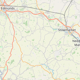
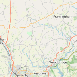
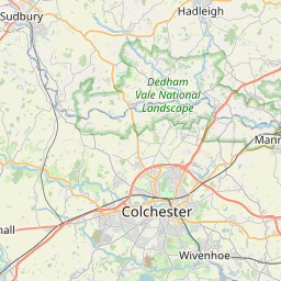
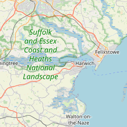
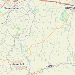

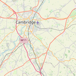

Leaflet | © OpenStreetMap contributors
Search distance between two cities
The weather for Raydon in the United Kingdom
Get today and tomorrow's weather forecasts for Raydon. Find out the weather forecast for the week ahead and the weekend for Raydon in the UK.Raydon weather forecast 15 days
What is the nearest train station to Raydon?
List of Railway Stations near to RaydonThe nearest railway stations to Raydon are listed below. Tickets are available at the train station ticket office or ticket machines.
| Name | Distances from Raydon |
|---|---|
| Manningtree Station | 7.45 Km |
| Mistley Station | 9.46 Km |
| Ipswich Station | 11.90 Km |
| Colchester Station | 13.32 Km |
| Hythe Station | 13.94 Km |
| Derby Road Station | 14.31 Km |
| Colchester Town Station | 14.38 Km |
| Wrabness Station | 14.63 Km |
| Westerfield Station | 14.85 Km |
| Bures Station | 15.38 Km |
RAF Wattisham , UK (13.70 Km)
What is the nearest Public Transport Stops to Raydon?
List of Stops near to RaydonGetting there by public transport (nearest train, tube, overground line station and bus stops). The nearest stops to Raydon are listed below.
| Stop Name | Distances from Raydon |
|---|---|
| Rectory Close Bus Stop (Opposite) | 37 m |
| Rectory Close Bus Stop (adj) | 83 m |
| Church Bus Stop (opp) | 299 m |
| Church Bus Stop (adj) | 336 m |
| Holton Place Bus Stop (opp) | 1.03 Km |
| Holton Place Bus Stop (adj) | 1.07 Km |
| Fox Wood Corner Bus Stop (opp) | 1.60 Km |
| Fox Wood Corner Bus Stop (adj) | 1.61 Km |
| Telephone Box Bus Stop (adj) | 1.79 Km |
| Telephone Box Bus Stop (opp) | 1.79 Km |
Historic Places to Visit near Raydon
List of Historic places near to Raydon
Cities or Towns near Raydon
List of places near to
| Name | Distance |
|---|---|
| Bacon's Green | 1.09 Km |
| Lower Raydon | 1.63 Km |
| Holton St Mary | 1.83 Km |
| Great Wenham | 1.95 Km |
| Shelley | 1.97 Km |
| The Woodlands | 2.00 Km |
| Coopers Corner | 2.03 Km |
| Gipsy Row | 2.30 Km |
| Upper Layham | 2.65 Km |
| Lower Layham | 2.83 Km |
| Cobblers Corner | 2.88 Km |
| Lattinford Hill | 2.89 Km |
| Little Wenham | 3.19 Km |
| Higham | 3.19 Km |
| Withermarsh Green | 3.68 Km |
| Stratford St Mary | 4.06 Km |
| East Bergholt | 4.08 Km |
| Capel St Mary | 4.17 Km |
| Hadleigh | 4.73 Km |
| Duke Street | 4.74 Km |
| Thorington Street | 4.97 Km |
| Dedham | 5.21 Km |
| Chattisham | 5.42 Km |
| Polstead Heath | 5.51 Km |
| Scotland Street | 5.53 Km |
| Polstead | 5.78 Km |
| Bentley | 5.82 Km |
| Hintlesham | 5.86 Km |
| Bell's Corner | 5.90 Km |
| Hadleigh Heath | 6.12 Km |
| Mace Green | 6.13 Km |
| East End | 6.25 Km |
| Mill Street | 6.31 Km |
| Aldham | 6.51 Km |
| Hornestreet | 6.58 Km |
| Parney Heath | 6.60 Km |
| Potash | 6.63 Km |
| Bower House Tye | 6.77 Km |
| Stoke-by-Nayland | 6.85 Km |
| Langham | 6.89 Km |
| Lamb Corner | 6.93 Km |
| Dedham Heath | 6.95 Km |
| Brantham | 7.01 Km |
| Oaks Tye | 7.04 Km |
| Copdock | 7.12 Km |
| Langham Wick | 7.16 Km |
| Cattawade | 7.21 Km |
| Washbrook Street | 7.26 Km |
| Boxted | 7.29 Km |
| Boxted Cross | 7.41 Km |