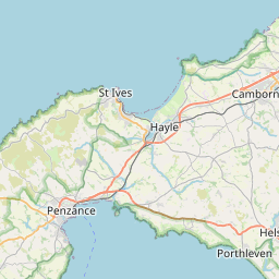
Plain-An-Gwarry Map, Satellite view of Plain-An-Gwarry, Cornwall, England
Plain-An-Gwarry is located in Cornwall County, Cornwall, South West, England, United Kingdom.
Location informations of Plain-An-Gwarry
Latitude of city of Plain-An-Gwarry is 50.23624 and longitude of city of Plain-An-Gwarry is -5.23153. Plain-An-Gwarry has 1 postcode / zip code, in county of Cornwall.The County of Plain-An-Gwarry is Cornwall.
Postcode / zip code of Plain-An-Gwarry
TR15 1Administrative division of Plain-An-Gwarry
County :CornwallGPS coordinates of Plain-An-Gwarry
Latitude : 50.23624Longitude : -5.23153
Online Map of Plain-An-Gwarry - road map, satellite view and street view


Leaflet | © OpenStreetMap contributors
Search distance between two cities
The weather for Plain-An-Gwarry in the United Kingdom
Get today and tomorrow's weather forecasts for Plain-An-Gwarry. Find out the weather forecast for the week ahead and the weekend for Plain-An-Gwarry in the UK.Plain-An-Gwarry weather forecast 15 days
What is the nearest train station to Plain-An-Gwarry?
List of Railway Stations near to Plain-An-GwarryThe nearest railway stations to Plain-An-Gwarry are listed below. Tickets are available at the train station ticket office or ticket machines.
| Name | Distances from Plain-An-Gwarry |
|---|---|
| Redruth Station | 518 m |
| Camborne Station | 5.50 Km |
| Perranwell Station | 8.77 Km |
| Penryn Station | 11.22 Km |
| Truro Station | 12.24 Km |
| Penmere Station | 14.24 Km |
| Hayle Station | 14.54 Km |
| Falmouth Town Station | 15.37 Km |
| Lelant Station | 15.70 Km |
| Falmouth Docks Station | 15.70 Km |
What is the nearest Public Transport Stops to Plain-An-Gwarry?
List of Stops near to Plain-An-GwarryGetting there by public transport (nearest train, tube, overground line station and bus stops). The nearest stops to Plain-An-Gwarry are listed below.
| Stop Name | Distances from Plain-An-Gwarry |
|---|---|
| Plain-an-Gwarry Bus Stop (SW-bound) | 115 m |
| Plain-an-Gwarry Bus Stop (NE-bound) | 130 m |
| Health Clinic Bus Stop (opp) | 234 m |
| Health Clinic Bus Stop (SE-bound) | 234 m |
| Treleigh Terrace Bus Stop (N-bound) | 247 m |
| Treleigh Terrace Bus Stop (S-bound) | 262 m |
| Tesco Bus Stop (W-bound) | 291 m |
| Tesco Bus Stop (opp) | 303 m |
| Pond Lane Bus Stop (NW-bound) | 333 m |
| Pond Lane Bus Stop (E-bound) | 338 m |
Historic Places to Visit near Plain-An-Gwarry
List of Historic places near to Plain-An-Gwarry
| Name | Distances from Plain-An-Gwarry |
|---|---|
| Carn Brea Neolithic Settlement | 1.90 Km |
| Wheal Peevor Mine | 2.13 Km |
| Gwennap Pit | 2.16 Km |
| East Pool Mine | 2.58 Km |
| Burncoose Garden | 5.49 Km |
| Wheal Coates Tin Mine | 7.69 Km |
| Poldark Mine | 10.97 Km |
| Bosvigo Gardens | 12.09 Km |
| Perranzabuloe, St Pirans Church | 12.18 Km |
| Royal Cornwall Museum | 12.95 Km |
| Godolphin | 13.91 Km |
| Penjerrick Gardens | 14.22 Km |
| Trelissick Garden | 14.23 Km |
| Perran Round | 14.65 Km |
Cities or Towns near Plain-An-Gwarry
List of places near to
| Name | Distance |
|---|---|
| Redruth | 0.51 Km |
| Church Town | 1.13 Km |
| Carn Brea Village | 1.25 Km |
| Blowinghouse | 1.27 Km |
| Tolgus Mount | 1.29 Km |
| Treleigh | 1.32 Km |
| North Country | 1.48 Km |
| Gilbert's Coombe | 1.49 Km |
| Mount Ambrose | 1.66 Km |
| Sparnon Gate | 1.67 Km |
| West Tolgus | 1.68 Km |
| Tolskithy | 1.73 Km |
| Church Coombe | 1.86 Km |
| Illogan Highway | 2.00 Km |
| Parc Erissey | 2.15 Km |
| Busveal | 2.16 Km |
| Treskerby | 2.16 Km |
| Trefula | 2.23 Km |
| Illogan | 2.28 Km |
| Paynter's Lane End | 2.43 Km |
| Pennance | 2.61 Km |
| Carnkie | 2.63 Km |
| Pool | 2.82 Km |
| Bosleake | 2.84 Km |
| Tregajorran | 2.84 Km |
| Vogue | 2.86 Km |
| Piece | 2.91 Km |
| Tolcarne | 3.11 Km |
| Cambrose | 3.11 Km |
| Laity Moor | 3.14 Km |
| Park Bottom | 3.15 Km |
| Lanner | 3.19 Km |
| Scorrier | 3.22 Km |
| St Day | 3.26 Km |
| Tolgullow | 3.32 Km |
| Wheal Rose | 3.38 Km |
| Mawla | 3.53 Km |
| Trevarth | 3.55 Km |
| Carn Arthen | 3.57 Km |
| Carharrack | 3.58 Km |
| Stencoose | 3.64 Km |
| Treskillard | 3.79 Km |
| Tolvaddon | 3.79 Km |
| Four Lanes | 3.80 Km |
| Nance | 3.80 Km |
| Tuckingmill | 3.82 Km |
| Brea | 3.86 Km |
| Crofthandy | 4.02 Km |
| Pencoys | 4.02 Km |
| Tresavean | 4.03 Km |