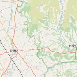
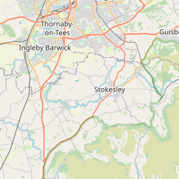
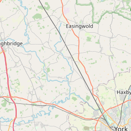
Old Byland Map, Satellite view of Old Byland, North Yorkshire, England
Old Byland is located in North Yorkshire County, Ryedale District, Yorkshire and the Humber, England, United Kingdom.
Location informations of Old Byland
Latitude of city of Old Byland is 54.26675 and longitude of city of Old Byland is -1.15723. Old Byland has 1 postcode / zip code, in county of North Yorkshire.The County of Old Byland is North Yorkshire.
Postcode / zip code of Old Byland
YO62 5Administrative division of Old Byland
County :North YorkshireGPS coordinates of Old Byland
Latitude : 54.26675Longitude : -1.15723
Online Map of Old Byland - road map, satellite view and street view


Leaflet | © OpenStreetMap contributors
Search distance between two cities
The weather for Old Byland in the United Kingdom
Get today and tomorrow's weather forecasts for Old Byland. Find out the weather forecast for the week ahead and the weekend for Old Byland in the UK.Old Byland weather forecast 15 days
What is the nearest train station to Old Byland?
List of Railway Stations near to Old BylandThe nearest railway stations to Old Byland are listed below. Tickets are available at the train station ticket office or ticket machines.
| Name | Distances from Old Byland |
|---|---|
| Thirsk Station | 14.63 Km |
| Northallerton Station | 19.85 Km |
| Battersby Station | 21.63 Km |
| Kildale Station | 24.16 Km |
| Great Ayton Station | 24.92 Km |
| Castleton Moor Station | 26.13 Km |
| Commondale Station | 26.61 Km |
| Danby Station | 27.32 Km |
| Malton Station | 27.80 Km |
| Yarm Station | 28.22 Km |
What is the nearest Public Transport Stops to Old Byland?
List of Stops near to Old BylandGetting there by public transport (nearest train, tube, overground line station and bus stops). The nearest stops to Old Byland are listed below.
| Stop Name | Distances from Old Byland |
|---|---|
| Village Green Bus Stop (N-bound) | 53 m |
| Village Green Bus Stop (S-bound) | 58 m |
| Cold Kirby Road Bus Stop (adj) | 2.54 Km |
| Cold Kirby Road Bus Stop (opp) | 2.54 Km |
| Abbey Bus Stop (S-bound) | 2.71 Km |
| Bank Top Bus Stop (NW-bound) | 3.46 Km |
| Bank Top Bus Stop (SE-bound) | 3.47 Km |
| Tea Rooms Bus Stop (S-bound) | 3.85 Km |
| Tea Rooms Bus Stop (N-bound) | 3.86 Km |
| Sneck Yate Bank Top Bus Stop (S-bound) | 4.32 Km |
Historic Places to Visit near Old Byland
List of Historic places near to Old Byland
| Name | Distances from Old Byland |
|---|---|
| Rievaulx Abbey | 2.79 Km |
| Rievaulx Terrace and Temples | 3.16 Km |
| White Horse of Kilburn | 5.89 Km |
| Duncombe Park | 6.18 Km |
| Helmsley Castle | 6.61 Km |
| Byland Abbey | 7.10 Km |
| Gilling Castle | 10.56 Km |
| Birdforth, St Marys Church | 11.91 Km |
| World of James Herriot | 12.75 Km |
| Nunnington Hall | 13.69 Km |
Cities or Towns near Old Byland
List of places near to
| Name | Distance |
|---|---|
| Cold Kirby | 2.28 Km |
| Scawton | 2.50 Km |
| Rievaulx | 2.83 Km |
| Murton Grange | 2.90 Km |
| Hawnby | 3.47 Km |
| Hambleton | 4.00 Km |
| Boltby | 5.97 Km |
| Carlton | 6.03 Km |
| Thirlby | 6.17 Km |
| Oldstead | 6.38 Km |
| Helmsley | 6.63 Km |
| Wass | 6.68 Km |
| Byland Abbey | 7.03 Km |
| High Kilburn | 7.13 Km |
| Kilburn | 7.52 Km |
| Sutton-under-Whitestonecliffe | 7.64 Km |
| Sproxton | 7.75 Km |
| Ampleforth | 7.98 Km |
| Kirby Knowle | 8.27 Km |
| Felixkirk | 8.31 Km |
| Pockley | 8.72 Km |
| Fangdale Beck | 8.89 Km |
| Coxwold | 8.97 Km |
| Balk | 9.05 Km |
| Cowesby | 9.23 Km |
| Kepwick | 9.35 Km |
| Upsall | 9.68 Km |
| Oswaldkirk | 10.11 Km |
| Bagby | 10.25 Km |
| Great Thirkleby | 10.26 Km |
| Beadlam | 10.36 Km |
| Harome | 10.45 Km |
| Cross Holme | 10.60 Km |
| Carlton Husthwaite | 10.65 Km |
| Nawton | 10.67 Km |
| Bagby Grange | 10.94 Km |
| Gilling East | 11.13 Km |
| Nether Silton | 11.41 Km |
| Husthwaite | 11.41 Km |
| East Newton | 11.59 Km |
| Oulston | 11.61 Km |
| Knayton | 11.80 Km |
| Birdforth | 12.01 Km |
| Old Thirsk | 12.02 Km |
| Wombleton | 12.06 Km |
| Yearsley | 12.07 Km |
| Over Silton | 12.20 Km |
| Thormanby | 12.39 Km |
| South Kilvington | 12.41 Km |
| North Kilvington | 12.45 Km |