Moel Ddolwen Map, Satellite view of Moel Ddolwen, Powys, Wales
Moel Ddolwen is located in Powys County, Powys, Wales, Wales, United Kingdom.
Location informations of Moel Ddolwen
Latitude of city of Moel Ddolwen is 52.65927 and longitude of city of Moel Ddolwen is -3.48900. Moel Ddolwen has 1 postcode / zip code, in county of Powys.The County of Moel Ddolwen is Powys.
Postcode / zip code of Moel Ddolwen
SY21 0Administrative division of Moel Ddolwen
County :PowysGPS coordinates of Moel Ddolwen
Latitude : 52.65927Longitude : -3.48900
Online Map of Moel Ddolwen - road map, satellite view and street view

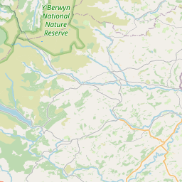

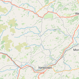
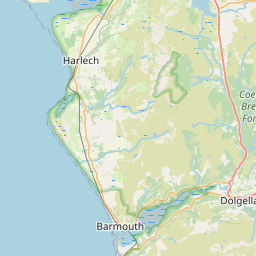
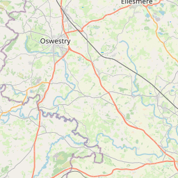

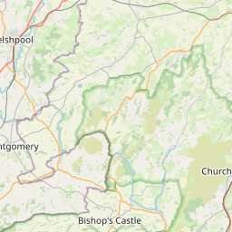

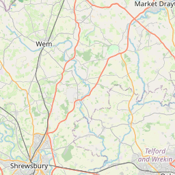
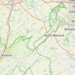

Leaflet | © OpenStreetMap contributors
Search distance between two cities
The weather for Moel Ddolwen in the United Kingdom
Get today and tomorrow's weather forecasts for Moel Ddolwen. Find out the weather forecast for the week ahead and the weekend for Moel Ddolwen in the UK.Moel Ddolwen weather forecast 15 days
What is the nearest train station to Moel Ddolwen?
List of Railway Stations near to Moel DdolwenThe nearest railway stations to Moel Ddolwen are listed below. Tickets are available at the train station ticket office or ticket machines.
| Name | Distances from Moel Ddolwen |
|---|---|
| Caersws Station | 16.37 Km |
| Newtown Station | 20.27 Km |
| Welshpool Station | 23.55 Km |
| Machynlleth Station | 25.68 Km |
What is the nearest Public Transport Stops to Moel Ddolwen?
List of Stops near to Moel DdolwenGetting there by public transport (nearest train, tube, overground line station and bus stops). The nearest stops to Moel Ddolwen are listed below.
| Stop Name | Distances from Moel Ddolwen |
|---|---|
| Cann Office Bus Stop | 3.48 Km |
| Cann Office Bus Stop | 3.48 Km |
| Llangadfan Q Bus Stop | 3.49 Km |
| Pen y Ddol Bus Stop | 3.65 Km |
| Post Office Bus Stop | 3.65 Km |
| War Memorial Bus Stop | 4.39 Km |
| War Memorial Bus Stop | 4.41 Km |
| Cefn Coch Inn Bus Stop | 7.38 Km |
| Cefn Coch Inn Bus Stop | 7.39 Km |
| Cefn Coch Bus Stop | 7.41 Km |
Historic Places to Visit near Moel Ddolwen
List of Historic places near to Moel Ddolwen
| Name | Distances from Moel Ddolwen |
|---|---|
| Gregynog Hall & Gardens | 13.71 Km |
| Pont Minllyn | 14.69 Km |
Cities or Towns near Moel Ddolwen
List of places near to
| Name | Distance |
|---|---|
| Llangadfan | 3.10 Km |
| Foel | 3.58 Km |
| Llanerfyl | 4.23 Km |
| Four Crosses | 6.65 Km |
| Cefn Coch | 7.40 Km |
| Rhyd | 7.54 Km |
| Pentyrch | 7.92 Km |
| Llanllugan | 8.44 Km |
| Pont Llogel | 8.65 Km |
| Dolanog | 8.72 Km |
| Ystrad Uchaf | 8.77 Km |
| Adfa | 9.45 Km |
| Pandy-rhiw-Saeson | 9.55 Km |
| Melin-y-ddôl | 9.60 Km |
| Plas-rhiw-Saeson | 9.61 Km |
| Dwyrhiw | 9.71 Km |
| Ddôl Cownwy | 9.78 Km |
| Glanhanog | 9.93 Km |
| Dol-fâch | 10.17 Km |
| Talerddig | 10.34 Km |
| Plasiolyn | 10.64 Km |
| Llanbrynmair | 10.80 Km |
| Llanwyddelan | 11.08 Km |
| Llanfair Caereinion | 11.08 Km |
| Tafolwern | 11.46 Km |
| Plasnewydd | 11.53 Km |
| Bryn-penarth | 11.58 Km |
| Llanwddyn | 11.73 Km |
| Carno | 11.78 Km |
| Bwlch y Garreg | 11.88 Km |
| Abertridwr | 11.92 Km |
| Llanfihangel-yng-Ngwynfa | 12.34 Km |
| Pontrobert | 12.36 Km |
| Maesypandy | 12.37 Km |
| New Mills / Felin Newydd | 12.45 Km |
| Glascoed | 12.51 Km |
| Manafon | 12.92 Km |
| Llan | 12.99 Km |
| Bont Dolgadfan | 13.00 Km |
| Heniarth | 13.09 Km |
| Clatter | 13.10 Km |
| Dolymelinau | 13.11 Km |
| Llangyniew | 13.24 Km |
| Cwm-Cewydd | 13.27 Km |
| Mallwyd | 13.67 Km |
| The Green | 13.79 Km |
| Gregynog | 13.79 Km |
| Tregynon | 13.91 Km |
| Pontdolgoch | 14.01 Km |
| Henllan | 14.21 Km |